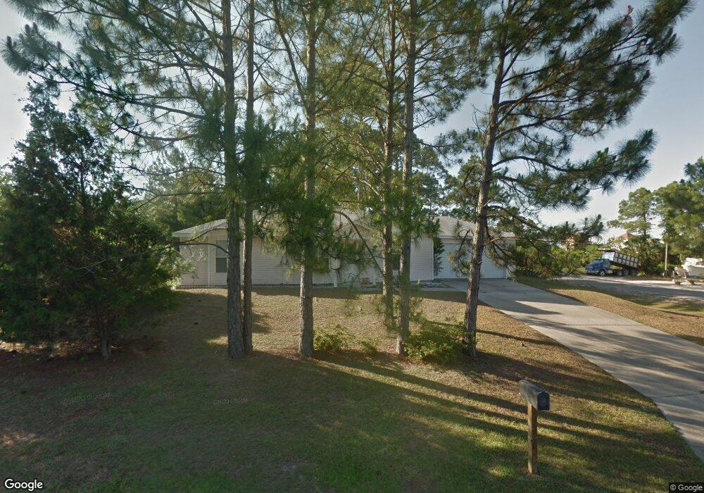
102 Coral Dr Port Saint Joe, FL 32456
Saint Joe Beach NeighborhoodEstimated Value: $323,000 - $544,000
3
Beds
2
Baths
1,144
Sq Ft
$377/Sq Ft
Est. Value
About This Home
This home is located at 102 Coral Dr, Port Saint Joe, FL 32456 and is currently estimated at $431,481, approximately $377 per square foot. 102 Coral Dr is a home located in Gulf County.
Ownership History
Date
Name
Owned For
Owner Type
Purchase Details
Closed on
Sep 7, 2007
Sold by
Thomas Janice S
Bought by
Humphries Nathan C
Current Estimated Value
Home Financials for this Owner
Home Financials are based on the most recent Mortgage that was taken out on this home.
Original Mortgage
$200,000
Outstanding Balance
$127,145
Interest Rate
6.65%
Mortgage Type
Unknown
Estimated Equity
$304,336
Purchase Details
Closed on
Mar 6, 2000
Sold by
Costin Margaret M
Bought by
Thomas Janice S
Home Financials for this Owner
Home Financials are based on the most recent Mortgage that was taken out on this home.
Original Mortgage
$111,589
Interest Rate
8.29%
Mortgage Type
FHA
Create a Home Valuation Report for This Property
The Home Valuation Report is an in-depth analysis detailing your home's value as well as a comparison with similar homes in the area
Home Values in the Area
Average Home Value in this Area
Purchase History
| Date | Buyer | Sale Price | Title Company |
|---|---|---|---|
| Humphries Nathan C | $250,000 | Attorney | |
| Thomas Janice S | $22,000 | -- |
Source: Public Records
Mortgage History
| Date | Status | Borrower | Loan Amount |
|---|---|---|---|
| Open | Humphries Nathan C | $200,000 | |
| Previous Owner | Thomas Janice S | $111,589 |
Source: Public Records
Tax History Compared to Growth
Tax History
| Year | Tax Paid | Tax Assessment Tax Assessment Total Assessment is a certain percentage of the fair market value that is determined by local assessors to be the total taxable value of land and additions on the property. | Land | Improvement |
|---|---|---|---|---|
| 2024 | $1,793 | $190,423 | -- | -- |
| 2023 | $1,822 | $184,877 | $0 | $0 |
| 2022 | $1,819 | $179,492 | $0 | $0 |
| 2021 | $1,837 | $174,265 | $0 | $0 |
| 2020 | $1,850 | $171,859 | $60,000 | $111,859 |
| 2019 | $1,248 | $88,656 | $50,000 | $38,656 |
| 2018 | $2,421 | $172,727 | $0 | $0 |
| 2017 | $2,315 | $173,666 | $0 | $0 |
| 2016 | $2,049 | $137,865 | $0 | $0 |
| 2015 | $1,965 | $128,899 | $0 | $0 |
| 2014 | $1,781 | $123,933 | $0 | $0 |
Source: Public Records
Map
Nearby Homes
- TBD Americus Ave
- TBD Americus Ave Unit A
- 122 Sea Mist Dr
- 8041 W Highway 98
- 7924 W Hwy 98
- 7924 W Highway 98 Unit Lot 2
- Lot 14 Monroe Ct
- 254 Court St
- 8184 W Highway 98
- Lot 11 Ward St
- Lot 14 Ward St
- 8205 W Highway 98 Unit 3
- 8205 W Highway 98
- 110 Ocean Ridge Ln
- 8215 W Highway 98 Unit 2
- 706 Nautilus Dr
- 10 Ponce de Leon St
- 154 Gulf Aire Dr Unit 2
- 211 Cortez St
- 8255 W Highway 98
- 202 Coral Dr
- 8102 Americus Ave
- 204 Coral Dr
- 8102 Coquina Dr
- 123 Narvaez St
- 192 Coral Dr
- 8104 Coquina Dr
- 8106 Americus Ave
- 8106 Coquina Dr
- 139 Narvaez St
- 7987 Americus Ave
- 8002 Americus Ave
- 0 Coquina Dr Unit Lot 1 258520
- 0 Coquina Dr
- 5 Coquina Dr
- 8114 Coquina Dr
- 8005 Alabama Ave
- 8108 Americus Ave
- 8103 Alabama Ave
- 8103 Alabama Ave