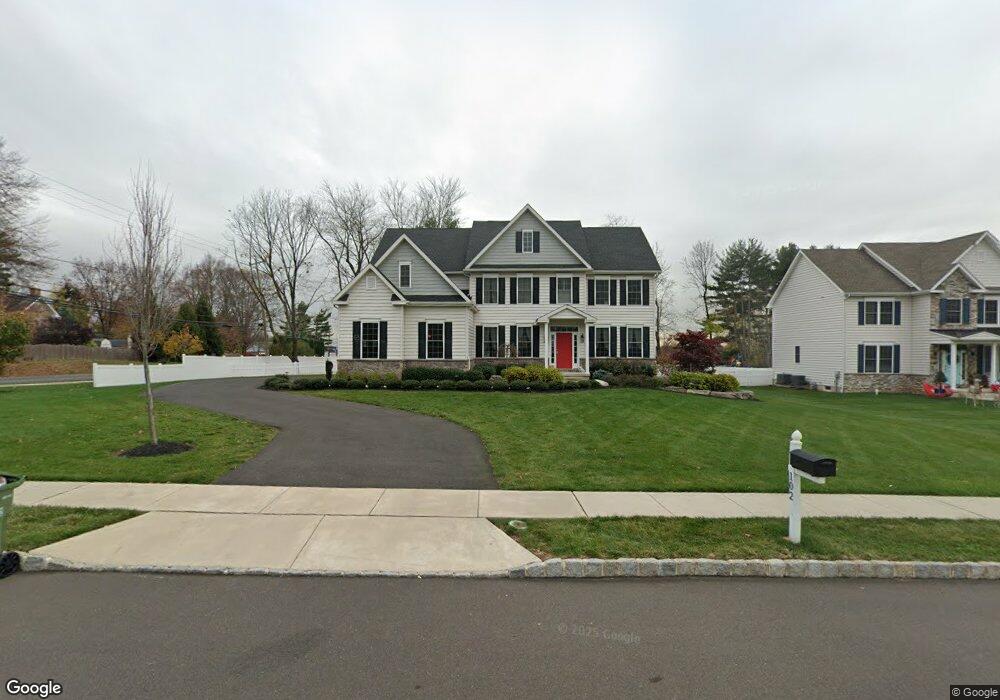
102 Daisy Ln Richboro, PA 18954
Estimated Value: $1,010,000 - $1,163,000
4
Beds
3
Baths
3,300
Sq Ft
$336/Sq Ft
Est. Value
About This Home
This home is located at 102 Daisy Ln, Richboro, PA 18954 and is currently estimated at $1,108,276, approximately $335 per square foot. 102 Daisy Ln is a home located in Bucks County with nearby schools including Richboro Elementary School, Richboro Middle School, and Council Rock High School - South.
Ownership History
Date
Name
Owned For
Owner Type
Purchase Details
Closed on
Jun 7, 2017
Sold by
Prestige Property Partners Llc
Bought by
Lally Stacy M
Current Estimated Value
Home Financials for this Owner
Home Financials are based on the most recent Mortgage that was taken out on this home.
Original Mortgage
$424,100
Outstanding Balance
$352,859
Interest Rate
4.03%
Mortgage Type
New Conventional
Estimated Equity
$755,417
Purchase Details
Closed on
May 23, 1974
Bought by
Gabriel Samuel and Gabriel Cerruti D
Create a Home Valuation Report for This Property
The Home Valuation Report is an in-depth analysis detailing your home's value as well as a comparison with similar homes in the area
Home Values in the Area
Average Home Value in this Area
Purchase History
| Date | Buyer | Sale Price | Title Company |
|---|---|---|---|
| Lally Stacy M | $665,358 | Sovereign Search & Abstract | |
| Gabriel Samuel | -- | -- |
Source: Public Records
Mortgage History
| Date | Status | Borrower | Loan Amount |
|---|---|---|---|
| Open | Lally Stacy M | $424,100 |
Source: Public Records
Tax History Compared to Growth
Tax History
| Year | Tax Paid | Tax Assessment Tax Assessment Total Assessment is a certain percentage of the fair market value that is determined by local assessors to be the total taxable value of land and additions on the property. | Land | Improvement |
|---|---|---|---|---|
| 2025 | $13,567 | $70,440 | $7,500 | $62,940 |
| 2024 | $13,567 | $70,440 | $7,500 | $62,940 |
| 2023 | $12,787 | $70,440 | $7,500 | $62,940 |
| 2022 | $12,670 | $70,440 | $7,500 | $62,940 |
| 2021 | $12,269 | $70,440 | $7,500 | $62,940 |
| 2020 | $11,993 | $70,440 | $7,500 | $62,940 |
| 2019 | $11,479 | $70,440 | $7,500 | $62,940 |
| 2018 | $11,275 | $70,440 | $7,500 | $62,940 |
| 2017 | $1,154 | $7,500 | $7,500 | $0 |
| 2016 | $7,756 | $50,400 | $50,400 | $0 |
| 2015 | -- | $50,400 | $50,400 | $0 |
| 2014 | -- | $50,400 | $50,400 | $0 |
Source: Public Records
Map
Nearby Homes
- 50 Mohawk Dr
- 39 Meadow Ln
- 3 Titus Ct Unit 102
- 158 Meadow Ln
- 52 Paisley Rd
- 54 Legacy Oaks Dr Unit 94
- 61 Legacy Oaks Dr Unit 62
- 64 Legacy Oaks Dr Unit 81
- 380 Newtown Richboro Rd
- 58 Highspire Rd
- 38 Bryan Dr
- 34 Acorn Dr
- 28 Dartmouth Ln
- 120 Gleniffer Hill Rd
- 56 Joshua Dr
- 379 Glen Meadow Rd
- 55 W Windrose Dr
- 46 Kings Ln
- 55 Mount Pleasant Dr
- 105 Edwards Dr
- 104 Daisy Ln
- 101 Daisy Ln
- 1135 2nd Street Pike
- 1121 2nd Street Pike
- 103 Daisy Ln
- 106 Daisy Ln
- 1147 2nd Street Pike
- 5 Manor Dr
- 105 Daisy Ln
- 1094 2nd Street Pike
- 1111 2nd Street Pike
- 1166 2nd Street Pike
- 1159 2nd Street Pike
- 71 Blue Fox Run
- 82 Blue Fox Run
- 24 Auckland Dr
- 71 Blue Fox Ln
- 14 Auckland Dr
- 34 Auckland Dr
- 25 Manor Dr