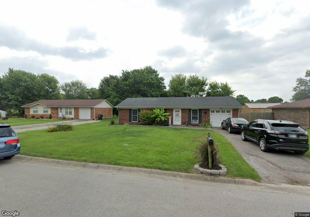
102 Danny Dr Charlestown, IN 47111
Estimated Value: $186,000 - $206,000
3
Beds
1
Bath
1,026
Sq Ft
$191/Sq Ft
Est. Value
About This Home
This home is located at 102 Danny Dr, Charlestown, IN 47111 and is currently estimated at $195,591, approximately $190 per square foot. 102 Danny Dr is a home located in Clark County with nearby schools including Pleasant Ridge Elementary School, Charlestown Senior High School, and St. Michael School.
Ownership History
Date
Name
Owned For
Owner Type
Purchase Details
Closed on
Aug 26, 2015
Sold by
Cash Megan B
Bought by
Savage Kyle
Current Estimated Value
Purchase Details
Closed on
Jun 30, 2010
Sold by
Murphy Chase
Bought by
Savage Kyle D and Cash Megan B
Purchase Details
Closed on
Jun 19, 2009
Sold by
Attorney For
Bought by
Murphy Chase
Purchase Details
Closed on
Mar 26, 2009
Sold by
Rodden Daniel
Bought by
Federal National Mortgage Association
Create a Home Valuation Report for This Property
The Home Valuation Report is an in-depth analysis detailing your home's value as well as a comparison with similar homes in the area
Home Values in the Area
Average Home Value in this Area
Purchase History
| Date | Buyer | Sale Price | Title Company |
|---|---|---|---|
| Savage Kyle | -- | None Available | |
| Savage Kyle D | $85,400 | Agency Title Inc | |
| Murphy Chase | $50,000 | Foutty And Foutty Llp | |
| Federal National Mortgage Association | $66,587 | Foutty & Foutty Llp |
Source: Public Records
Tax History Compared to Growth
Tax History
| Year | Tax Paid | Tax Assessment Tax Assessment Total Assessment is a certain percentage of the fair market value that is determined by local assessors to be the total taxable value of land and additions on the property. | Land | Improvement |
|---|---|---|---|---|
| 2024 | $1,607 | $160,700 | $43,400 | $117,300 |
| 2023 | $1,500 | $157,800 | $43,400 | $114,400 |
| 2022 | $1,303 | $140,300 | $34,700 | $105,600 |
| 2021 | $958 | $115,000 | $21,700 | $93,300 |
| 2020 | $875 | $106,800 | $18,200 | $88,600 |
| 2019 | $761 | $100,900 | $18,200 | $82,700 |
| 2018 | $723 | $90,300 | $18,200 | $72,100 |
| 2017 | $567 | $87,900 | $18,200 | $69,700 |
| 2016 | $510 | $85,900 | $18,200 | $67,700 |
| 2014 | $513 | $83,700 | $18,200 | $65,500 |
| 2013 | -- | $84,500 | $18,200 | $66,300 |
Source: Public Records
Map
Nearby Homes
- 228 Drive-In (Lot #1) Ct
- 102 Lisa Ln
- 339 Bohart Ln
- BERKSHIRE Plan at Villas of Springville Manor
- AUBURN Plan at Villas of Springville Manor
- 222 Drive-In (Lot #4) Ct
- The Eston (Slab) Plan at Aspen Meadows
- The Harper (Slab) Plan at Aspen Meadows
- The Madelynn (Slab) Plan at Aspen Meadows
- 432 Springville Dr
- 435 Springville Dr
- 430 Springville Dr
- 434 Springville Dr
- 101 Jackson Way
- 226 Drive-In (Lot #2) Ct
- 179 5th St
- 129 Broadmoor Ave
- 2080 Edgewood Dr
- 1515 Tunnel Mill Rd
- 1511 Tunnel Mill Rd
- 100 Danny Dr
- 104 Danny Dr
- 210 Whitsett Way
- 106 Danny Dr
- 103 Danny Dr
- 208 Whitsett Way
- 203 Locust St
- 101 Danny Dr
- 107 Danny Dr
- 407 Green Valley Dr
- 206 Whitsett Way
- 212 Whitsett Way
- 105 Danny Dr
- 409 Green Valley Dr
- 204 Whitsett Way
- 405 Green Valley Dr
- 100 Chris Ct
- 214 Whitsett Way
- 102 Chris Ct
- 211 Whitsett Way