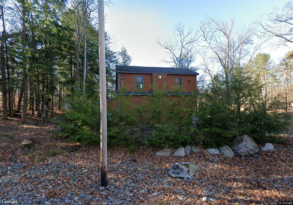
102 Deep Cove Raymond, ME 04071
Estimated Value: $2,476,000 - $3,566,843
4
Beds
5
Baths
3,851
Sq Ft
$808/Sq Ft
Est. Value
About This Home
This home is located at 102 Deep Cove, Raymond, ME 04071 and is currently estimated at $3,110,281, approximately $807 per square foot. 102 Deep Cove is a home located in Cumberland County with nearby schools including Raymond Elementary School, Jordan-Small Middle School, and Windham High School.
Ownership History
Date
Name
Owned For
Owner Type
Purchase Details
Closed on
Apr 26, 2024
Sold by
Harnum Keith D and Harnum Celeste N
Bought by
Nardi John F and Nardi Jennifer L
Current Estimated Value
Purchase Details
Closed on
Apr 12, 2024
Sold by
Keith D Harnum Ret and Harnum
Bought by
Harnum Keith D and Harnum Celeste N
Purchase Details
Closed on
Feb 7, 2023
Sold by
Harnum Celeste N and Harnum
Bought by
Harnum Keith D and Harnum
Purchase Details
Closed on
Sep 13, 2013
Sold by
Harnum Keith D and Harnum Celeste N
Bought by
Celeste N Harnum Ret and Harnum
Home Financials for this Owner
Home Financials are based on the most recent Mortgage that was taken out on this home.
Original Mortgage
$358,000
Interest Rate
4.43%
Mortgage Type
New Conventional
Create a Home Valuation Report for This Property
The Home Valuation Report is an in-depth analysis detailing your home's value as well as a comparison with similar homes in the area
Home Values in the Area
Average Home Value in this Area
Purchase History
| Date | Buyer | Sale Price | Title Company |
|---|---|---|---|
| Nardi John F | $3,550,000 | None Available | |
| Nardi John F | $3,550,000 | None Available | |
| Harnum Keith D | -- | None Available | |
| Harnum Keith D | -- | None Available | |
| Harnum Keith D | -- | None Available | |
| Keith D Harnum Ret | -- | None Available | |
| Harnum Keith D | -- | None Available | |
| Harnum Celeste N | -- | None Available | |
| Celeste N Harnum Ret | -- | -- | |
| Celeste N Harnum Ret | -- | -- |
Source: Public Records
Mortgage History
| Date | Status | Borrower | Loan Amount |
|---|---|---|---|
| Previous Owner | Celeste N Harnum Ret | $358,000 |
Source: Public Records
Tax History
| Year | Tax Paid | Tax Assessment Tax Assessment Total Assessment is a certain percentage of the fair market value that is determined by local assessors to be the total taxable value of land and additions on the property. | Land | Improvement |
|---|---|---|---|---|
| 2024 | $16,964 | $986,300 | $465,500 | $520,800 |
| 2023 | $15,682 | $986,300 | $465,500 | $520,800 |
| 2022 | $14,795 | $986,300 | $465,500 | $520,800 |
| 2021 | $13,907 | $986,300 | $465,500 | $520,800 |
| 2019 | $13,266 | $986,300 | $465,500 | $520,800 |
| 2018 | $0 | $942,600 | $465,500 | $477,100 |
| 2017 | $11,594 | $942,600 | $465,500 | $477,100 |
| 2016 | $11,405 | $942,600 | $465,500 | $477,100 |
| 2015 | $10,620 | $888,700 | $465,500 | $423,200 |
| 2014 | $10,396 | $881,000 | $465,500 | $415,500 |
| 2013 | $6,517 | $579,300 | $465,500 | $113,800 |
Source: Public Records
Map
Nearby Homes
- 17 Murray Dr
- 1525 Roosevelt Trail
- 1569 Roosevelt Trail
- 42 Bracken Woods Rd
- 2 Flynn Rd
- 16 Peterson Rd
- 105 Meadow Rd
- 18 Hillside Dr
- 20 Bittersweet Way
- 1112 Roosevelt Trail Unit 8
- 142 Lakewood Rd
- 10 Woodland Trail
- 1083 Roosevelt Trail
- 84 Watkins Shores Rd
- 58 Watkins Shores Rd
- Lot 19 Thomas Pond Shore Rd
- 1042 Roosevelt Trail
- 13 Brown Ave
- 12 Presidential View
- 361 Cape Rd
Your Personal Tour Guide
Ask me questions while you tour the home.