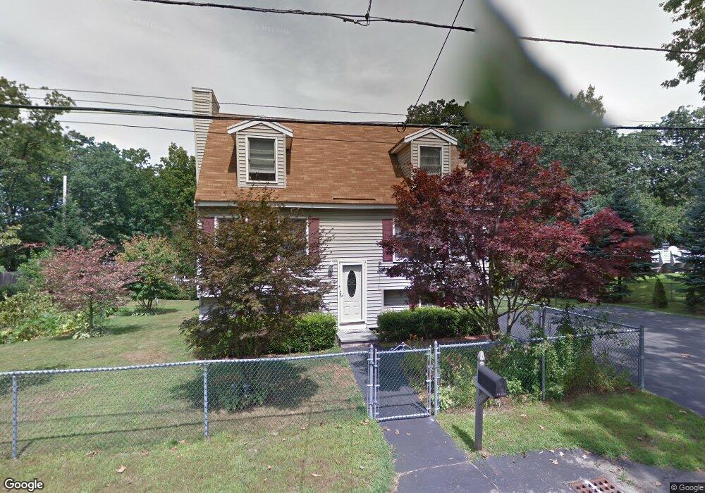
102 Derry Rd Methuen, MA 01844
The East End NeighborhoodEstimated Value: $602,000 - $668,000
3
Beds
2
Baths
2,086
Sq Ft
$304/Sq Ft
Est. Value
About This Home
This home is located at 102 Derry Rd, Methuen, MA 01844 and is currently estimated at $635,035, approximately $304 per square foot. 102 Derry Rd is a home located in Essex County with nearby schools including Timony Grammar School, Methuen High School, and Community Day Charter Public School - Gateway.
Ownership History
Date
Name
Owned For
Owner Type
Purchase Details
Closed on
Sep 3, 1992
Sold by
Brickyard Rt
Bought by
Ellis Glenn P
Current Estimated Value
Home Financials for this Owner
Home Financials are based on the most recent Mortgage that was taken out on this home.
Original Mortgage
$125,000
Interest Rate
8.09%
Mortgage Type
Purchase Money Mortgage
Create a Home Valuation Report for This Property
The Home Valuation Report is an in-depth analysis detailing your home's value as well as a comparison with similar homes in the area
Home Values in the Area
Average Home Value in this Area
Purchase History
| Date | Buyer | Sale Price | Title Company |
|---|---|---|---|
| Ellis Glenn P | $131,600 | -- | |
| Ellis Glenn P | $131,600 | -- |
Source: Public Records
Mortgage History
| Date | Status | Borrower | Loan Amount |
|---|---|---|---|
| Open | Ellis Glenn P | $101,000 | |
| Closed | Ellis Glenn P | $125,000 |
Source: Public Records
Tax History
| Year | Tax Paid | Tax Assessment Tax Assessment Total Assessment is a certain percentage of the fair market value that is determined by local assessors to be the total taxable value of land and additions on the property. | Land | Improvement |
|---|---|---|---|---|
| 2025 | $5,589 | $528,300 | $219,000 | $309,300 |
| 2024 | $5,481 | $504,700 | $199,800 | $304,900 |
| 2023 | $5,265 | $450,000 | $177,600 | $272,400 |
| 2022 | $4,887 | $374,500 | $148,000 | $226,500 |
| 2021 | $4,842 | $367,100 | $140,600 | $226,500 |
| 2020 | $4,824 | $358,900 | $140,600 | $218,300 |
| 2019 | $4,593 | $323,700 | $125,800 | $197,900 |
| 2018 | $4,379 | $306,900 | $125,800 | $181,100 |
| 2017 | $4,383 | $299,200 | $125,800 | $173,400 |
| 2016 | $4,070 | $274,800 | $118,400 | $156,400 |
| 2015 | $3,962 | $271,400 | $118,400 | $153,000 |
Source: Public Records
Map
Nearby Homes
- 86 Comet Rd
- 30 Anderson Dr
- 60 Ames St
- 5 Pilgrim Cir Unit C
- 128 Pleasant Valley St
- 68 Ashford St
- 21 Oak St Unit A
- 27 Russell Farm Dr
- 35 Christopher Dr
- 14 Magna Rd
- 17 Ferry Rd
- 18 Erhardt Terrace
- 37 Albion St
- 12 Annette St
- 1 Riverview Blvd Unit 8-203
- 1 Riverview Blvd Unit 3-8
- 593 Prospect St
- 39 Swan Ave
- 106 Leroy Ave
- 264 E Haverhill St Unit 2
Your Personal Tour Guide
Ask me questions while you tour the home.