Estimated Value: $360,188 - $415,000
3
Beds
1
Bath
1,067
Sq Ft
$365/Sq Ft
Est. Value
About This Home
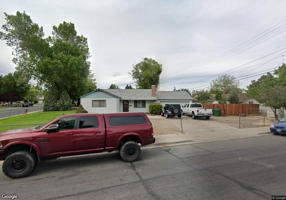
This home is located at 102 E I St, Sparks, NV 89431 and is currently estimated at $389,297, approximately $364 per square foot. 102 E I St is a home located in Washoe County with nearby schools including Greenbrae Elementary School, George L Dilworth Middle School, and Sparks High School.
Ownership History
Date
Name
Owned For
Owner Type
Purchase Details
Closed on
May 28, 2021
Sold by
Durns William H and Durns Karen L
Bought by
Durns William H and Durns Karen L
Current Estimated Value
Purchase Details
Closed on
May 20, 2019
Sold by
Sharkey Jerry
Bought by
Durns William H and Durns Karen L
Purchase Details
Closed on
Aug 24, 1994
Sold by
Sharkey Jerry M
Bought by
Sharkey Jerry M and Durns William H
Create a Home Valuation Report for This Property
The Home Valuation Report is an in-depth analysis detailing your home's value as well as a comparison with similar homes in the area
Home Values in the Area
Average Home Value in this Area
Purchase History
| Date | Buyer | Sale Price | Title Company |
|---|---|---|---|
| Durns William H | -- | None Available | |
| Durns William H | -- | None Available | |
| Sharkey Jerry M | -- | -- | |
| Sharkey Jerry M | -- | -- |
Source: Public Records
Tax History
| Year | Tax Paid | Tax Assessment Tax Assessment Total Assessment is a certain percentage of the fair market value that is determined by local assessors to be the total taxable value of land and additions on the property. | Land | Improvement |
|---|---|---|---|---|
| 2026 | $522 | $50,879 | $34,090 | $16,789 |
| 2025 | $682 | $50,233 | $33,565 | $16,668 |
| 2024 | $663 | $46,520 | $30,065 | $16,455 |
| 2023 | $663 | $46,514 | $31,325 | $15,189 |
| 2022 | $644 | $38,566 | $26,180 | $12,386 |
| 2021 | $625 | $30,023 | $17,955 | $12,068 |
| 2020 | $607 | $28,780 | $16,940 | $11,840 |
| 2019 | $588 | $27,101 | $15,890 | $11,211 |
| 2018 | $571 | $22,476 | $11,725 | $10,751 |
| 2017 | $556 | $20,956 | $10,395 | $10,561 |
| 2016 | $540 | $19,911 | $9,345 | $10,566 |
| 2015 | $539 | $18,194 | $7,700 | $10,494 |
| 2014 | $526 | $16,375 | $6,440 | $9,935 |
| 2013 | -- | $13,930 | $4,270 | $9,660 |
Source: Public Records
Map
Nearby Homes
- 11 E J St
- 31 E L St
- 370 O'Brien Way
- 480 E Mclean Way
- 14 E Greenbrae Dr
- 8 E O St
- 959 Mesa Ridge Dr Unit 2
- 314 M St
- 801 Woodglen Dr Unit 2
- 828 Woodglen Dr Unit 2
- 483 Beacon Hill Ct Unit 16-D
- 115 P St
- 601 Oakwood Dr Unit 4
- 560 Nichols Blvd
- 995 Sage View Dr
- 1777 Howard Ct
- 28 Arndell Way
- 1940 4th St Unit 20
- 1940 4th St Unit 51
- 1940 4th St Unit 46
- 1108 Probasco Way
- 80 E I St
- 134 E I St
- 1111 Breaker Way
- 1112 Probasco Way
- 1103 Probasco Way
- 101 E I St
- 1131 Breaker Way
- 1107 Probasco Way
- 1200 Probasco Way
- 131 E I St
- 1161 Breaker Way
- 38 E I St
- 1008 Probasco Way
- 1110 Breaker Way
- 1007 Probasco Way
- 39 E J St
- 1204 Probasco Way
- 1211 Breaker Way
- 1130 Breaker Way
Your Personal Tour Guide
Ask me questions while you tour the home.