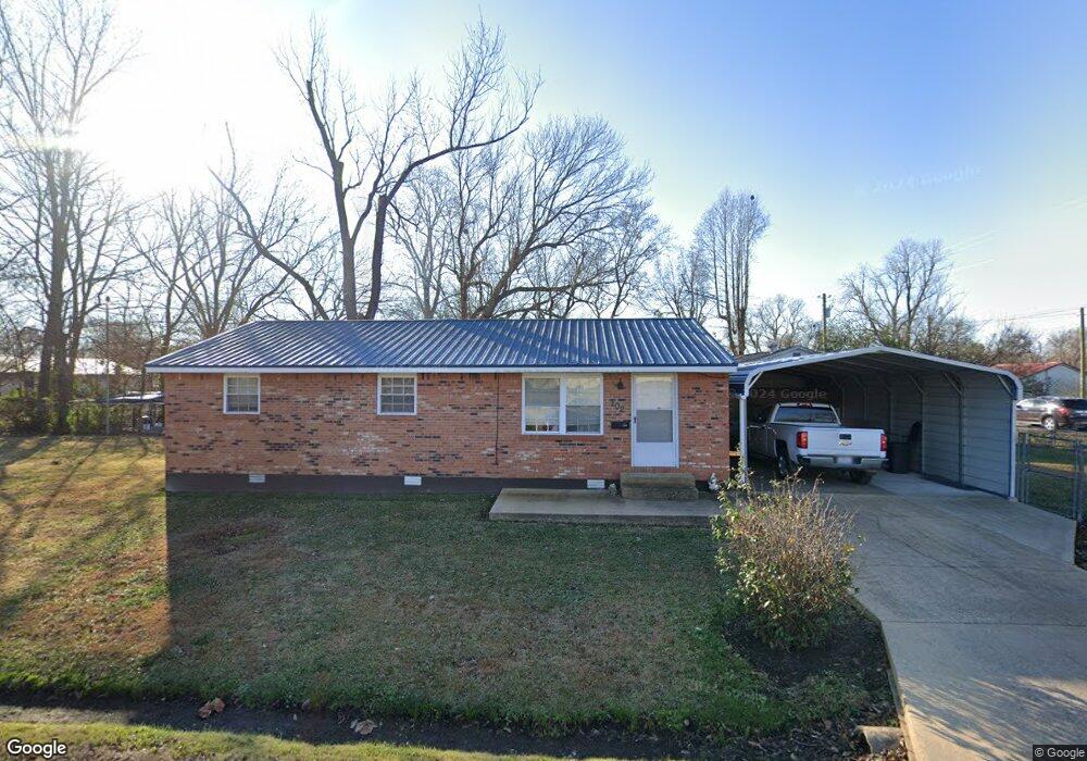
102 E Roosevelt St Poplar Bluff, MO 63901
Estimated Value: $68,000 - $98,000
3
Beds
--
Bath
1,072
Sq Ft
$80/Sq Ft
Est. Value
About This Home
This home is located at 102 E Roosevelt St, Poplar Bluff, MO 63901 and is currently estimated at $85,598, approximately $79 per square foot. 102 E Roosevelt St is a home located in Butler County with nearby schools including Eugene Field Elementary School, Poplar Bluff Fifth & Sixth Grade Center, and Poplar Bluff Junior High School.
Ownership History
Date
Name
Owned For
Owner Type
Purchase Details
Closed on
Dec 28, 2021
Sold by
Vinson Velva S
Bought by
Vinson Velva
Current Estimated Value
Home Financials for this Owner
Home Financials are based on the most recent Mortgage that was taken out on this home.
Original Mortgage
$31,000
Interest Rate
3.56%
Mortgage Type
New Conventional
Purchase Details
Closed on
Dec 21, 2021
Sold by
Velva Vinson
Bought by
Vinson Velva and Vinson Terry
Home Financials for this Owner
Home Financials are based on the most recent Mortgage that was taken out on this home.
Original Mortgage
$31,000
Interest Rate
3.56%
Mortgage Type
New Conventional
Purchase Details
Closed on
Mar 8, 2010
Sold by
Bean Wanda L
Bought by
Vinson Velva S and Hendrix Charles L
Home Financials for this Owner
Home Financials are based on the most recent Mortgage that was taken out on this home.
Original Mortgage
$56,949
Interest Rate
5.37%
Mortgage Type
FHA
Create a Home Valuation Report for This Property
The Home Valuation Report is an in-depth analysis detailing your home's value as well as a comparison with similar homes in the area
Home Values in the Area
Average Home Value in this Area
Purchase History
| Date | Buyer | Sale Price | Title Company |
|---|---|---|---|
| Vinson Velva | -- | Servicelink | |
| Vinson Velva | -- | Servicelink | |
| Vinson Velva S | -- | -- |
Source: Public Records
Mortgage History
| Date | Status | Borrower | Loan Amount |
|---|---|---|---|
| Previous Owner | Vinson Velva | $31,000 | |
| Previous Owner | Vinson Velva S | $56,949 |
Source: Public Records
Tax History
| Year | Tax Paid | Tax Assessment Tax Assessment Total Assessment is a certain percentage of the fair market value that is determined by local assessors to be the total taxable value of land and additions on the property. | Land | Improvement |
|---|---|---|---|---|
| 2025 | $385 | $8,170 | $0 | $0 |
| 2024 | $4 | $7,540 | $0 | $0 |
| 2023 | $364 | $7,540 | $0 | $0 |
| 2022 | $341 | $7,070 | $0 | $0 |
| 2021 | $341 | $7,070 | $0 | $0 |
| 2020 | $318 | $6,510 | $0 | $0 |
| 2019 | $318 | $6,510 | $0 | $0 |
| 2018 | $318 | $6,510 | $0 | $0 |
| 2017 | -- | $6,510 | $0 | $0 |
| 2016 | -- | $6,510 | $0 | $0 |
| 2015 | -- | $6,510 | $0 | $0 |
| 2014 | -- | $6,120 | $0 | $0 |
| 2012 | $246 | $6,120 | $0 | $0 |
Source: Public Records
Map
Nearby Homes
- 1620 Thomas St
- 2017 Tennessee St
- 518 W Victor St
- 625 Dewey St
- 2320 Thomas St
- 439 Short A St
- 251 Hampton Ct
- 713 W Victor St
- 234 S Riverview Dr
- 1000 W Victor St
- 816 Kendall Dr
- 912 Delano St
- 2335 Cheshire Blvd
- 000
- 225 S 6th St
- 1300 Highway 53
- 925 Kendall Dr
- 2325 Mangold St
- 0 County Road 605
- 693 County Road 605
- 1516 Thomas St
- 1501 Thomas St
- 1505 Thomas St
- 1425 Thomas St
- 1507 Woodrow St
- 1518 Thomas St
- 1509 Thomas St
- 1526 Thomas St
- 113 W Roosevelt St
- 1420 Woodrow St
- 1515 Thomas St
- 1500 Woodrow St
- 1418 Woodrow St
- 1510 Woodrow St
- 1504 Woodrow St
- 1600 Thomas St
- 106 E Mckinley St
- 1518 Woodrow St
- 1603 Woodrow St
- 1605 Woodrow St
Your Personal Tour Guide
Ask me questions while you tour the home.