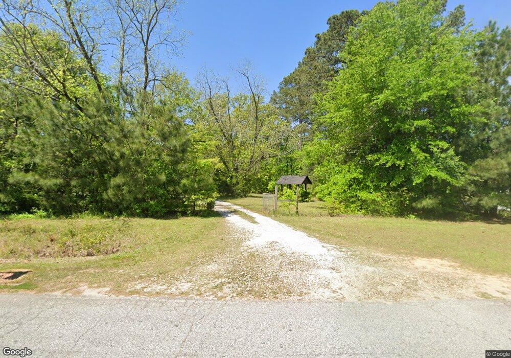
102 Elder Rd Hampton, GA 30228
Spalding County NeighborhoodEstimated Value: $220,000 - $356,850
2
Beds
3
Baths
2,053
Sq Ft
$134/Sq Ft
Est. Value
About This Home
This home is located at 102 Elder Rd, Hampton, GA 30228 and is currently estimated at $274,283, approximately $133 per square foot. 102 Elder Rd is a home located in Spalding County with nearby schools including Futral Road Elementary School, Rehoboth Road Middle School, and Spalding High School.
Ownership History
Date
Name
Owned For
Owner Type
Purchase Details
Closed on
May 10, 1977
Sold by
Jeanes Jeanes H and Jeanes Mary C
Bought by
Davis Charles H and Davis Helen S
Current Estimated Value
Purchase Details
Closed on
May 26, 1970
Sold by
Brittain Edward R and Brittain Ruth B
Bought by
Jeanes Jeanes H and Jeanes Mary C
Purchase Details
Closed on
Mar 19, 1960
Bought by
Brittain Edward R and Brittain Ruth B
Purchase Details
Closed on
Mar 14, 1960
Bought by
Brittain Edward R and Brittain Ruth B
Create a Home Valuation Report for This Property
The Home Valuation Report is an in-depth analysis detailing your home's value as well as a comparison with similar homes in the area
Home Values in the Area
Average Home Value in this Area
Purchase History
| Date | Buyer | Sale Price | Title Company |
|---|---|---|---|
| Davis Charles H | $70,000 | -- | |
| Jeanes Jeanes H | $55,000 | -- | |
| Brittain Edward R | -- | -- | |
| Brittain Edward R | $31,900 | -- |
Source: Public Records
Tax History Compared to Growth
Tax History
| Year | Tax Paid | Tax Assessment Tax Assessment Total Assessment is a certain percentage of the fair market value that is determined by local assessors to be the total taxable value of land and additions on the property. | Land | Improvement |
|---|---|---|---|---|
| 2024 | $2,723 | $99,482 | $47,025 | $52,457 |
| 2023 | $2,713 | $96,213 | $47,025 | $49,188 |
| 2022 | $2,467 | $81,656 | $37,620 | $44,036 |
| 2021 | $2,223 | $77,313 | $37,620 | $39,693 |
| 2020 | $2,340 | $75,482 | $37,620 | $37,862 |
| 2019 | $2,387 | $75,482 | $37,620 | $37,862 |
| 2018 | $2,563 | $72,670 | $37,620 | $35,050 |
| 2017 | $2,489 | $72,670 | $37,620 | $35,050 |
| 2016 | $2,533 | $72,670 | $37,620 | $35,050 |
| 2015 | $2,610 | $72,670 | $37,620 | $35,050 |
| 2014 | $2,657 | $72,670 | $37,620 | $35,050 |
Source: Public Records
Map
Nearby Homes
- 108 Timber Ridge Dr
- 2613 Rehoboth Rd
- 320 Buck Creek Rd
- 111 Cynthia Cir
- 331 Calhoun Rd
- 2495 Barnesville Rd
- 460 McKneely Rd
- 104 Willow Creek Dr
- 121 Sheldon Point
- 245 Kennelsman Dr
- 275 Liberty Bell Ln
- 220 Eve Cir
- 287 Mangham Rd
- 87 Hounds Way
- 270 Kennelsman Dr
- Flora Plan at Fox Crossing
- Cali Plan at Fox Crossing
- Galen Plan at Fox Crossing
- Aisle Plan at Fox Crossing
- Aria Plan at Fox Crossing
- 147 Ellis Dairy Rd
- 1210 Rehoboth Church Rd
- 55 Ellis Dairy Rd
- 196 Ellis Dairy Rd
- 1218 Rehoboth Church Rd
- 1242 Rehoboth Church Rd
- 1248 Rehoboth Church Rd
- 1015 Rehoboth Church Rd
- LOT 2 4.19 ACRE Rehoboth Church Rd
- LOT 1 4.19 ACRE Rehoboth Church Rd
- LOT 6 Rehoboth Church Rd
- LOT 5 Rehoboth Church Rd
- 1239 Rehoboth Church Rd
- 475 Hereford Farm Rd
- 1260 Rehoboth Church Rd
- 1262 Rehoboth Church Rd
- 1500 Barnesville Rd
- 410 Hereford Farm Rd
- 315 Hereford Farm Rd
- 321 Ellis Dairy Rd
