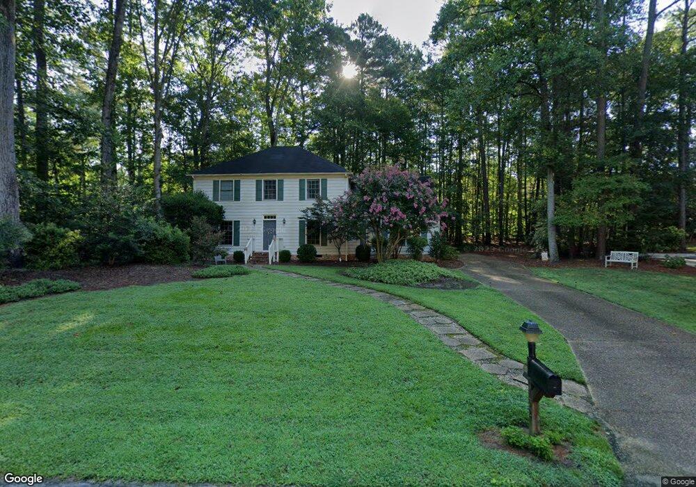
102 First Patent Ct Williamsburg, VA 23188
Powhatan NeighborhoodEstimated Value: $497,000 - $552,000
3
Beds
3
Baths
2,164
Sq Ft
$240/Sq Ft
Est. Value
About This Home
This home is located at 102 First Patent Ct, Williamsburg, VA 23188 and is currently estimated at $519,534, approximately $240 per square foot. 102 First Patent Ct is a home located in James City County with nearby schools including Matoaka Elementary School, Lois Hornsby Middle School, and Jamestown High School.
Ownership History
Date
Name
Owned For
Owner Type
Purchase Details
Closed on
Sep 1, 2005
Sold by
Sande Dennis A
Bought by
Dunn James M
Current Estimated Value
Home Financials for this Owner
Home Financials are based on the most recent Mortgage that was taken out on this home.
Original Mortgage
$200,000
Outstanding Balance
$104,281
Interest Rate
5.84%
Mortgage Type
New Conventional
Estimated Equity
$415,253
Purchase Details
Closed on
May 5, 2000
Sold by
Smead Phillip E
Bought by
Sande Dennis A
Home Financials for this Owner
Home Financials are based on the most recent Mortgage that was taken out on this home.
Original Mortgage
$195,597
Interest Rate
8.19%
Create a Home Valuation Report for This Property
The Home Valuation Report is an in-depth analysis detailing your home's value as well as a comparison with similar homes in the area
Home Values in the Area
Average Home Value in this Area
Purchase History
| Date | Buyer | Sale Price | Title Company |
|---|---|---|---|
| Dunn James M | $355,500 | -- | |
| Sande Dennis A | $189,900 | -- |
Source: Public Records
Mortgage History
| Date | Status | Borrower | Loan Amount |
|---|---|---|---|
| Open | Dunn James M | $200,000 | |
| Previous Owner | Sande Dennis A | $195,597 |
Source: Public Records
Tax History
| Year | Tax Paid | Tax Assessment Tax Assessment Total Assessment is a certain percentage of the fair market value that is determined by local assessors to be the total taxable value of land and additions on the property. | Land | Improvement |
|---|---|---|---|---|
| 2025 | $2,804 | $412,400 | $118,100 | $294,300 |
| 2023 | $2,804 | $337,800 | $78,200 | $259,600 |
| 2022 | $2,804 | $337,800 | $78,200 | $259,600 |
| 2021 | $2,579 | $307,000 | $71,000 | $236,000 |
| 2020 | $2,579 | $307,000 | $71,000 | $236,000 |
| 2019 | $2,544 | $302,900 | $69,300 | $233,600 |
| 2018 | $2,544 | $302,900 | $69,300 | $233,600 |
| 2017 | $2,486 | $296,000 | $69,300 | $226,700 |
| 2016 | $2,486 | $296,000 | $69,300 | $226,700 |
| 2015 | -- | $296,000 | $69,300 | $226,700 |
| 2014 | -- | $296,000 | $69,300 | $226,700 |
Source: Public Records
Map
Nearby Homes
- 4405 Silver Fox Ln
- 4440 Pleasant View Dr
- 4068 Powhatan Secondary
- 4245 Falcon Creek Dr
- 101 Pine Valley
- 108 Southern Hills
- 4409 Wind River Run
- 117 Marion
- 132 Warwick Hills
- 117 Congressional
- 4004 Owl Creek
- 113 Stratton
- 3841 Cromwell Ln
- 5000 Winding Creek Unit 1A
- 4009 Driftwood Way
- 5002 Winding Creek Unit 1B
- 5004 Winding Creek Unit 2A
- 5006 Winding Creek Unit 2B
- 5008 Winding Creek Unit 2C
- 5012 Winding Creek
- 103 Old Cart Rd
- 112 Powhatan Dr
- 104 First Patent Ct
- 105 Powhatan Secondary
- 101 Old Cart Rd
- 103 First Patent Ct
- 201 Old Cart Rd
- 128 Ewell Place
- 132 Ewell Place
- 173 Old Carriage Way
- 169 Old Carriage Way
- 124 Ewell Place
- 104 Old Cart Rd
- 133 Ewell Place
- 106 First Patent Ct
- 106 1st Patent Ct
- 106 Old Cart Rd
- 203 Old Cart Rd
- 105 Shields Poynt
- 102 Old Cart Rd
Your Personal Tour Guide
Ask me questions while you tour the home.