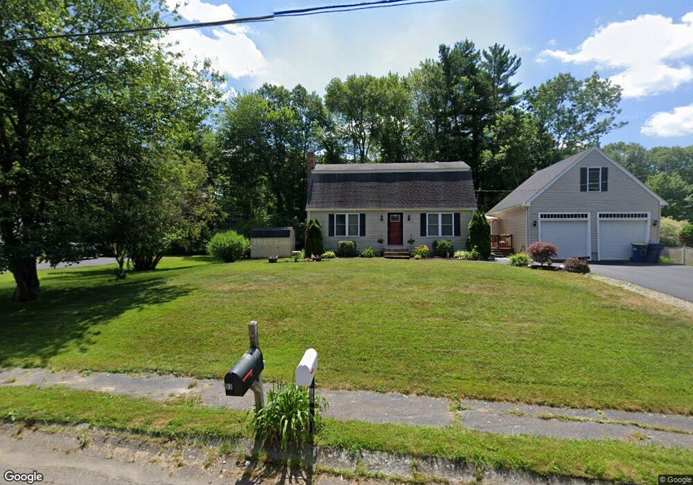
102 Forest Trail East Bridgewater, MA 02333
Estimated Value: $590,189 - $665,000
3
Beds
2
Baths
1,632
Sq Ft
$383/Sq Ft
Est. Value
About This Home
This home is located at 102 Forest Trail, East Bridgewater, MA 02333 and is currently estimated at $625,047, approximately $382 per square foot. 102 Forest Trail is a home located in Plymouth County with nearby schools including Central Elementary School, Gordon W Mitchell Middle School, and East Bridgewater Jr./Sr. High School.
Ownership History
Date
Name
Owned For
Owner Type
Purchase Details
Closed on
Dec 19, 2008
Sold by
Mac Rt
Bought by
Huss Lawrence C and Huss Jennifer J
Current Estimated Value
Home Financials for this Owner
Home Financials are based on the most recent Mortgage that was taken out on this home.
Original Mortgage
$274,500
Outstanding Balance
$182,612
Interest Rate
6.27%
Mortgage Type
Purchase Money Mortgage
Estimated Equity
$442,435
Purchase Details
Closed on
Jun 13, 2008
Sold by
Buchard Noreen S and Sampson Noreen E
Bought by
Mac Rt
Home Financials for this Owner
Home Financials are based on the most recent Mortgage that was taken out on this home.
Original Mortgage
$147,500
Interest Rate
6.13%
Mortgage Type
Purchase Money Mortgage
Purchase Details
Closed on
Feb 15, 2008
Sold by
Sawtelle Lisa M and Sampson Lisa M
Bought by
Sampson Lorie A
Create a Home Valuation Report for This Property
The Home Valuation Report is an in-depth analysis detailing your home's value as well as a comparison with similar homes in the area
Home Values in the Area
Average Home Value in this Area
Purchase History
| Date | Buyer | Sale Price | Title Company |
|---|---|---|---|
| Huss Lawrence C | $289,000 | -- | |
| Mac Rt | $125,000 | -- | |
| Sampson Lorie A | -- | -- |
Source: Public Records
Mortgage History
| Date | Status | Borrower | Loan Amount |
|---|---|---|---|
| Open | Sampson Lorie A | $274,500 | |
| Previous Owner | Sampson Lorie A | $147,500 |
Source: Public Records
Tax History Compared to Growth
Tax History
| Year | Tax Paid | Tax Assessment Tax Assessment Total Assessment is a certain percentage of the fair market value that is determined by local assessors to be the total taxable value of land and additions on the property. | Land | Improvement |
|---|---|---|---|---|
| 2025 | $6,784 | $496,300 | $211,600 | $284,700 |
| 2024 | $6,394 | $462,000 | $203,500 | $258,500 |
| 2023 | $6,303 | $436,200 | $203,500 | $232,700 |
| 2022 | $5,844 | $374,600 | $169,700 | $204,900 |
| 2021 | $6,233 | $324,200 | $163,000 | $161,200 |
| 2020 | $5,284 | $314,000 | $156,800 | $157,200 |
| 2019 | $4,873 | $299,600 | $149,800 | $149,800 |
| 2018 | $3,733 | $282,400 | $149,800 | $132,600 |
| 2017 | $4,551 | $269,200 | $142,900 | $126,300 |
| 2016 | $4,802 | $264,400 | $142,900 | $121,500 |
| 2015 | $4,637 | $261,100 | $141,900 | $119,200 |
| 2014 | $4,450 | $256,200 | $138,900 | $117,300 |
Source: Public Records
Map
Nearby Homes
- 1247 Central St
- 936 Central St
- 170 Elm St
- 182 Crystal Water Dr Unit 182
- 5 Della Way
- 1 Simmons Place
- 844 Washington St
- 9 Daisy Ln
- 217 Crystal Water Dr
- 28 Brookbend Way E
- 1993 Washington St
- 71 Stonegate Dr
- 78 Crystal Water Dr
- 587 Bridge St
- 2045 Washington St
- 26 Meadowbrook Dr
- 22 Hudson St
- 94 Pond St
- 10 Eliab Latham Way
- 29 Hayes Rd