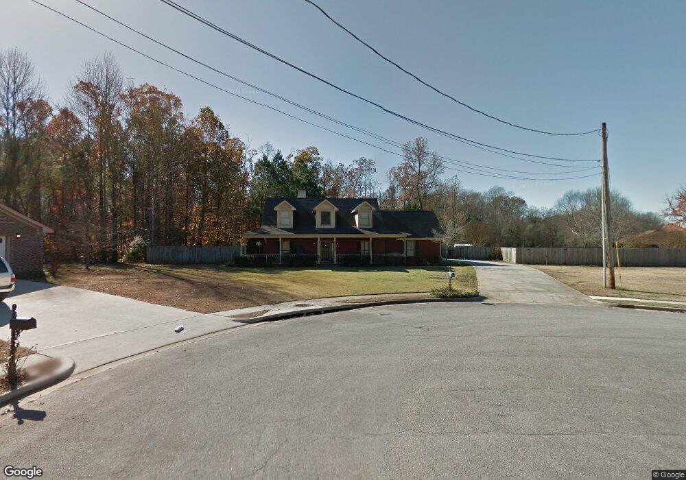
102 Foxwatch Cir Harvest, AL 35749
Harvest-Cluttsville NeighborhoodEstimated Value: $322,000 - $352,849
3
Beds
3
Baths
1,910
Sq Ft
$176/Sq Ft
Est. Value
About This Home
This home is located at 102 Foxwatch Cir, Harvest, AL 35749 and is currently estimated at $336,212, approximately $176 per square foot. 102 Foxwatch Cir is a home located in Madison County with nearby schools including Endeavor Elementary School, Monrovia Middle School, and Sparkman High School.
Ownership History
Date
Name
Owned For
Owner Type
Purchase Details
Closed on
Apr 16, 2010
Sold by
Paoline Edmund Arthur
Bought by
Paoline Deborah Sue
Current Estimated Value
Purchase Details
Closed on
Jan 19, 2006
Sold by
Scranton Steven J and Scranton Marian A
Bought by
Paoline Edmund Arthur and Paoline Deborah Sue
Home Financials for this Owner
Home Financials are based on the most recent Mortgage that was taken out on this home.
Original Mortgage
$127,900
Outstanding Balance
$71,634
Interest Rate
6.21%
Mortgage Type
New Conventional
Estimated Equity
$264,578
Create a Home Valuation Report for This Property
The Home Valuation Report is an in-depth analysis detailing your home's value as well as a comparison with similar homes in the area
Home Values in the Area
Average Home Value in this Area
Purchase History
| Date | Buyer | Sale Price | Title Company |
|---|---|---|---|
| Paoline Deborah Sue | -- | -- | |
| Paoline Edmund Arthur | -- | -- |
Source: Public Records
Mortgage History
| Date | Status | Borrower | Loan Amount |
|---|---|---|---|
| Open | Paoline Edmund Arthur | $127,900 |
Source: Public Records
Tax History Compared to Growth
Tax History
| Year | Tax Paid | Tax Assessment Tax Assessment Total Assessment is a certain percentage of the fair market value that is determined by local assessors to be the total taxable value of land and additions on the property. | Land | Improvement |
|---|---|---|---|---|
| 2024 | $1,075 | $31,220 | $5,400 | $25,820 |
| 2023 | $1,075 | $30,300 | $5,400 | $24,900 |
| 2022 | $979 | $28,580 | $5,400 | $23,180 |
| 2021 | $760 | $22,300 | $2,040 | $20,260 |
| 2020 | $710 | $20,930 | $2,040 | $18,890 |
| 2019 | $679 | $20,070 | $2,040 | $18,030 |
| 2018 | $631 | $18,760 | $0 | $0 |
| 2017 | $631 | $18,760 | $0 | $0 |
| 2016 | $631 | $18,760 | $0 | $0 |
| 2015 | $631 | $18,760 | $0 | $0 |
| 2014 | $636 | $18,900 | $0 | $0 |
Source: Public Records
Map
Nearby Homes
- 119 Bilton Dr
- 211 Woodgrove Dr NW
- 380 Sam Thomas Rd
- 204 NW Hawks Crest Dr
- 1781 Capshaw Rd NW
- 203 Blackwood Dr NW
- 11113 Ravenel Dr
- 11114 Ravenel Dr
- 223 Blackwater Dr
- 11111 Ravenel Dr
- 280 Dustin Ln NW
- 103 Canning Place NW
- 263 Dustin Ln NW
- 159 Dustin Ln NW
- 107 Leona Ln NW
- 100 Bayridge Dr
- 11 Flintridge Dr
- 10 Flintridge Dr
- 9 Flintridge Dr
- 7 Flintridge Dr
- 104 Foxwatch Cir
- 105 Foxwatch Cir
- 162 Rosecliff Dr
- 103 Foxwatch Cir
- 101 Foxwatch Cir
- 164 Rosecliff Dr
- 161 Rosecliff Dr
- 156 Rosecliff Dr
- 163 Rosecliff Dr
- 166 Rosecliff Dr
- 202 Crossrail Cir
- 154 Sam Thomas Rd
- 152 Sam Thomas Rd
- 200 Crossrail Cir
- 154 Rosecliff Dr
- 165 Rosecliff Dr
- 155 Rosecliff Dr
- 204 Crossrail Cir
- 168 Rosecliff Dr
- 220 Sam Thomas Rd