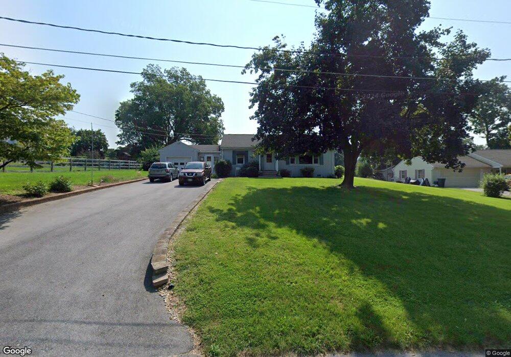
102 George St Union Bridge, MD 21791
Estimated Value: $268,571 - $328,000
Studio
1
Bath
1,336
Sq Ft
$229/Sq Ft
Est. Value
About This Home
This home is located at 102 George St, Union Bridge, MD 21791 and is currently estimated at $306,143, approximately $229 per square foot. 102 George St is a home located in Carroll County with nearby schools including Elmer A. Wolfe Elementary School, Northwest Middle School, and Francis Scott Key High School.
Ownership History
Date
Name
Owned For
Owner Type
Purchase Details
Closed on
Mar 4, 2003
Sold by
Yingling Douglas L
Bought by
Grimes Charles D and Grimes Pamela L
Current Estimated Value
Purchase Details
Closed on
Dec 14, 1993
Sold by
Marsar Development Corp
Bought by
Kreit Suzanne M
Home Financials for this Owner
Home Financials are based on the most recent Mortgage that was taken out on this home.
Original Mortgage
$50,000
Interest Rate
6.78%
Create a Home Valuation Report for This Property
The Home Valuation Report is an in-depth analysis detailing your home's value as well as a comparison with similar homes in the area
Purchase History
We collect this data history from publicly available records. To have your information removed, we recommend requesting removal directly through your county’s website.
| Date | Buyer | Sale Price | Title Company |
|---|---|---|---|
| Grimes Charles D | $146,000 | -- | |
| Kreit Suzanne M | $99,000 | -- |
Source: Public Records
Mortgage History
We collect this data history from publicly available records. To have your information removed, we recommend requesting removal directly through your county’s website.
| Date | Status | Borrower | Loan Amount |
|---|---|---|---|
| Previous Owner | Kreit Suzanne M | $50,000 |
Source: Public Records
Tax History
| Year | Tax Paid | Tax Assessment Tax Assessment Total Assessment is a certain percentage of the fair market value that is determined by local assessors to be the total taxable value of land and additions on the property. | Land | Improvement |
|---|---|---|---|---|
| 2025 | $2,972 | $207,667 | $0 | $0 |
| 2024 | $2,828 | $195,333 | $0 | $0 |
| 2023 | $2,690 | $183,000 | $90,000 | $93,000 |
| 2022 | $2,665 | $181,333 | $0 | $0 |
| 2021 | $5,318 | $179,667 | $0 | $0 |
| 2020 | $2,634 | $178,000 | $90,000 | $88,000 |
| 2019 | $2,540 | $171,600 | $0 | $0 |
| 2018 | $2,428 | $165,200 | $0 | $0 |
| 2017 | $2,334 | $158,800 | $0 | $0 |
| 2016 | -- | $158,800 | $0 | $0 |
| 2015 | -- | $158,800 | $0 | $0 |
| 2014 | -- | $160,400 | $0 | $0 |
Source: Public Records
Map
Nearby Homes
- 302 E Thomas St
- 110 N Main St
- 13411 Rabbit Run Terrace
- 57B Hoff Rd
- 244 Stem Rd
- 12763 Bunker Hill Rd
- 285 Stem Rd
- 0 Stem Rd
- 6245 Middleburg Rd
- 3875 Bark Hill Rd
- 118 S Clear Ridge Rd
- 0 Crouse Mill
- 837 Francis Scott Key Hwy
- 9630 B Clemsonville Rd
- 800 Trevanion Rd
- 0 Muth Rd
- 1309 Trevanion Rd
- 12734 Woodsboro Pike
- 1183 Jo Apter Place
- 3238 Atlee Ridge Rd
- 145 W Broadway St
- 142 W Broadway St
- 143 W Broadway St
- 110 W Locust St
- 106 George St
- 141 W Broadway St
- 140 W Broadway St
- 12 E Locust St
- 139 W Broadway St
- 106 W Locust St
- 37 W Broadway St
- 134 W Broadway St
- 136 W Broadway St
- 112 W Locust St
- 104 W Locust St
- 132 W Broadway St
- 4 Whyte St
- 8 Whyte St
- 6 Whyte St
- 33 W Broadway St
Your Personal Tour Guide
Ask me questions while you tour the home.