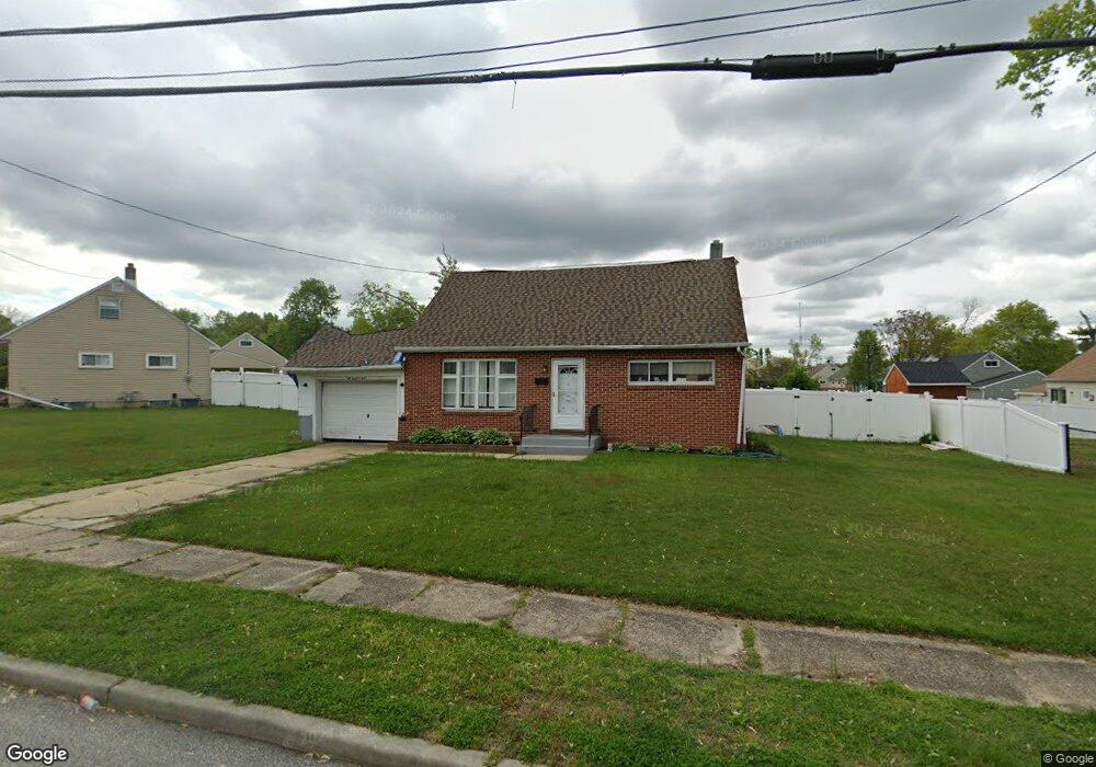
102 Hammond Ave Wenonah, NJ 08090
Deptford Township NeighborhoodEstimated Value: $290,000 - $324,000
--
Bed
--
Bath
1,267
Sq Ft
$243/Sq Ft
Est. Value
About This Home
This home is located at 102 Hammond Ave, Wenonah, NJ 08090 and is currently estimated at $307,603, approximately $242 per square foot. 102 Hammond Ave is a home located in Gloucester County with nearby schools including Deptford Township High School and St Margaret Regional School.
Ownership History
Date
Name
Owned For
Owner Type
Purchase Details
Closed on
Dec 19, 2004
Sold by
Blemings Gary B and Goble Blemmings Regina M
Bought by
Hagan Douglas and Hagan Dana
Current Estimated Value
Home Financials for this Owner
Home Financials are based on the most recent Mortgage that was taken out on this home.
Original Mortgage
$141,536
Outstanding Balance
$70,881
Interest Rate
5.73%
Mortgage Type
FHA
Estimated Equity
$236,722
Purchase Details
Closed on
Apr 28, 1995
Sold by
Turner Emanuel R and Augustus John E
Bought by
Blemings Gary B
Create a Home Valuation Report for This Property
The Home Valuation Report is an in-depth analysis detailing your home's value as well as a comparison with similar homes in the area
Home Values in the Area
Average Home Value in this Area
Purchase History
| Date | Buyer | Sale Price | Title Company |
|---|---|---|---|
| Hagan Douglas | $143,800 | Congress Ch | |
| Blemings Gary B | $60,000 | Congress Title Corp |
Source: Public Records
Mortgage History
| Date | Status | Borrower | Loan Amount |
|---|---|---|---|
| Open | Hagan Douglas | $141,536 |
Source: Public Records
Tax History Compared to Growth
Tax History
| Year | Tax Paid | Tax Assessment Tax Assessment Total Assessment is a certain percentage of the fair market value that is determined by local assessors to be the total taxable value of land and additions on the property. | Land | Improvement |
|---|---|---|---|---|
| 2025 | $5,112 | $142,600 | $36,700 | $105,900 |
| 2024 | $4,948 | $142,600 | $36,700 | $105,900 |
| 2023 | $4,948 | $142,600 | $36,700 | $105,900 |
| 2022 | $4,913 | $142,600 | $36,700 | $105,900 |
| 2021 | $5,084 | $149,700 | $36,700 | $113,000 |
| 2020 | $5,025 | $149,700 | $36,700 | $113,000 |
| 2019 | $4,930 | $149,700 | $36,700 | $113,000 |
| 2018 | $4,819 | $149,700 | $36,700 | $113,000 |
| 2017 | $4,690 | $149,700 | $36,700 | $113,000 |
| 2016 | $4,594 | $149,700 | $36,700 | $113,000 |
| 2015 | $4,452 | $149,700 | $36,700 | $113,000 |
| 2014 | $4,337 | $149,700 | $36,700 | $113,000 |
Source: Public Records
Map
Nearby Homes
- 103 Carver Dr
- 1 W Buttonwood St
- 206 E Elm St
- 8 W Buttonwood St
- 413 Eryn Rd
- 616 Fairview Ave
- 859 Cattell Rd
- 853 Mail Ave
- 525 Westminster Rd
- 3 E Mantua Ave
- 818 Mail Ave
- 315 Ogden Station Rd
- 313 Ogden Station Rd
- 477 Bucknell Ave
- 505 University Blvd
- 36 Dancy Ave
- 711 Howard Ave
- 441 Bucknell Ave
- 916 Georgetown Rd
- 360 Haverford Ave
- 104 Brookfield Ave
- 1408 Glassboro Rd
- 1410 Glassboro Rd
- 110 Brookfield Ave
- 99 Hammond Ave
- 1404 Glassboro Rd
- 101 Carver Dr
- 1 Pine Ln
- 1414 Glassboro Rd
- 112 Brookfield Ave
- 109 Brookfield Ave
- 110 Carver Dr
- 113 Brookfield Ave
- 1418 Glassboro Rd
- 1396 Glassboro Rd
- 1403 Glassboro Rd
- 1407 Glassboro Rd
- 114 Carver Dr
- 1409 Glassboro Rd
- 117 Brookfield Ave
