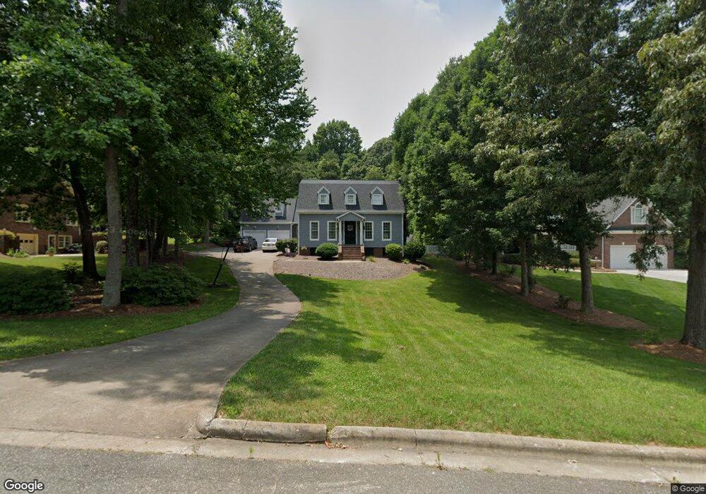
102 Jason Dr Kings Mountain, NC 28086
Estimated Value: $406,907 - $567,000
--
Bed
--
Bath
2,680
Sq Ft
$185/Sq Ft
Est. Value
About This Home
This home is located at 102 Jason Dr, Kings Mountain, NC 28086 and is currently estimated at $495,727, approximately $184 per square foot. 102 Jason Dr is a home located in Cleveland County with nearby schools including North Elementary School, Kings Mountain Intermediate School, and Kings Mountain Middle.
Ownership History
Date
Name
Owned For
Owner Type
Purchase Details
Closed on
Aug 11, 2017
Sold by
Miller Keith E and Miller Julia G
Bought by
Bundon Jonathan Michael and Bundon Heather Hogan
Current Estimated Value
Home Financials for this Owner
Home Financials are based on the most recent Mortgage that was taken out on this home.
Original Mortgage
$224,000
Outstanding Balance
$187,263
Interest Rate
4.03%
Mortgage Type
New Conventional
Estimated Equity
$308,464
Create a Home Valuation Report for This Property
The Home Valuation Report is an in-depth analysis detailing your home's value as well as a comparison with similar homes in the area
Home Values in the Area
Average Home Value in this Area
Purchase History
| Date | Buyer | Sale Price | Title Company |
|---|---|---|---|
| Bundon Jonathan Michael | $284,000 | None Available |
Source: Public Records
Mortgage History
| Date | Status | Borrower | Loan Amount |
|---|---|---|---|
| Open | Bundon Jonathan Michael | $224,000 |
Source: Public Records
Tax History Compared to Growth
Tax History
| Year | Tax Paid | Tax Assessment Tax Assessment Total Assessment is a certain percentage of the fair market value that is determined by local assessors to be the total taxable value of land and additions on the property. | Land | Improvement |
|---|---|---|---|---|
| 2025 | $4,077 | $397,717 | $36,630 | $361,087 |
| 2024 | $3,395 | $288,690 | $27,472 | $261,218 |
| 2023 | $3,251 | $288,690 | $27,472 | $261,218 |
| 2022 | $3,235 | $288,690 | $27,472 | $261,218 |
| 2021 | $3,251 | $288,690 | $27,472 | $261,218 |
| 2020 | $2,610 | $225,034 | $22,661 | $202,373 |
| 2019 | $2,610 | $225,034 | $22,661 | $202,373 |
| 2018 | $2,609 | $225,034 | $22,661 | $202,373 |
| 2017 | $2,596 | $225,034 | $22,661 | $202,373 |
| 2016 | $2,606 | $225,034 | $22,661 | $202,373 |
| 2015 | $2,417 | $214,119 | $19,536 | $194,583 |
| 2014 | $2,417 | $214,119 | $19,536 | $194,583 |
Source: Public Records
Map
Nearby Homes
- 521 Coman Ln
- 1417 Merrimont Ave
- 117 Parker Claire Ln
- 111 Parker Claire Ln
- 213 Parker Claire Ln
- 1500 Shelby Rd
- 1427 Merrimont Ave
- 1610 Shelby Rd
- 1301 Shelby Rd
- 155 Patterson Rd
- 208 Victoria Cir
- 145 Crown Ct
- 167 Patterson Rd
- 442 Phifer Rd
- 117 Sir Lancelot Ln
- Plan 2338 at Cottages at Clovis Point
- Plan 2723 at Cottages at Clovis Point
- Plan 2539 at Cottages at Clovis Point
- Plan 1844 at Cottages at Clovis Point
- Plan 1445 at Cottages at Clovis Point
- 100 Jason Dr
- 104 Jason Dr
- 106 Jason Dr
- 514 Deerfield Dr
- 511 Deerfield Dr
- 108 Jason Dr
- 512 Deerfield Dr
- 509 Deerfield Dr
- 109 Jason Dr
- 110 Jason Dr
- 310 Woodhaven Ln
- 507 Deerfield Dr
- 508 Deerfield Dr
- 112 Jason Dr
- 539 Coman Ln Unit Lot 9
- 505 Deerfield Dr
- 113 Jason Dr
- 543 Coman Ln
- 535 Coman Ln Unit Lot 8
- 504 Deerfield Dr