Estimated Value: $631,000 - $1,147,000
3
Beds
2
Baths
2,393
Sq Ft
$376/Sq Ft
Est. Value
About This Home
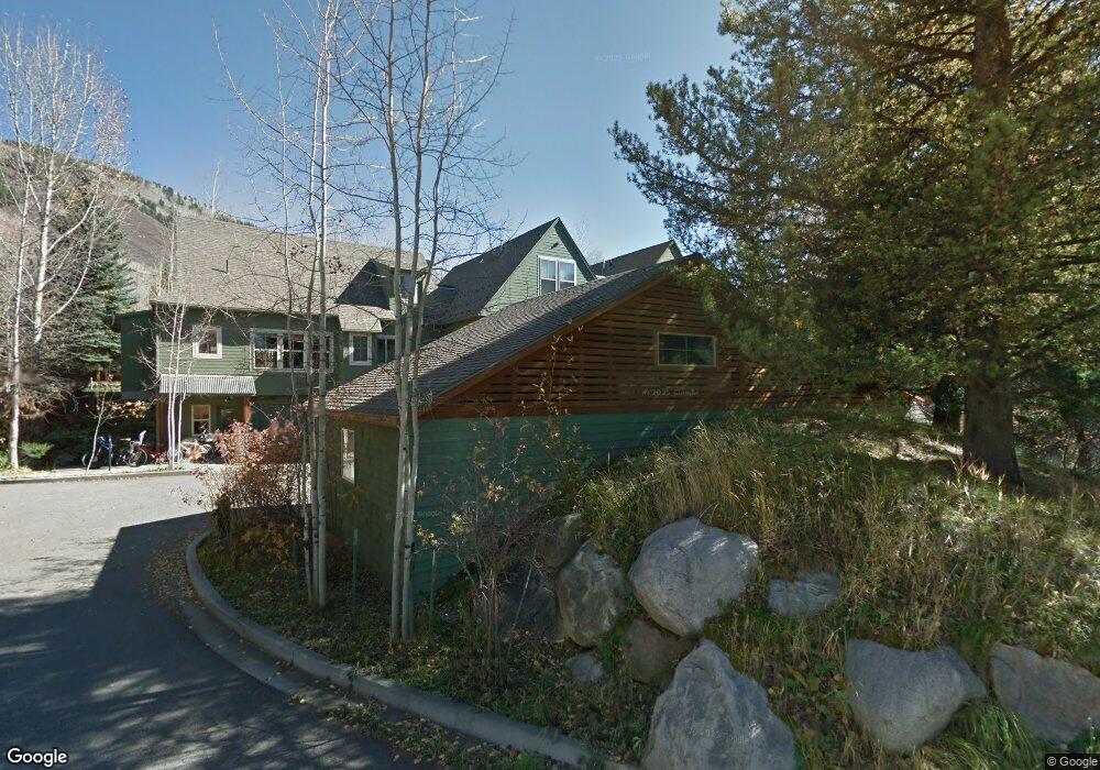
This home is located at 102 Kathryns Way Unit A2, Aspen, CO 81611 and is currently estimated at $899,942, approximately $376 per square foot. 102 Kathryns Way Unit A2 is a home located in Pitkin County with nearby schools including Aspen Elementary School, Aspen Middle School, and Aspen High School.
Ownership History
Date
Name
Owned For
Owner Type
Purchase Details
Closed on
Mar 11, 2014
Sold by
Jarrell Kimberly Wilson
Bought by
Wilson Kimberly
Current Estimated Value
Purchase Details
Closed on
Feb 8, 2010
Sold by
Aspen/Pitkin County Housing Authority
Bought by
Jarrell Kimberly Wilson
Home Financials for this Owner
Home Financials are based on the most recent Mortgage that was taken out on this home.
Original Mortgage
$227,723
Interest Rate
5.08%
Mortgage Type
New Conventional
Create a Home Valuation Report for This Property
The Home Valuation Report is an in-depth analysis detailing your home's value as well as a comparison with similar homes in the area
Home Values in the Area
Average Home Value in this Area
Purchase History
| Date | Buyer | Sale Price | Title Company |
|---|---|---|---|
| Wilson Kimberly | -- | None Available | |
| Jarrell Kimberly Wilson | $284,654 | Stewart Title | |
| Aspen/Pitkin County Housing Authority | -- | Stewart Title |
Source: Public Records
Mortgage History
| Date | Status | Borrower | Loan Amount |
|---|---|---|---|
| Previous Owner | Jarrell Kimberly Wilson | $227,723 |
Source: Public Records
Tax History Compared to Growth
Tax History
| Year | Tax Paid | Tax Assessment Tax Assessment Total Assessment is a certain percentage of the fair market value that is determined by local assessors to be the total taxable value of land and additions on the property. | Land | Improvement |
|---|---|---|---|---|
| 2024 | $746 | $22,490 | $0 | $22,490 |
| 2023 | $746 | $25,420 | $0 | $25,420 |
| 2022 | $869 | $23,460 | $0 | $23,460 |
| 2021 | $878 | $24,140 | $0 | $24,140 |
| 2020 | $855 | $23,670 | $0 | $23,670 |
| 2019 | $855 | $23,670 | $0 | $23,670 |
| 2018 | $827 | $23,830 | $0 | $23,830 |
| 2017 | $731 | $22,690 | $0 | $22,690 |
| 2016 | $824 | $25,070 | $0 | $25,070 |
| 2015 | $813 | $25,070 | $0 | $25,070 |
| 2014 | $823 | $24,250 | $0 | $24,250 |
Source: Public Records
Map
Nearby Homes
- 108 Midland Ave
- 201 Midland Ave
- 71 & 73 Smuggler Grove Rd
- 1212 E Hopkins Ave
- 311 Midland Ave
- 100 Park Ave
- 326 Midland Ave Unit 306
- 326 Midland Ave Unit 302
- 322 Park Ave Unit 2
- 1034 E Cooper Ave Unit 19A
- 1024 E Hopkins Ave Unit 16
- 1039 E Cooper Ave Unit 16A
- 1006 E Cooper Ave
- 415 Park Cir Unit 5
- 979 Queen St
- 935 E Hopkins Ave
- 939 E Cooper Ave Unit B
- City Tdr
- 515 Park Cir
- 901 E Hyman Ave Unit 13
- 103 Kathryns Way Unit A3
- 101 Kathryns Way Unit A1
- 104 Kathryns Way Unit A4
- 514 Kathryns Way Unit E1
- 413 Kathryns Way Unit D4
- 515 Kathryns Way Unit E2
- 412 Kathryns Way Unit D3
- 205 Kathryns Way Unit B1
- 411 Kathryns Way Unit D2
- 410 Kathryns Way Unit D1
- 206 Kathryns Way Unit B2
- 207 Kathryns Way Unit B3
- 309 Kathryns Way Unit C2
- 308 Kathryns Way Unit C1
- 320 Midland Ave
- 26 Smuggler Grove
- 28 Smuggler Grove
- 26 Smuggler Grv Rd
- 28 Smuggler Grv Rd
- 55 Smuggler Grv Rd