Estimated Value: $273,000 - $310,000
4
Beds
2
Baths
2,116
Sq Ft
$135/Sq Ft
Est. Value
About This Home
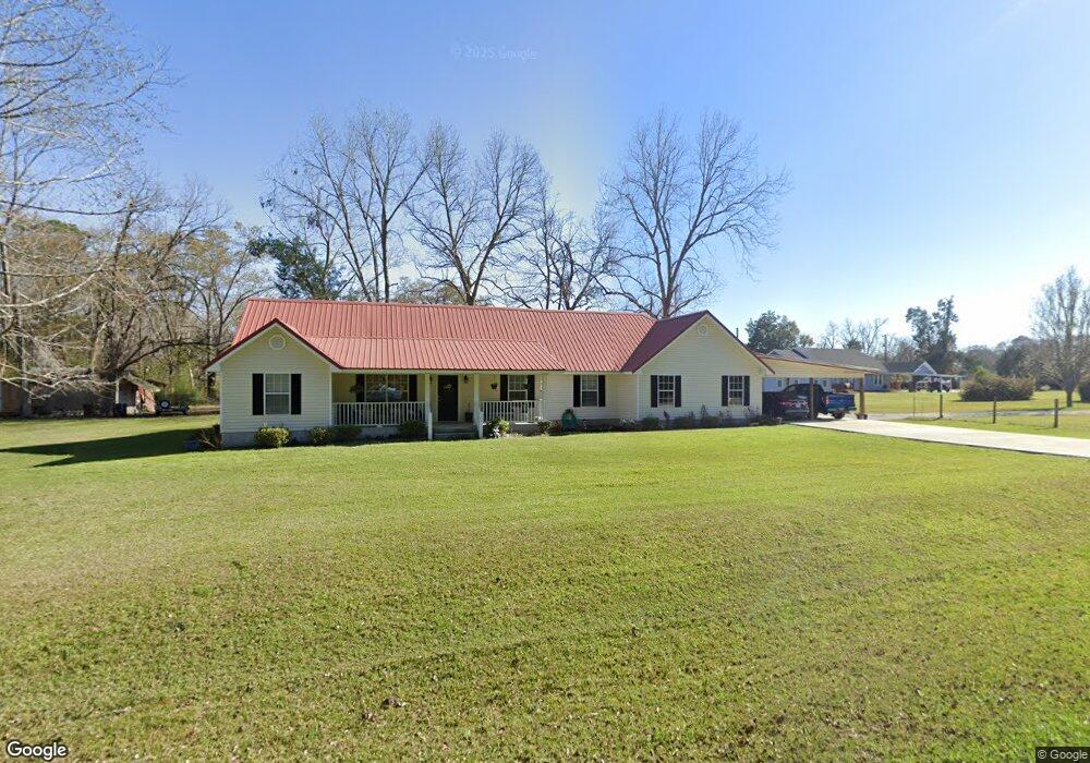
This home is located at 102 Kent Dr, Adel, GA 31620 and is currently estimated at $286,391, approximately $135 per square foot. 102 Kent Dr is a home located in Cook County with nearby schools including Cook Primary School, Cook Elementary School, and Cook County Middle School.
Ownership History
Date
Name
Owned For
Owner Type
Purchase Details
Closed on
Feb 17, 2023
Sold by
Us Bank Trust National Association Trust
Bought by
Lashley Diana and Lashley Roy L
Current Estimated Value
Purchase Details
Closed on
Jul 6, 2021
Sold by
Ahrens Wade W
Bought by
Us Bank Trust National Association Trust
Purchase Details
Closed on
Dec 3, 2019
Sold by
Ahrens Walter Wade
Bought by
Wbl Spo I Llc
Purchase Details
Closed on
Apr 30, 2013
Sold by
Ahrens Mandy D
Bought by
Ahrens Walter Wade
Create a Home Valuation Report for This Property
The Home Valuation Report is an in-depth analysis detailing your home's value as well as a comparison with similar homes in the area
Home Values in the Area
Average Home Value in this Area
Purchase History
| Date | Buyer | Sale Price | Title Company |
|---|---|---|---|
| Lashley Diana | $156,900 | -- | |
| Us Bank Trust National Association Trust | $86,666 | -- | |
| Wbl Spo I Llc | $41,200 | -- | |
| Ahrens Walter Wade | -- | -- |
Source: Public Records
Tax History Compared to Growth
Tax History
| Year | Tax Paid | Tax Assessment Tax Assessment Total Assessment is a certain percentage of the fair market value that is determined by local assessors to be the total taxable value of land and additions on the property. | Land | Improvement |
|---|---|---|---|---|
| 2024 | $1,998 | $81,541 | $6,021 | $75,520 |
| 2023 | $1,688 | $62,661 | $6,021 | $56,640 |
| 2022 | $1,671 | $62,016 | $5,376 | $56,640 |
| 2021 | $1,496 | $51,816 | $5,376 | $46,440 |
| 2020 | $1,496 | $51,816 | $5,376 | $46,440 |
| 2019 | $1,442 | $51,816 | $5,376 | $46,440 |
| 2018 | $1,498 | $51,816 | $5,376 | $46,440 |
| 2017 | $1,443 | $51,816 | $5,376 | $46,440 |
| 2016 | $1,445 | $51,816 | $5,376 | $46,440 |
| 2015 | $1,447 | $51,816 | $5,376 | $46,440 |
| 2014 | $1,450 | $51,816 | $5,376 | $46,440 |
| 2013 | -- | $51,816 | $5,376 | $46,440 |
Source: Public Records
Map
Nearby Homes
- 1402 Bear Creek Rd
- 1306 Bear Creek Rd
- 703 N Elm St
- 105 Orchard Cir
- 2302 Thomas St
- 701 Gloria St
- 304 E 3rd St
- 103 N College St
- 418 E 3rd St
- 315 Newton Dr
- 2603 Dianne St
- 2503 Dianne St
- 284 Barrett Rd
- 120 Westover Dr
- 211 S Gordon Ave
- 123 Westover Dr
- 901 E 4th St
- 625 Coxstill Rd
- 322 Magnolia Dr
- 415 E 8th St