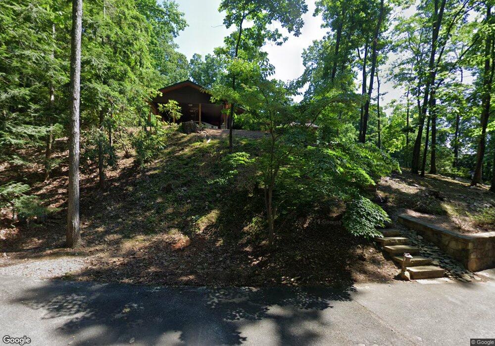
102 Kyle Ln Dalton, GA 30720
Estimated Value: $355,588 - $502,000
4
Beds
4
Baths
3,404
Sq Ft
$122/Sq Ft
Est. Value
About This Home
This home is located at 102 Kyle Ln, Dalton, GA 30720 and is currently estimated at $413,647, approximately $121 per square foot. 102 Kyle Ln is a home located in Whitfield County with nearby schools including City Park Elementary School, Dalton High School, and Rock Hill School.
Ownership History
Date
Name
Owned For
Owner Type
Purchase Details
Closed on
Mar 25, 2003
Sold by
Waldrop Amy L
Bought by
Howalt Frederick H and Howalt Cynthia B
Current Estimated Value
Purchase Details
Closed on
May 9, 2001
Sold by
Henley Holli Barnes
Bought by
Waldrop Amy L
Purchase Details
Closed on
Jun 1, 1992
Bought by
Henley Holli Barnes
Create a Home Valuation Report for This Property
The Home Valuation Report is an in-depth analysis detailing your home's value as well as a comparison with similar homes in the area
Purchase History
| Date | Buyer | Sale Price | Title Company |
|---|---|---|---|
| Howalt Frederick H | $214,500 | -- | |
| Waldrop Amy L | $188,500 | -- | |
| Henley Holli Barnes | $155,000 | -- |
Source: Public Records
Tax History
| Year | Tax Paid | Tax Assessment Tax Assessment Total Assessment is a certain percentage of the fair market value that is determined by local assessors to be the total taxable value of land and additions on the property. | Land | Improvement |
|---|---|---|---|---|
| 2025 | $4,224 | $150,548 | $12,000 | $138,548 |
| 2024 | $4,224 | $150,548 | $12,000 | $138,548 |
| 2023 | $3,935 | $106,418 | $10,000 | $96,418 |
| 2022 | $3,542 | $102,850 | $10,000 | $92,850 |
| 2021 | $3,548 | $102,850 | $10,000 | $92,850 |
| 2020 | $3,685 | $102,850 | $10,000 | $92,850 |
| 2019 | $2,885 | $85,918 | $10,000 | $75,918 |
| 2018 | $2,923 | $85,918 | $10,000 | $75,918 |
| 2017 | $2,807 | $85,918 | $10,000 | $75,918 |
| 2016 | $2,561 | $78,708 | $9,660 | $69,048 |
| 2014 | $2,369 | $78,708 | $9,660 | $69,048 |
| 2013 | -- | $78,708 | $9,660 | $69,048 |
Source: Public Records
Map
Nearby Homes
- 2214 Mount Haven Dr
- 2214 Mount Haven Dr Unit 9
- 2219 Rocky Face Cir
- 1946 Tibbs Terrace
- 129 Lisa Ln
- 00 Shugart Rd
- 1833 Woodvalley Dr
- 1202 Covie Dr
- 1502 Mockingbird Place
- 1295 Walston St
- 0 Overlook Trail
- lot 25 Covie Ridge
- 2400 Botany Woods Dr
- 2305 Ravine Way
- 432 Castle Rd
- 376 Amanda Way
- 1414 Walston Ave
- 451 Castle Rd
- 1501 Anthony Ave
- 0 Battleline Dr Unit 133896
- 103 Kyle Ln
- 100 Kyle Ln
- 100 Kyle Ln
- 2214 Mount Haven Dr Unit 3
- 2214 Mount Haven Dr Unit 12
- 2214 Mount Haven Dr Unit 7
- 2214 Mount Haven Dr Unit 11
- 2214 Mount Haven Dr Unit 2
- 2214 Mount Haven Dr
- 2214 Mount Haven Dr Unit 4
- 2214 Mount Haven Dr Unit 6
- 2214 Mount Haven Dr Unit 5
- 2218 Mount Haven Dr Unit 27
- 2218 Mount Haven Dr Unit 25
- 2218 Mount Haven Dr Unit 23
- 2218 Mount Haven Dr Unit 22
- 2218 Mount Haven Dr Unit 26
- 2218 Mount Haven Dr Unit 24
- 2218 Mount Haven Dr Unit 28
- 2312 Mount Haven Dr
Your Personal Tour Guide
Ask me questions while you tour the home.