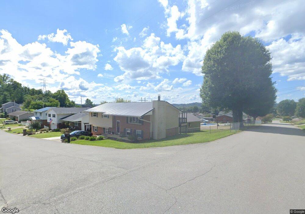
102 Lea St South Point, OH 45680
Estimated Value: $211,220 - $271,000
3
Beds
3
Baths
1,250
Sq Ft
$182/Sq Ft
Est. Value
About This Home
This home is located at 102 Lea St, South Point, OH 45680 and is currently estimated at $228,055, approximately $182 per square foot. 102 Lea St is a home located in Lawrence County with nearby schools including South Point High School.
Ownership History
Date
Name
Owned For
Owner Type
Purchase Details
Closed on
Jun 14, 2017
Sold by
Wesbanco Bank Inc
Bought by
Keefer Daniel and Keefer Miranda
Current Estimated Value
Home Financials for this Owner
Home Financials are based on the most recent Mortgage that was taken out on this home.
Original Mortgage
$130,404
Outstanding Balance
$108,081
Interest Rate
3.89%
Estimated Equity
$119,974
Purchase Details
Closed on
Jun 6, 2016
Sold by
Wesbanco Bank Inc and Russell Scott
Bought by
Wesbanco Bank Inc
Purchase Details
Closed on
May 17, 2000
Sold by
Weekley Christopher F
Bought by
Russell Scott and Russell Karen
Purchase Details
Closed on
Mar 15, 1995
Sold by
Mascari Michael E and Mascari Car
Bought by
Weekley Christopher F
Purchase Details
Closed on
May 4, 1988
Sold by
Mccade Vincent E and Lind Mccade
Bought by
Mascari Michael E and Mascari Car
Create a Home Valuation Report for This Property
The Home Valuation Report is an in-depth analysis detailing your home's value as well as a comparison with similar homes in the area
Home Values in the Area
Average Home Value in this Area
Purchase History
| Date | Buyer | Sale Price | Title Company |
|---|---|---|---|
| Keefer Daniel | -- | -- | |
| Wesbanco Bank Inc | $99,412 | None Available | |
| Russell Scott | $113,000 | -- | |
| Weekley Christopher F | $82,000 | -- | |
| Mascari Michael E | $77,900 | -- |
Source: Public Records
Mortgage History
| Date | Status | Borrower | Loan Amount |
|---|---|---|---|
| Open | Keefer Daniel | $130,404 | |
| Closed | Keefer Daniel | -- |
Source: Public Records
Tax History Compared to Growth
Tax History
| Year | Tax Paid | Tax Assessment Tax Assessment Total Assessment is a certain percentage of the fair market value that is determined by local assessors to be the total taxable value of land and additions on the property. | Land | Improvement |
|---|---|---|---|---|
| 2024 | -- | $49,380 | $7,230 | $42,150 |
| 2023 | $1,697 | $49,380 | $7,230 | $42,150 |
| 2022 | $1,692 | $49,380 | $7,230 | $42,150 |
| 2021 | $1,526 | $41,850 | $5,400 | $36,450 |
| 2020 | $1,539 | $41,850 | $5,400 | $36,450 |
| 2019 | $1,531 | $41,850 | $5,400 | $36,450 |
| 2018 | $1,420 | $38,050 | $4,910 | $33,140 |
| 2017 | $1,417 | $38,050 | $4,910 | $33,140 |
| 2016 | $1,328 | $38,050 | $4,910 | $33,140 |
| 2015 | $1,248 | $33,530 | $4,910 | $28,620 |
| 2014 | $1,247 | $33,530 | $4,910 | $28,620 |
| 2013 | $1,127 | $33,530 | $4,910 | $28,620 |
Source: Public Records
Map
Nearby Homes
- 119 Meadow Ln
- 105 Orchard Dr
- 0 Twp R 135
- 205 Michael St
- 404 Township Road 135
- 0 Township Road 135
- 408 Brubaker Dr
- 609 4th St E
- 101 Henray Dr
- 00 County Road 1
- 102 Park Ave
- 110 Kitts Ln
- 1184 County Road 18
- 1524 Beech St
- 217 17th St
- 304 15th St
- 1104 Beech St
- 312 13th St
- 1715 Poplar St
- 0 Township Road 161 Unit 182331