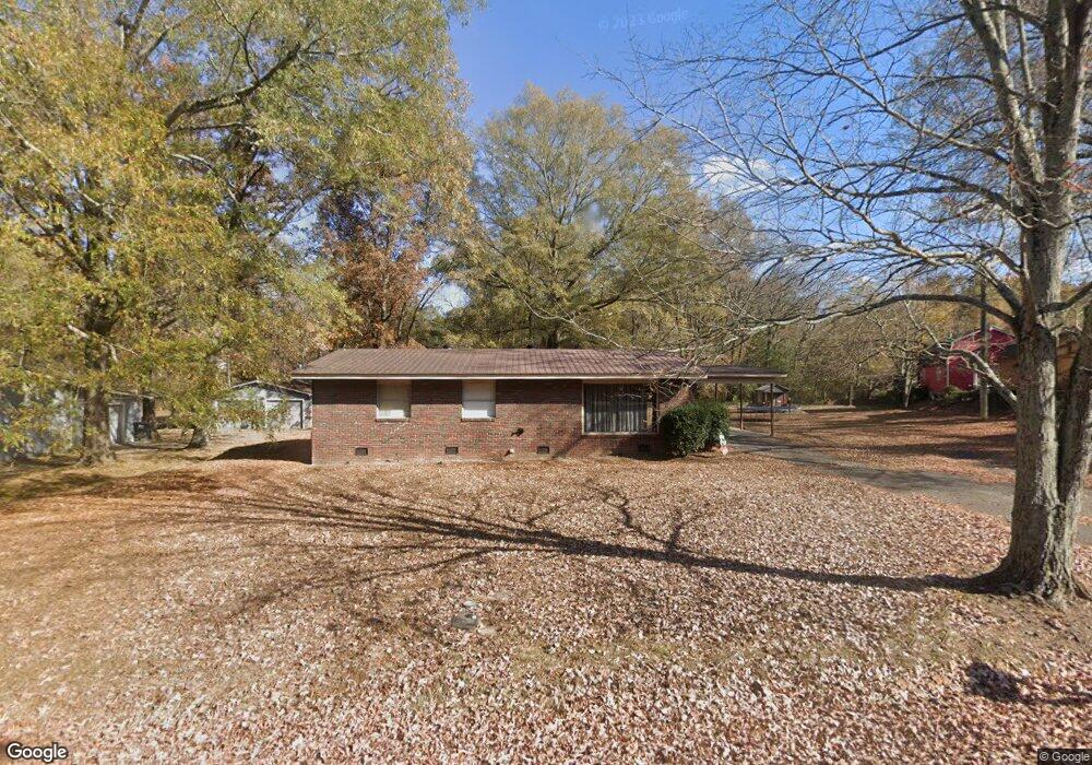
102 Lewis Dr Calhoun, GA 30701
Estimated Value: $149,000 - $197,207
3
Beds
1
Bath
1,390
Sq Ft
$131/Sq Ft
Est. Value
About This Home
This home is located at 102 Lewis Dr, Calhoun, GA 30701 and is currently estimated at $182,552, approximately $131 per square foot. 102 Lewis Dr is a home located in Gordon County with nearby schools including Calhoun Elementary School, Calhoun Middle School, and Calhoun High School.
Ownership History
Date
Name
Owned For
Owner Type
Purchase Details
Closed on
Jan 19, 2012
Sold by
Taylor Hazel Maxine
Bought by
Banks Bobby G
Current Estimated Value
Purchase Details
Closed on
Aug 26, 2011
Sold by
Lovett Lynda
Bought by
Taylor Hazel M
Purchase Details
Closed on
Aug 19, 2011
Sold by
Taylor Hazel M
Bought by
Lovett Lynda
Purchase Details
Closed on
Jun 15, 2009
Sold by
M L Johnson Construction Llc
Bought by
Johnson Group Properties Llc
Purchase Details
Closed on
Jun 1, 1993
Bought by
Taylor Hazel M
Create a Home Valuation Report for This Property
The Home Valuation Report is an in-depth analysis detailing your home's value as well as a comparison with similar homes in the area
Purchase History
| Date | Buyer | Sale Price | Title Company |
|---|---|---|---|
| Banks Bobby G | $28,500 | -- | |
| Banks Bobby G | $28,500 | -- | |
| Taylor Hazel M | -- | -- | |
| Lovett Lynda | -- | -- | |
| Johnson Group Properties Llc | -- | -- | |
| Taylor Hazel M | $55,000 | -- |
Source: Public Records
Tax History
| Year | Tax Paid | Tax Assessment Tax Assessment Total Assessment is a certain percentage of the fair market value that is determined by local assessors to be the total taxable value of land and additions on the property. | Land | Improvement |
|---|---|---|---|---|
| 2025 | $1,219 | $46,400 | $4,480 | $41,920 |
| 2023 | $1,107 | $39,360 | $5,040 | $34,320 |
| 2022 | $355 | $37,320 | $5,040 | $32,280 |
| 2021 | $915 | $30,720 | $5,040 | $25,680 |
| 2020 | $937 | $31,240 | $5,040 | $26,200 |
| 2019 | $936 | $31,240 | $5,040 | $26,200 |
| 2018 | $286 | $29,720 | $5,040 | $24,680 |
| 2017 | $277 | $28,200 | $5,040 | $23,160 |
| 2016 | $278 | $28,200 | $5,040 | $23,160 |
| 2015 | $273 | $27,400 | $5,040 | $22,360 |
| 2014 | $261 | $26,516 | $5,040 | $21,476 |
Source: Public Records
Map
Nearby Homes
- 111 Lewis Dr SE
- 00 Cir
- 00 Hwy 53 and Kenmoreland Cir
- 00 Curtis Cir
- 108 Rips Rd
- 342 Jo Ann Dr SE
- 503 Peters St
- 111 Sylvan Dr
- 199 Cherry St SE
- 0 Curtis Cir SE Unit 10611011
- 0 Curtis Cir SE Unit 7654260
- 0 Lovers Lane Rd SE Unit 10509663
- 220 Porch Loop SE
- 1311 Us Highway 41
- 0 Deer Park Ln Unit 10659841
- 1136 S Wall St
- 123 Deer Park Ln
- 0 W Belmont Dr Unit 10703135
- 0 W Belmont Dr Unit 7729054
- 118 Lavender Cir
Your Personal Tour Guide
Ask me questions while you tour the home.