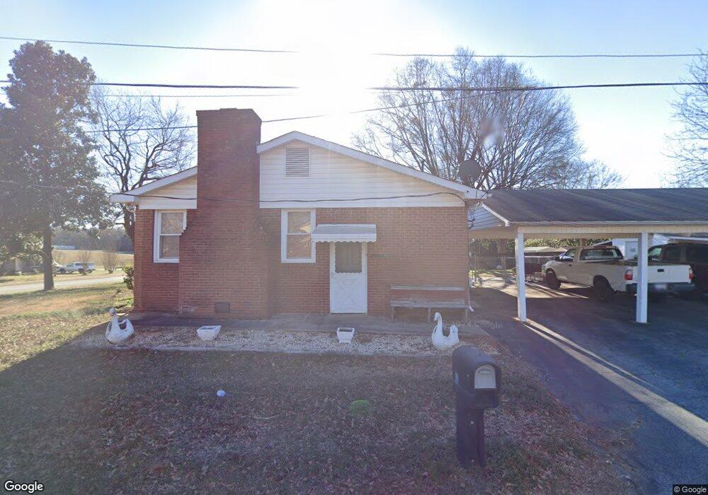
102 Lytle St Spartanburg, SC 29301
Estimated Value: $202,000 - $239,000
3
Beds
2
Baths
2,000
Sq Ft
$114/Sq Ft
Est. Value
About This Home
This home is located at 102 Lytle St, Spartanburg, SC 29301 and is currently estimated at $227,054, approximately $113 per square foot. 102 Lytle St is a home located in Spartanburg County with nearby schools including Dorman High School Freshman Campus, Dorman High School, and GREEN Charter School Spartanburg.
Ownership History
Date
Name
Owned For
Owner Type
Purchase Details
Closed on
Jun 19, 2024
Sold by
Parris Paul E
Bought by
Flores Beatriz Merida
Current Estimated Value
Purchase Details
Closed on
Apr 30, 2024
Sold by
Parris Daniel Richard
Bought by
Parris Paul Edward
Purchase Details
Closed on
Jan 21, 2011
Sold by
Parris Gail Burnett
Bought by
Parris Gail Burnett and Parris Daniel
Purchase Details
Closed on
Dec 23, 2009
Sold by
Estate Of Paul Edward Parris
Bought by
Parris Gail Burnett
Create a Home Valuation Report for This Property
The Home Valuation Report is an in-depth analysis detailing your home's value as well as a comparison with similar homes in the area
Home Values in the Area
Average Home Value in this Area
Purchase History
| Date | Buyer | Sale Price | Title Company |
|---|---|---|---|
| Flores Beatriz Merida | $175,000 | None Listed On Document | |
| Parris Paul Edward | -- | None Listed On Document | |
| Parris Gail Burnett | -- | -- | |
| Parris Gail Burnett | -- | -- |
Source: Public Records
Tax History Compared to Growth
Tax History
| Year | Tax Paid | Tax Assessment Tax Assessment Total Assessment is a certain percentage of the fair market value that is determined by local assessors to be the total taxable value of land and additions on the property. | Land | Improvement |
|---|---|---|---|---|
| 2025 | $3,930 | $10,500 | $864 | $9,636 |
| 2024 | $3,930 | $11,100 | $864 | $10,236 |
| 2023 | $3,930 | $5,860 | $456 | $5,404 |
| 2022 | $595 | $5,096 | $480 | $4,616 |
| 2021 | $595 | $5,096 | $480 | $4,616 |
| 2020 | $577 | $5,096 | $480 | $4,616 |
| 2019 | $572 | $5,096 | $480 | $4,616 |
| 2018 | $568 | $5,096 | $480 | $4,616 |
| 2017 | $496 | $4,720 | $480 | $4,240 |
| 2016 | $802 | $4,720 | $480 | $4,240 |
| 2015 | $478 | $4,428 | $480 | $3,948 |
| 2014 | $425 | $4,428 | $480 | $3,948 |
Source: Public Records
Map
Nearby Homes
- 216 Brannon Ct
- 540 Molly Parker Ln
- 532 Molly Parker Ln
- 517 Molly Parker Ln
- 528 Molly Parker Ln
- 524 Molly Parker Ln
- Elliott Plan at Gentry Place
- Riley Plan at Gentry Place
- Victor Plan at Gentry Place
- Duncan Plan at Gentry Place
- Kline Plan at Gentry Place
- Branson Plan at Gentry Place
- Lexington Plan at Gentry Place
- Yale Plan at Gentry Place
- 432 Ward Thomas Way
- 1320 Shoresbrook Rd
- 1314 Shoresbrook Rd
- 1328 Shoresbrook Rd
- 516 Molly Parker Ln
- 512 Molly Parker Way
- 110 Lytle St
- 101 Westhaven Ct
- 100 Lytle St
- 102 Westhaven Ct
- 105 Lytle St
- 103 Westhaven Ct
- 109 Lytle St
- 101 Lytle St
- 104 Westhaven Ct
- 3053 N Blackstock Rd
- 105 Westhaven Ct
- 3049 N Blackstock Rd
- 3059 N Blackstock Rd
- 412 W Townes Ct Unit 412
- 414 W Townes Ct
- 410 W Townes Ct
- 416 W Townes Ct
- 406 W Townes Ct
- 106 Westhaven Ct
- 408 W Townes Ct