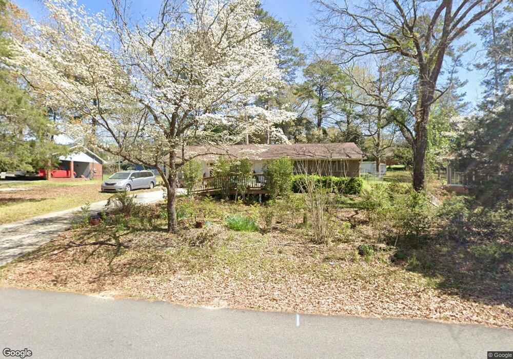
102 Michael St Bonaire, GA 31005
Estimated Value: $179,841 - $204,000
--
Bed
2
Baths
1,641
Sq Ft
$115/Sq Ft
Est. Value
About This Home
This home is located at 102 Michael St, Bonaire, GA 31005 and is currently estimated at $189,460, approximately $115 per square foot. 102 Michael St is a home located in Houston County with nearby schools including Bonaire Elementary School, Huntington Middle School, and Warner Robins High School.
Ownership History
Date
Name
Owned For
Owner Type
Purchase Details
Closed on
May 13, 2009
Sold by
Shugart Eva Estate
Bought by
Naugle Patricia Lee
Current Estimated Value
Purchase Details
Closed on
Dec 14, 2007
Sold by
Shugart Eva
Bought by
Naugle Patricia Lee
Purchase Details
Closed on
May 21, 2007
Sold by
Naugle Patricia Lee and Shugart Charles Lewis
Bought by
Shugart Eva
Purchase Details
Closed on
Aug 17, 1973
Sold by
Lewis E Smith Real Estate-Construction
Bought by
Shugart Charles L and Shugart Eva
Create a Home Valuation Report for This Property
The Home Valuation Report is an in-depth analysis detailing your home's value as well as a comparison with similar homes in the area
Home Values in the Area
Average Home Value in this Area
Purchase History
| Date | Buyer | Sale Price | Title Company |
|---|---|---|---|
| Naugle Patricia Lee | -- | -- | |
| Naugle Patricia Lee | -- | None Available | |
| Shugart Eva | -- | None Available | |
| Shugart Charles L | -- | -- |
Source: Public Records
Tax History Compared to Growth
Tax History
| Year | Tax Paid | Tax Assessment Tax Assessment Total Assessment is a certain percentage of the fair market value that is determined by local assessors to be the total taxable value of land and additions on the property. | Land | Improvement |
|---|---|---|---|---|
| 2024 | $1,108 | $48,320 | $5,840 | $42,480 |
| 2023 | $929 | $40,440 | $5,840 | $34,600 |
| 2022 | $863 | $37,720 | $5,840 | $31,880 |
| 2021 | $775 | $33,880 | $5,840 | $28,040 |
| 2020 | $760 | $33,120 | $5,840 | $27,280 |
| 2019 | $760 | $33,120 | $5,840 | $27,280 |
| 2018 | $760 | $33,120 | $5,840 | $27,280 |
| 2017 | $760 | $33,120 | $5,840 | $27,280 |
| 2016 | $762 | $33,120 | $5,840 | $27,280 |
| 2015 | $763 | $33,120 | $5,840 | $27,280 |
| 2014 | -- | $29,360 | $5,840 | $23,520 |
| 2013 | -- | $29,360 | $5,840 | $23,520 |
Source: Public Records
Map
Nearby Homes
- 307 Fleming Dr
- 0 Michael Ct Unit 10532063
- 0 Michael Ct Unit 179429
- 0 Michael Ct Unit 252716
- 202 Sandy Run Rd
- 104 Old Perry Rd
- 114 Saint Augustine Dr
- 204 Thornton Dr
- 108 Savannah Ln
- 106 Mulligan Ct
- 109 Harmony Path
- 102 Harmony Path
- 305 Edgarton Way
- 100 Deerwood Dr
- 315 Apalachee Way
- 503 Edgarton Way
- 107 Shadowood Dr
- 104 Michael St
- 201 Fleming Dr
- 205 Fleming Dr
- 106 Michael St
- 105 Michael St
- 101 Michael St
- 207 Fleming Dr
- 0 Fleming Dr Unit 8777459
- 0 Fleming Dr Unit 8627336
- 0 Fleming Dr
- 107 Michael St
- 105 Fleming Dr
- 103 Stanley St
- 105 Stanley St
- 201 Stanley St
- 209 Fleming Dr
- 202 Fleming Dr
- 200 Fleming Dr
- 204 Fleming Dr
- 203 Stanley St