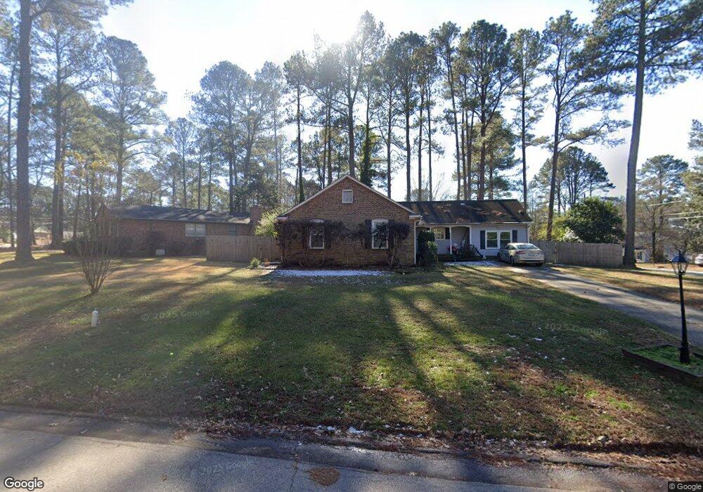
102 Montclair Cir Durham, NC 27713
South Durham NeighborhoodEstimated Value: $389,000 - $416,000
4
Beds
2
Baths
1,934
Sq Ft
$209/Sq Ft
Est. Value
About This Home
This home is located at 102 Montclair Cir, Durham, NC 27713 and is currently estimated at $404,312, approximately $209 per square foot. 102 Montclair Cir is a home located in Durham County with nearby schools including Parkwood Elementary, Lowe's Grove Middle, and Hillside High School.
Ownership History
Date
Name
Owned For
Owner Type
Purchase Details
Closed on
Jul 7, 2017
Sold by
Gurley Grayson O and Gurley Melanie M
Bought by
Knoor Kimberly M
Current Estimated Value
Home Financials for this Owner
Home Financials are based on the most recent Mortgage that was taken out on this home.
Original Mortgage
$216,600
Outstanding Balance
$179,958
Interest Rate
3.89%
Mortgage Type
New Conventional
Estimated Equity
$224,354
Create a Home Valuation Report for This Property
The Home Valuation Report is an in-depth analysis detailing your home's value as well as a comparison with similar homes in the area
Home Values in the Area
Average Home Value in this Area
Purchase History
| Date | Buyer | Sale Price | Title Company |
|---|---|---|---|
| Knoor Kimberly M | $228,000 | None Available |
Source: Public Records
Mortgage History
| Date | Status | Borrower | Loan Amount |
|---|---|---|---|
| Open | Knoor Kimberly M | $216,600 |
Source: Public Records
Tax History
| Year | Tax Paid | Tax Assessment Tax Assessment Total Assessment is a certain percentage of the fair market value that is determined by local assessors to be the total taxable value of land and additions on the property. | Land | Improvement |
|---|---|---|---|---|
| 2025 | $4,021 | $405,645 | $133,000 | $272,645 |
| 2024 | $3,007 | $215,580 | $39,990 | $175,590 |
| 2023 | $2,824 | $215,580 | $39,990 | $175,590 |
| 2022 | $2,759 | $215,580 | $39,990 | $175,590 |
| 2021 | $2,746 | $215,580 | $39,990 | $175,590 |
| 2020 | $2,682 | $215,580 | $39,990 | $175,590 |
| 2019 | $2,682 | $215,580 | $39,990 | $175,590 |
| 2018 | $2,216 | $163,331 | $29,992 | $133,339 |
| 2017 | $2,199 | $163,331 | $29,992 | $133,339 |
| 2016 | $2,125 | $163,331 | $29,992 | $133,339 |
| 2015 | $2,106 | $152,110 | $30,354 | $121,756 |
| 2014 | $2,106 | $152,110 | $30,354 | $121,756 |
Source: Public Records
Map
Nearby Homes
- 123 Montclair Cir
- 5504 Pelham Rd
- 1446 Clermont Rd
- 1621 Clermont Rd
- 104 Deblyn Ct
- 6353 Grandale Dr
- 124 Wicklow Ln
- 7 Scenic Ct
- 1304 Seaton Rd Unit 2
- 1304 Seaton Rd Unit 30
- 1509 Clermont Rd Unit T27
- 1509 Clermont Rd Unit T24
- 5409 Grandhaven Dr
- 111 Wenonah Way
- 5608 Frenchmans Creek Dr
- 5907 Rustic Wood Ln
- 1510 Haventree Rd
- 43 Redbud Ct
- 4 Green Springs Ct
- 5113 Wineberry Dr
- 106 Montclair Cir
- 5407 Newhall Rd
- 112 Montclair Cir
- 5400 Newhall Rd
- 101 Montclair Cir
- 5324 Newhall Rd
- 5404 Newhall Rd
- 105 Montclair Cir
- 5411 Newhall Rd
- 116 Montclair Cir
- 107 Montclair Cir
- 5408 Newhall Rd
- 113 Montclair Cir
- 5417 Newhall Rd
- 5317 Newhall Rd
- 115 Montclair Cir
- 5412 Newhall Rd
- 5316 Newhall Rd
- 120 Montclair Cir
- 119 Montclair Cir
Your Personal Tour Guide
Ask me questions while you tour the home.