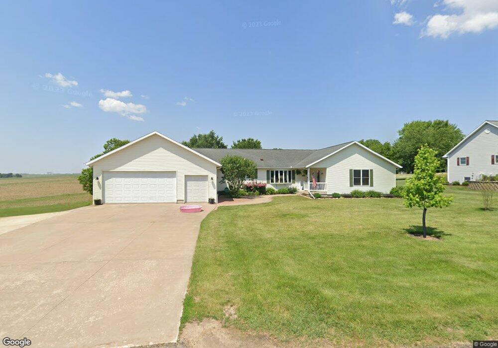
102 N Maple Ln Lanark, IL 61046
Estimated Value: $272,000 - $419,000
3
Beds
3
Baths
2,499
Sq Ft
$138/Sq Ft
Est. Value
About This Home
This home is located at 102 N Maple Ln, Lanark, IL 61046 and is currently estimated at $343,815, approximately $137 per square foot. 102 N Maple Ln is a home located in Carroll County with nearby schools including Eastland Elementary School and Eastland Junior-Senior High School.
Ownership History
Date
Name
Owned For
Owner Type
Purchase Details
Closed on
Jun 4, 2021
Sold by
Pierce James L
Bought by
Lartz Ethan
Current Estimated Value
Home Financials for this Owner
Home Financials are based on the most recent Mortgage that was taken out on this home.
Original Mortgage
$185,999
Outstanding Balance
$168,399
Interest Rate
2.9%
Mortgage Type
Construction
Estimated Equity
$175,416
Purchase Details
Closed on
Jul 13, 2017
Sold by
Weber Janice L Trust
Bought by
Pierce James L
Create a Home Valuation Report for This Property
The Home Valuation Report is an in-depth analysis detailing your home's value as well as a comparison with similar homes in the area
Purchase History
| Date | Buyer | Sale Price | Title Company |
|---|---|---|---|
| Lartz Ethan | $245,000 | Attorney Only | |
| Pierce James L | -- | -- |
Source: Public Records
Mortgage History
| Date | Status | Borrower | Loan Amount |
|---|---|---|---|
| Open | Lartz Ethan | $185,999 |
Source: Public Records
Tax History
| Year | Tax Paid | Tax Assessment Tax Assessment Total Assessment is a certain percentage of the fair market value that is determined by local assessors to be the total taxable value of land and additions on the property. | Land | Improvement |
|---|---|---|---|---|
| 2024 | $6,971 | $102,249 | $13,521 | $88,728 |
| 2023 | $6,971 | $91,293 | $12,072 | $79,221 |
| 2022 | $6,149 | $81,512 | $10,779 | $70,733 |
| 2021 | $6,383 | $81,512 | $10,779 | $70,733 |
| 2020 | $6,030 | $77,049 | $10,779 | $66,270 |
| 2019 | $6,248 | $77,049 | $10,779 | $66,270 |
| 2018 | $6,261 | $77,049 | $10,779 | $66,270 |
| 2017 | $6,162 | $77,049 | $10,779 | $66,270 |
| 2016 | $6,120 | $76,672 | $10,779 | $65,893 |
| 2015 | $6,070 | $76,672 | $10,779 | $65,893 |
| 2014 | $5,823 | $76,672 | $10,779 | $65,893 |
| 2013 | $5,823 | $76,672 | $10,779 | $65,893 |
Source: Public Records
Map
Nearby Homes
- 108 SW Lanark Ave
- 108 SW Lanark Ave Unit 110 SW Lanark Avenue
- 515 Hill St
- 23633 Carroll Rd
- 205 Illinois 64
- 328 E Carroll St
- 629 E Locust St
- 20-31 & 32 Fox Run Dr
- 13-143 Newberry Ct
- 23205 Blackberry Ct
- 21-59 Lake Carroll Blvd
- 21-54 Old Wharf Rd
- 13-102 Quail Hollow Dr Unit 13-103 Quail Hollow
- 21-51 Marina Ct
- 12-124R Briarwood Dr
- 12-199 Willow Ct
- 3-521 Shady Ln
- 3521 Shady Ln
- 1-145 Perry Ct
- 3-608R Fawn Ridge Dr
- 104 N Maple Ln
- 103 N Maple Ln
- 700 W Locust St
- 608 W Carroll St
- 609 W Locust St
- 23857 Carroll Rd
- 100 S Westview Dr
- 23929 Carroll Rd
- 606 W Carroll St
- 102 S Westview Dr
- 104 S Westview Dr
- 103 S Westview Dr
- 701 Meadow Ct
- 23784 Carroll Rd
- 604 W Carroll St
- 107 S Westview Dr
- 102 SW Lanark Ave
- 109 S Westview Dr
- 540 W Carroll St
- 106 SW Lanark Ave
Your Personal Tour Guide
Ask me questions while you tour the home.