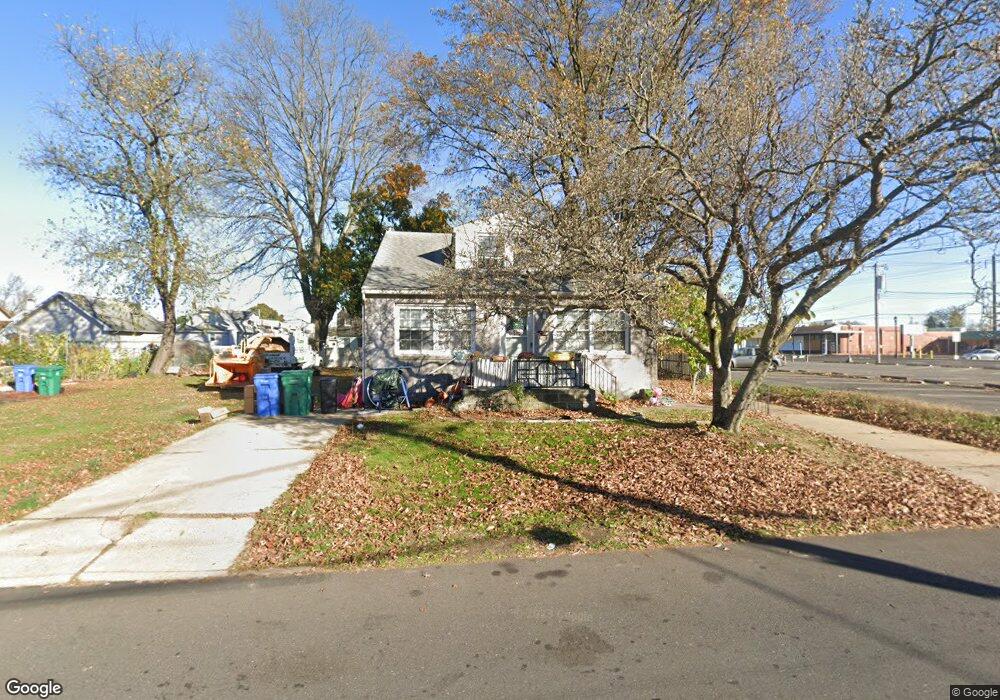
102 Neshaminy Rd Croydon, PA 19021
Estimated Value: $317,000 - $428,000
3
Beds
2
Baths
1,756
Sq Ft
$210/Sq Ft
Est. Value
About This Home
This home is located at 102 Neshaminy Rd, Croydon, PA 19021 and is currently estimated at $368,169, approximately $209 per square foot. 102 Neshaminy Rd is a home located in Bucks County with nearby schools including Truman Senior High School, School Lane Charter School, and St Charles Borromeo School.
Ownership History
Date
Name
Owned For
Owner Type
Purchase Details
Closed on
Oct 28, 2022
Sold by
Mcwade Jacquelyn A
Bought by
Catalanotti Louis B
Current Estimated Value
Home Financials for this Owner
Home Financials are based on the most recent Mortgage that was taken out on this home.
Original Mortgage
$175,000
Outstanding Balance
$169,701
Interest Rate
7.08%
Mortgage Type
New Conventional
Estimated Equity
$198,468
Purchase Details
Closed on
Feb 5, 2002
Sold by
Mcwade Edward J
Bought by
Mcwade Jacquelyn A
Purchase Details
Closed on
Sep 29, 2000
Sold by
Mckee Esq Charles E and Meehan Mary Ellen
Bought by
Mcwade Edward J
Create a Home Valuation Report for This Property
The Home Valuation Report is an in-depth analysis detailing your home's value as well as a comparison with similar homes in the area
Home Values in the Area
Average Home Value in this Area
Purchase History
| Date | Buyer | Sale Price | Title Company |
|---|---|---|---|
| Catalanotti Louis B | $250,000 | -- | |
| Mcwade Jacquelyn A | -- | -- | |
| Mcwade Edward J | -- | -- |
Source: Public Records
Mortgage History
| Date | Status | Borrower | Loan Amount |
|---|---|---|---|
| Open | Catalanotti Louis B | $175,000 |
Source: Public Records
Tax History Compared to Growth
Tax History
| Year | Tax Paid | Tax Assessment Tax Assessment Total Assessment is a certain percentage of the fair market value that is determined by local assessors to be the total taxable value of land and additions on the property. | Land | Improvement |
|---|---|---|---|---|
| 2025 | $5,106 | $18,800 | $3,280 | $15,520 |
| 2024 | $5,106 | $18,800 | $3,280 | $15,520 |
| 2023 | $5,068 | $18,800 | $3,280 | $15,520 |
| 2022 | $5,068 | $18,800 | $3,280 | $15,520 |
| 2021 | $5,068 | $18,800 | $3,280 | $15,520 |
| 2020 | $5,068 | $18,800 | $3,280 | $15,520 |
| 2019 | $5,049 | $18,800 | $3,280 | $15,520 |
| 2018 | $4,968 | $18,800 | $3,280 | $15,520 |
| 2017 | $4,892 | $18,800 | $3,280 | $15,520 |
| 2016 | $4,892 | $18,800 | $3,280 | $15,520 |
| 2015 | $3,794 | $18,800 | $3,280 | $15,520 |
| 2014 | $3,794 | $18,800 | $3,280 | $15,520 |
Source: Public Records
Map
Nearby Homes
- 434 Sycamore Ave
- 509 Neshaminy Rd
- 0 Neshaminy St Unit PABU2089046
- 518 Main Ave
- 910 Magnolia Ave
- 906 Stephen Ave
- 0 Allen Ave
- 0 Newportville Rd Unit PABU487252
- 1000 Main Ave
- 4482 E Yates Rd
- 619 First Ave
- 618 Cedar Ave
- 222 New York Ave
- 718 Second Ave
- L:15 Dunston Rd
- 4744 Dunston Rd
- 1020 Hilary Ave
- 500 Wyoming Ave
- 817 Fifth Ave
- 1005 Maryland Ave
- 118 Neshaminy Rd
- 315 Bristol Pike
- 115 Clover Ave
- 122 Neshaminy Rd
- 119 Clover Ave
- 117 Neshaminy Rd
- 125 Clover Ave
- 132 Neshaminy Rd
- 129 Clover Ave
- 118 Clover Ave
- 120 Clover Ave
- 136 Neshaminy Rd
- 135 Clover Ave
- 124 Clover Ave
- 300 Route 13
- 90 Neshaminy Rd
- 304 Bristol Pike
- 132 Clover Ave
- 141 Clover Ave
- 290 Bristol Pike