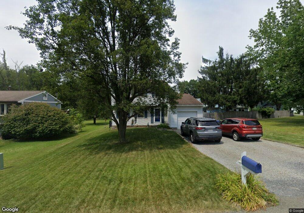
102 Pheasant Dr Cranberry Township, PA 16066
Estimated Value: $340,418 - $355,000
3
Beds
2
Baths
1,320
Sq Ft
$263/Sq Ft
Est. Value
About This Home
This home is located at 102 Pheasant Dr, Cranberry Township, PA 16066 and is currently estimated at $347,355, approximately $263 per square foot. 102 Pheasant Dr is a home located in Butler County with nearby schools including Rowan Elementary School, Haine Middle School, and Ryan Gloyer Middle School.
Ownership History
Date
Name
Owned For
Owner Type
Purchase Details
Closed on
Aug 28, 2008
Sold by
Delong Benjamin J
Bought by
Sypien Michael J
Current Estimated Value
Home Financials for this Owner
Home Financials are based on the most recent Mortgage that was taken out on this home.
Original Mortgage
$148,800
Outstanding Balance
$97,877
Interest Rate
6.29%
Mortgage Type
New Conventional
Estimated Equity
$249,478
Purchase Details
Closed on
Feb 23, 2005
Sold by
Schreckengost Richard
Bought by
Delong Benjamin
Home Financials for this Owner
Home Financials are based on the most recent Mortgage that was taken out on this home.
Original Mortgage
$127,200
Interest Rate
5.73%
Mortgage Type
New Conventional
Create a Home Valuation Report for This Property
The Home Valuation Report is an in-depth analysis detailing your home's value as well as a comparison with similar homes in the area
Home Values in the Area
Average Home Value in this Area
Purchase History
| Date | Buyer | Sale Price | Title Company |
|---|---|---|---|
| Sypien Michael J | $186,000 | -- | |
| Delong Benjamin | $159,000 | -- |
Source: Public Records
Mortgage History
| Date | Status | Borrower | Loan Amount |
|---|---|---|---|
| Open | Sypien Michael J | $148,800 | |
| Previous Owner | Delong Benjamin | $127,200 |
Source: Public Records
Tax History Compared to Growth
Tax History
| Year | Tax Paid | Tax Assessment Tax Assessment Total Assessment is a certain percentage of the fair market value that is determined by local assessors to be the total taxable value of land and additions on the property. | Land | Improvement |
|---|---|---|---|---|
| 2025 | $3,283 | $18,320 | $1,140 | $17,180 |
| 2024 | $3,185 | $18,320 | $1,140 | $17,180 |
| 2023 | $3,139 | $18,320 | $1,140 | $17,180 |
| 2022 | $3,139 | $18,320 | $1,140 | $17,180 |
| 2021 | $3,092 | $18,320 | $0 | $0 |
| 2020 | $3,092 | $18,320 | $1,140 | $17,180 |
| 2019 | $3,057 | $18,320 | $1,140 | $17,180 |
| 2018 | $3,057 | $18,320 | $1,140 | $17,180 |
| 2017 | $3,002 | $18,320 | $1,140 | $17,180 |
| 2016 | $824 | $18,320 | $1,140 | $17,180 |
| 2015 | $371 | $18,320 | $1,140 | $17,180 |
| 2014 | $371 | $18,320 | $1,140 | $17,180 |
Source: Public Records
Map
Nearby Homes
- 147 Fox Run Rd
- 606 Whitby Ln
- 610 Whitby Ln
- 612 Whitby Ln
- 614 Whitby Ln
- 346 Highbridge Ln
- 417 Ramsgate Rd
- 338 Highbridge Ln
- 806 Calan St
- 413 Ramsgate Rd
- 423 Ramsgate Rd
- 332 Highbridge Ln
- 407 Ramsgate Rd
- 405 Ramsgate Rd
- 403 Ramsgate Rd
- 401 Ramsgate Rd
- 503 Quail Dr
- 302 Highbridge Ln
- Glasgow Plan at Crescent - Single Family
- 102 Ramsgate Rd Unit Royston
- 104 Pheasant Dr
- 612 Partridge Dr
- 100 Pheasant Dr
- 610 Partridge Dr
- 608 Partridge Dr
- 101 Pheasant Dr
- 103 Pheasant Dr
- 105 Pheasant Dr
- 606 Partridge Dr
- 614 Partridge Dr
- 613 Partridge Dr
- 445 Deerfield Dr
- 615 Partridge Dr
- 617 Partridge Dr
- 616 Partridge Dr
- 604 Partridge Dr
- 611 Partridge Dr
- 619 Partridge Dr
- 621 Partridge Dr
- 443 Deerfield Dr