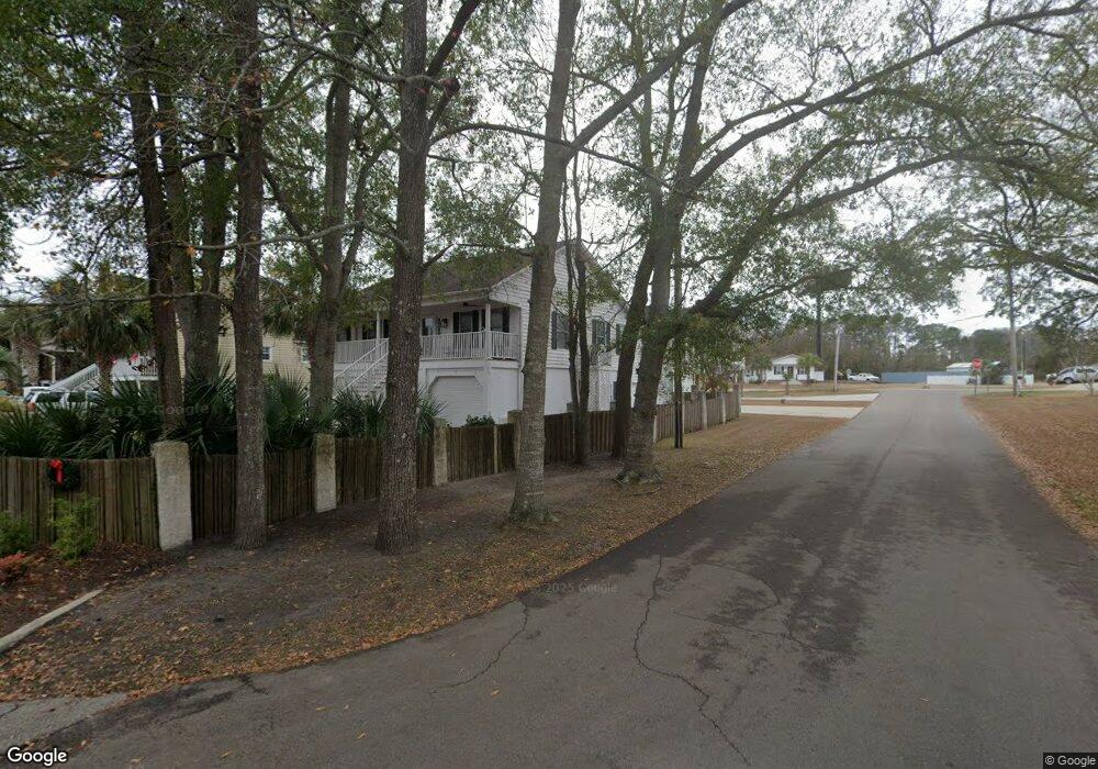
102 Pier Pointe Dr Little River, SC 29566
Estimated Value: $395,000 - $613,000
3
Beds
3
Baths
1,755
Sq Ft
$303/Sq Ft
Est. Value
About This Home
This home is located at 102 Pier Pointe Dr, Little River, SC 29566 and is currently estimated at $531,967, approximately $303 per square foot. 102 Pier Pointe Dr is a home located in Horry County with nearby schools including Ocean Drive Elementary School, North Myrtle Beach Middle School, and North Myrtle Beach High School.
Ownership History
Date
Name
Owned For
Owner Type
Purchase Details
Closed on
Feb 27, 2006
Sold by
Creswell Benny P and Creswell Susan D
Bought by
Strickland Tiffany Dee
Current Estimated Value
Home Financials for this Owner
Home Financials are based on the most recent Mortgage that was taken out on this home.
Original Mortgage
$265,000
Outstanding Balance
$148,703
Interest Rate
6.05%
Mortgage Type
Fannie Mae Freddie Mac
Estimated Equity
$383,264
Purchase Details
Closed on
Feb 21, 2002
Sold by
Hardwick Bradley E and Hardwick Elizabeth
Bought by
Creswell Benny P and Spence Susan D
Home Financials for this Owner
Home Financials are based on the most recent Mortgage that was taken out on this home.
Original Mortgage
$40,480
Interest Rate
6.95%
Mortgage Type
Credit Line Revolving
Create a Home Valuation Report for This Property
The Home Valuation Report is an in-depth analysis detailing your home's value as well as a comparison with similar homes in the area
Home Values in the Area
Average Home Value in this Area
Purchase History
| Date | Buyer | Sale Price | Title Company |
|---|---|---|---|
| Strickland Tiffany Dee | $365,000 | None Available | |
| Creswell Benny P | $202,400 | -- |
Source: Public Records
Mortgage History
| Date | Status | Borrower | Loan Amount |
|---|---|---|---|
| Open | Strickland Tiffany Dee | $265,000 | |
| Previous Owner | Creswell Benny P | $40,480 | |
| Previous Owner | Creswell Benny P | $161,920 |
Source: Public Records
Tax History Compared to Growth
Tax History
| Year | Tax Paid | Tax Assessment Tax Assessment Total Assessment is a certain percentage of the fair market value that is determined by local assessors to be the total taxable value of land and additions on the property. | Land | Improvement |
|---|---|---|---|---|
| 2024 | $2,972 | $31,737 | $15,000 | $16,737 |
| 2023 | $2,972 | $12,473 | $2,908 | $9,565 |
| 2021 | $2,742 | $13,270 | $2,908 | $10,362 |
| 2020 | $2,602 | $8,846 | $1,938 | $6,908 |
| 2019 | $768 | $8,846 | $1,938 | $6,908 |
| 2018 | $692 | $7,230 | $1,938 | $5,292 |
| 2017 | $677 | $7,230 | $1,938 | $5,292 |
| 2016 | -- | $7,230 | $1,938 | $5,292 |
| 2015 | $677 | $7,231 | $1,939 | $5,292 |
| 2014 | $625 | $7,231 | $1,939 | $5,292 |
Source: Public Records
Map
Nearby Homes
- 130 Pier Pointe Dr
- 202 Old Harbour Ct
- 155 Pier Pointe Dr
- 2428 Park St
- 4385 6th Ave N
- 244 Gloucester Way
- 220 Gloucester Way
- 138 Marblehead Dr
- 141 Marblehead Dr
- 129 Marblehead Dr
- 1718 26th Ave N Unit Lot 20
- 2600 Broome Terrace
- 1712 26th Ave N
- 1716 26th Ave N
- 11642 S Carolina 90
- 107 Waterway Crossing Ct
- 1513 Magnolia Dr
- 2100 Sea Mountain Hwy Unit 522
- 2100 Sea Mountain Hwy Unit 630
- 2100 Sea Mountain Hwy Unit 200
- 106 Pier Pointe Dr Unit 106 Pier Pointe
- 194 Morgan Ave
- 110 Pier Pointe Dr
- 202 Morgan Ave
- 109 Pier Pointe Dr
- 190 Morgan Ave
- Parcel B Morgan & Park
- 114 Pier Pointe Dr
- 115 Pier Pointe Dr
- 4374 5th Ave N
- 118 Pier Pointe Dr
- Parcel B Morgan Ave
- 135 Pier Pointe Dr
- 215 Park St
- 201 Morgan Ave
- 119 Pier Pointe Dr
- 122 Pier Pointe Dr
- 195 Morgan Ave
- 205 Morgan Ave
- 123 Pier Pointe Dr Unit Olde Harbour