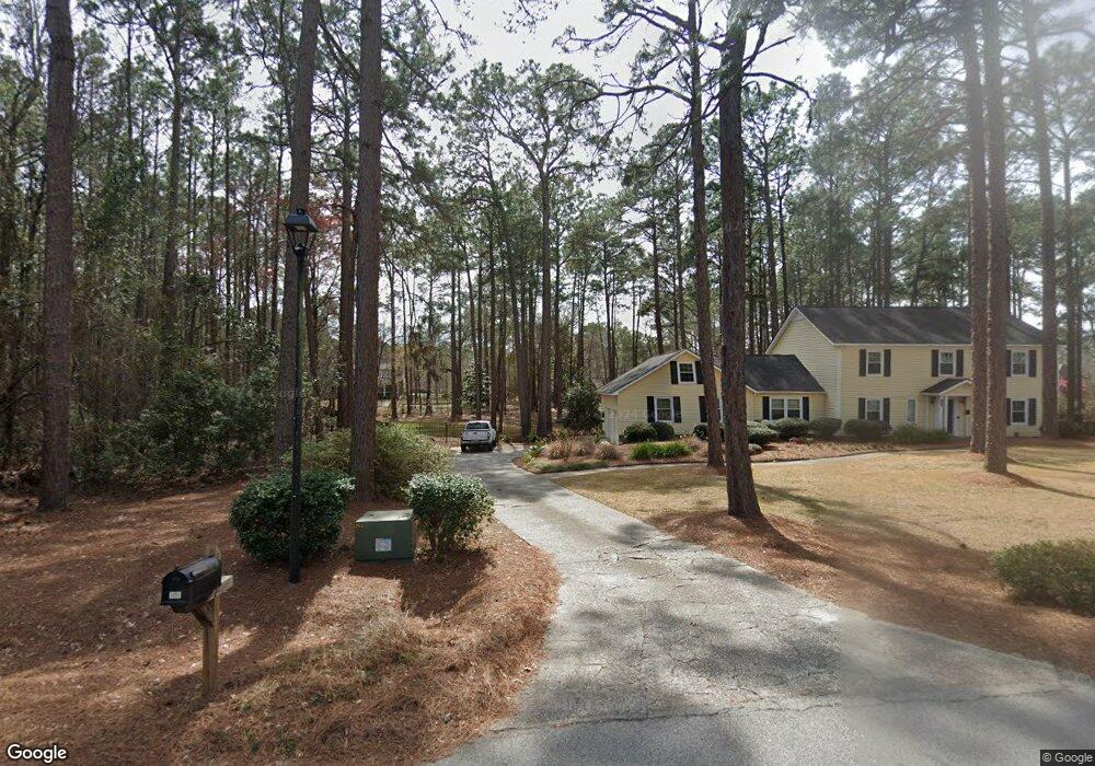
102 Remington Way Statesboro, GA 30458
Estimated Value: $389,086 - $470,000
4
Beds
3
Baths
2,800
Sq Ft
$155/Sq Ft
Est. Value
About This Home
This home is located at 102 Remington Way, Statesboro, GA 30458 and is currently estimated at $434,522, approximately $155 per square foot. 102 Remington Way is a home located in Bulloch County with nearby schools including Julia P. Bryant Elementary School, Statesboro High School, and William James Middle School.
Ownership History
Date
Name
Owned For
Owner Type
Purchase Details
Closed on
May 27, 2021
Sold by
Lanier Bob W
Bought by
Merriam Philip and Merriam Amber
Current Estimated Value
Home Financials for this Owner
Home Financials are based on the most recent Mortgage that was taken out on this home.
Original Mortgage
$294,156
Outstanding Balance
$266,322
Interest Rate
2.9%
Mortgage Type
VA
Estimated Equity
$168,200
Purchase Details
Closed on
Dec 1, 1930
Bought by
Lanier Bob W and Lanier Terri L
Create a Home Valuation Report for This Property
The Home Valuation Report is an in-depth analysis detailing your home's value as well as a comparison with similar homes in the area
Home Values in the Area
Average Home Value in this Area
Purchase History
| Date | Buyer | Sale Price | Title Company |
|---|---|---|---|
| Merriam Philip | $285,000 | -- | |
| Lanier Bob W | -- | -- |
Source: Public Records
Mortgage History
| Date | Status | Borrower | Loan Amount |
|---|---|---|---|
| Open | Merriam Philip | $294,156 |
Source: Public Records
Tax History Compared to Growth
Tax History
| Year | Tax Paid | Tax Assessment Tax Assessment Total Assessment is a certain percentage of the fair market value that is determined by local assessors to be the total taxable value of land and additions on the property. | Land | Improvement |
|---|---|---|---|---|
| 2024 | $2,805 | $123,080 | $21,760 | $101,320 |
| 2023 | $3,030 | $122,640 | $19,800 | $102,840 |
| 2022 | $2,429 | $107,479 | $19,800 | $87,679 |
| 2021 | $2,135 | $92,086 | $19,800 | $72,286 |
| 2020 | $1,853 | $84,747 | $19,800 | $64,947 |
| 2019 | $1,934 | $83,902 | $18,600 | $65,302 |
| 2018 | $1,932 | $80,949 | $18,600 | $62,349 |
| 2017 | $1,900 | $78,626 | $18,600 | $60,026 |
| 2016 | $1,882 | $75,987 | $18,600 | $57,387 |
| 2015 | $1,850 | $74,353 | $18,600 | $55,753 |
| 2014 | $1,707 | $74,353 | $18,600 | $55,753 |
Source: Public Records
Map
Nearby Homes
- 101 Remington Way
- 137 Pin Oak Ln
- 218 Wellington Cir
- 202 Plantation Trail
- 0 Surrey Ln Unit 10441906
- 225 Wellington Cir
- 0 Brentwood Cir Unit 10648008
- 0 Country Club Rd Unit SA343019
- 0 Country Club Rd Unit 10637928
- 105 Oak Ridge Dr
- 214 Surrey Ln
- 324 Farmington Rd
- 135 Avalon Lot 18 Trace
- 220 Bald Cypress Ct
- 16 Forest Pine Dr
- 152 Sandalwood Cir
- 160 Sandalwood Cir
- 0 Sandalwood Cir Unit SA345331
- 0 Sandalwood Cir Unit 10658328
- 7 Woodrum Place
- 100 Remington Way
- 106 Lakeside Ct
- 106 Remington Way
- 111 Ramblewood Dr
- 108 Lakeside Ct
- 103 Remington Way
- 105 Remington Way
- 113 Ramblewood Dr
- LOT 5 Remington Way
- 108 Remington Way
- 107 Remington Way
- 102 Lakeside Ct
- 100 Winchester Way
- 110 Lakeside Ct
- 109 Lakeside Ct
- 108 Ramblewood Dr
- 109 Remington Way
- 107 Lakeside Ct
- 100 Lakeside Ct
- 111 Lakeside Ct