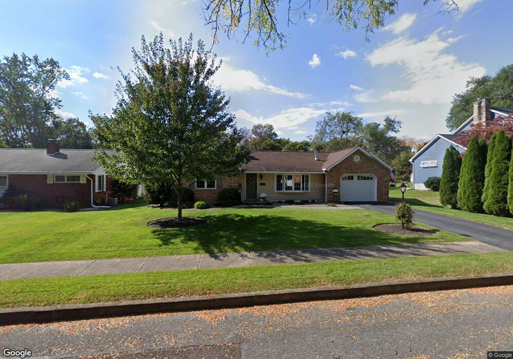
102 Rhoads Ave Selinsgrove, PA 17870
Estimated Value: $151,427 - $336,000
--
Bed
--
Bath
--
Sq Ft
0.32
Acres
About This Home
This home is located at 102 Rhoads Ave, Selinsgrove, PA 17870 and is currently estimated at $245,857. 102 Rhoads Ave is a home located in Snyder County with nearby schools including Selinsgrove Intermediate School, Selinsgrove Area Elementary School, and Selinsgrove Area Middle School.
Ownership History
Date
Name
Owned For
Owner Type
Purchase Details
Closed on
Jul 28, 2020
Sold by
Hackenburg Roger L and Hackenburg Peggy L
Bought by
Burke Stephanie L and Wilburn Terri L
Current Estimated Value
Purchase Details
Closed on
Mar 1, 2013
Sold by
Gilbert Carrie Leigh
Bought by
Hackenburg Roger L and Hackenburg Peggy L
Home Financials for this Owner
Home Financials are based on the most recent Mortgage that was taken out on this home.
Original Mortgage
$155,000
Interest Rate
3.45%
Mortgage Type
Unknown
Purchase Details
Closed on
Sep 11, 2009
Sold by
Anderson Eleonora M and Conrad Eleonora M
Bought by
Gilbert Carrie Leigh
Home Financials for this Owner
Home Financials are based on the most recent Mortgage that was taken out on this home.
Original Mortgage
$116,375
Interest Rate
5.31%
Mortgage Type
Purchase Money Mortgage
Create a Home Valuation Report for This Property
The Home Valuation Report is an in-depth analysis detailing your home's value as well as a comparison with similar homes in the area
Home Values in the Area
Average Home Value in this Area
Purchase History
| Date | Buyer | Sale Price | Title Company |
|---|---|---|---|
| Burke Stephanie L | -- | None Available | |
| Hackenburg Roger L | $155,000 | -- | |
| Gilbert Carrie Leigh | $122,500 | -- |
Source: Public Records
Mortgage History
| Date | Status | Borrower | Loan Amount |
|---|---|---|---|
| Previous Owner | Hackenburg Roger L | $155,000 | |
| Previous Owner | Gilbert Carrie Leigh | $116,375 |
Source: Public Records
Tax History Compared to Growth
Tax History
| Year | Tax Paid | Tax Assessment Tax Assessment Total Assessment is a certain percentage of the fair market value that is determined by local assessors to be the total taxable value of land and additions on the property. | Land | Improvement |
|---|---|---|---|---|
| 2025 | $3,438 | $28,740 | $7,200 | $21,540 |
| 2024 | $3,228 | $28,740 | $7,200 | $21,540 |
| 2023 | $1,288 | $28,740 | $7,200 | $21,540 |
| 2022 | $3,098 | $28,740 | $7,200 | $21,540 |
| 2021 | $3,070 | $28,740 | $7,200 | $21,540 |
| 2020 | $3,055 | $28,740 | $7,200 | $21,540 |
| 2019 | $3,041 | $28,740 | $7,200 | $21,540 |
| 2018 | $3,012 | $28,740 | $7,200 | $21,540 |
| 2017 | $2,983 | $28,740 | $7,200 | $21,540 |
| 2016 | $1,604 | $28,740 | $7,200 | $21,540 |
| 2015 | $105,799 | $28,740 | $7,200 | $21,540 |
| 2014 | $105,799 | $22,360 | $7,200 | $15,160 |
Source: Public Records
Map
Nearby Homes
- 104 18th St
- 21 Calvett Place
- 207 Orange St Unit 209
- 501 N 9th St
- 500 N Orange St
- Lot 1 522 Route S
- 610 N 10th St
- 321 Pleasant Dr
- 722 N 8th St
- 223 E Pine St
- 301 E Pine St
- 301 E Walnut St
- 20 Quarry Rd
- 456 State School Rd
- 0 Wedgewood Dr
- 732 Salem Rd
- 85 Old Colony Rd
- 34 Oakmont Ct
- 0 Mill Rd
- 1667&1679 Route 204
- 100 Rhoads Ave
- 104 Rhoads Ave
- 103 Magnolia Ave
- 101 Magnolia Ave
- 101 Rhoads Ave
- 105 Magnolia Ave
- 107 Rhoads Ave
- 200 Rhoads Ave
- 201 Magnolia Ave
- 201 Rhoads Ave
- 216 Rhoads Ave
- 102 Magnolia Ave
- 106 Susquehanna Ave
- 104 Magnolia Ave
- 100 Susquehanna Ave
- 108 Susquehanna Ave
- 203 Magnolia Ave
- 100 Magnolia Ave
- 218 Rhoads Ave
- 203 Rhoads Ave