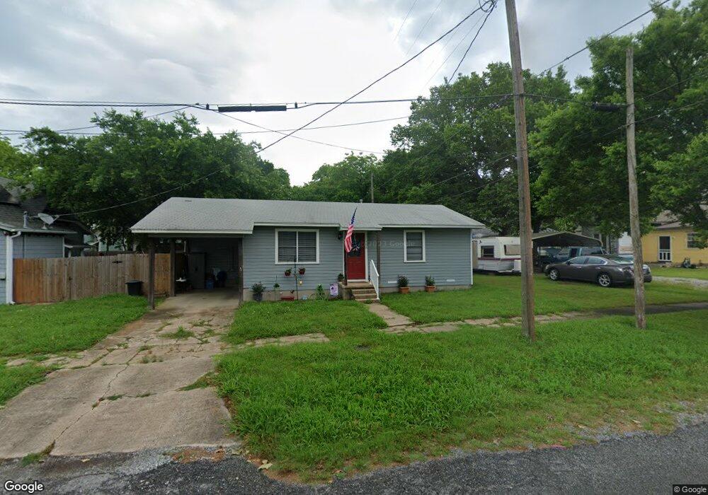
102 S Gowdy St Whitewright, TX 75491
Estimated Value: $147,000
2
Beds
1
Bath
952
Sq Ft
$154/Sq Ft
Est. Value
About This Home
This home is located at 102 S Gowdy St, Whitewright, TX 75491 and is currently estimated at $147,000, approximately $154 per square foot. 102 S Gowdy St is a home located in Grayson County with nearby schools including Whitewright Elementary School, Whitewright Middle School, and Whitewright High School.
Ownership History
Date
Name
Owned For
Owner Type
Purchase Details
Closed on
Aug 19, 2011
Sold by
Thompson Terry G and Thompson Terry Gene
Bought by
Smith Paul C
Current Estimated Value
Home Financials for this Owner
Home Financials are based on the most recent Mortgage that was taken out on this home.
Original Mortgage
$24,000
Outstanding Balance
$16,679
Interest Rate
4.65%
Mortgage Type
Purchase Money Mortgage
Estimated Equity
$130,321
Purchase Details
Closed on
Oct 14, 2010
Sold by
Thompson Jackie L
Bought by
Thompson Terry G
Create a Home Valuation Report for This Property
The Home Valuation Report is an in-depth analysis detailing your home's value as well as a comparison with similar homes in the area
Home Values in the Area
Average Home Value in this Area
Purchase History
| Date | Buyer | Sale Price | Title Company |
|---|---|---|---|
| Smith Paul C | -- | Grayson County Title | |
| Thompson Terry G | -- | None Available |
Source: Public Records
Mortgage History
| Date | Status | Borrower | Loan Amount |
|---|---|---|---|
| Open | Smith Paul C | $24,000 |
Source: Public Records
Tax History Compared to Growth
Tax History
| Year | Tax Paid | Tax Assessment Tax Assessment Total Assessment is a certain percentage of the fair market value that is determined by local assessors to be the total taxable value of land and additions on the property. | Land | Improvement |
|---|---|---|---|---|
| 2025 | $2,276 | $116,804 | $28,521 | $88,283 |
| 2024 | $2,256 | $119,024 | $35,963 | $83,061 |
| 2023 | $2,107 | $110,737 | $21,355 | $89,382 |
| 2022 | $1,987 | $93,155 | $19,243 | $73,912 |
| 2021 | $1,588 | $68,309 | $16,133 | $52,176 |
| 2020 | $1,556 | $62,599 | $8,448 | $54,151 |
| 2019 | $1,559 | $60,367 | $8,037 | $52,330 |
| 2018 | $1,528 | $57,588 | $8,037 | $49,551 |
| 2017 | $1,151 | $46,906 | $8,037 | $38,869 |
| 2016 | $1,114 | $45,381 | $3,623 | $41,758 |
| 2015 | $0 | $26,070 | $3,992 | $22,078 |
| 2014 | -- | $28,259 | $3,992 | $24,267 |
Source: Public Records
Map
Nearby Homes
- 417 W Grand St
- 401 W Maple St
- 203 S Carter St
- 602 1/2 W Grand St
- 507 W Locust St
- 402 S Carter St
- TBD W Oak St
- 211 W Elm St
- 118 W Grand St Unit 1A
- 209 W Elm St
- 404 N Blanton
- 207 W Elm St
- 202 W Elm St
- 205 W Elm St
- 1988 Fm 2729
- 800 Blk Bois d Arc St
- 14AC TBD N Highway 69
- TBD Westfield Way
- 114 E Cedar St
- 12075 Texas 11