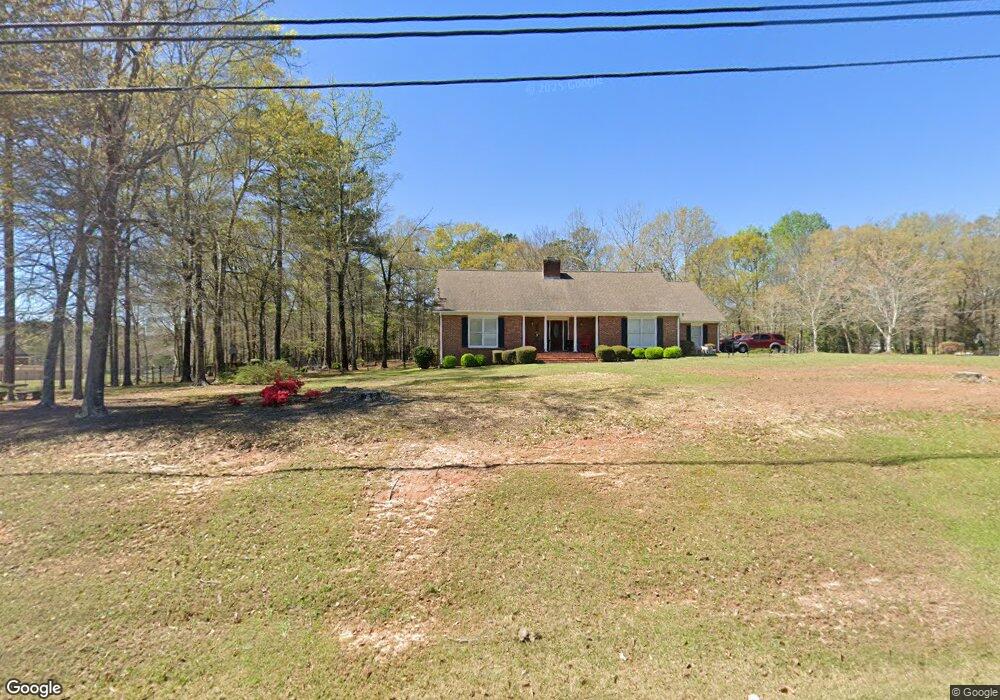
102 S Phillips Rd La Nett, AL 36863
Estimated Value: $242,000 - $307,000
3
Beds
2
Baths
2,500
Sq Ft
$113/Sq Ft
Est. Value
About This Home
This home is located at 102 S Phillips Rd, La Nett, AL 36863 and is currently estimated at $282,324, approximately $112 per square foot. 102 S Phillips Rd is a home located in Chambers County with nearby schools including W. O. Lance Elementary School, Lanett Junior High School, and Lanett Senior High School.
Ownership History
Date
Name
Owned For
Owner Type
Purchase Details
Closed on
Sep 30, 2009
Sold by
Hsbc Bank Usa
Bought by
Perryman Leon and Perryman Estella
Current Estimated Value
Purchase Details
Closed on
Sep 22, 2005
Sold by
Huckaby Richard H and Huckaby Bonnie F
Bought by
White Emily and White Tim
Home Financials for this Owner
Home Financials are based on the most recent Mortgage that was taken out on this home.
Original Mortgage
$176,000
Interest Rate
8.25%
Mortgage Type
Adjustable Rate Mortgage/ARM
Create a Home Valuation Report for This Property
The Home Valuation Report is an in-depth analysis detailing your home's value as well as a comparison with similar homes in the area
Home Values in the Area
Average Home Value in this Area
Purchase History
| Date | Buyer | Sale Price | Title Company |
|---|---|---|---|
| Perryman Leon | -- | None Available | |
| White Emily | -- | None Available |
Source: Public Records
Mortgage History
| Date | Status | Borrower | Loan Amount |
|---|---|---|---|
| Previous Owner | White Emily | $176,000 |
Source: Public Records
Tax History Compared to Growth
Tax History
| Year | Tax Paid | Tax Assessment Tax Assessment Total Assessment is a certain percentage of the fair market value that is determined by local assessors to be the total taxable value of land and additions on the property. | Land | Improvement |
|---|---|---|---|---|
| 2024 | -- | $26,360 | $2,980 | $23,380 |
| 2023 | $0 | $26,360 | $2,980 | $23,380 |
| 2022 | $0 | $26,360 | $2,980 | $23,380 |
| 2021 | $998 | $22,480 | $2,980 | $19,500 |
| 2020 | $998 | $22,480 | $2,980 | $19,500 |
| 2019 | $998 | $22,480 | $2,980 | $19,500 |
| 2018 | $0 | $22,480 | $2,980 | $19,500 |
| 2017 | $0 | $20,740 | $2,980 | $17,760 |
| 2016 | -- | $20,740 | $2,980 | $17,760 |
| 2015 | $998 | $20,740 | $2,980 | $17,760 |
| 2014 | $998 | $20,740 | $2,980 | $17,760 |
| 2013 | $923 | $20,740 | $2,980 | $17,760 |
Source: Public Records
Map
Nearby Homes
- 2252 8th St SW
- 511 Brae Burn Ct
- 1906 8th St SW
- 501 19th Ave SW
- 716 Riverside Estates
- 1501 1st St
- 502 S 15th Ave
- 1414 S 8th St
- 1508 N 15th Dr
- 401 N 14th Ave
- 1011 S 13th Ave
- 1015 S 13th Ave
- 609 S 11th Ave
- 304 N 11th Ave Unit N 11th Ave
- 902 S Jennings Ave
- 905 S 7th Ave
- 909 N 13th St
- 806 N 5th St
- 1662 18th St SW
- 1902 18th St SW
- 103 S Phillips Rd
- 101 N Phillips Rd
- 101 S Phillips Rd
- 120 S Phillips Rd
- N N Phillips Rd
- 1027 Clubview Ln
- 104 N 26th Ave
- 103 N Phillips Rd
- 106 N 26th Ave
- 105 N Phillips Rd
- 103 N 26th Ave
- N N 26th Ave
- 108 N 26th Ave
- 650 Ivy Ct
- 110 N 26th Ave
- 107 N Phillips Rd
- 105 N 26th Ave
- 2605 1st Ct SW
- 609 Ivy Ct
- 112 N 26th Ave