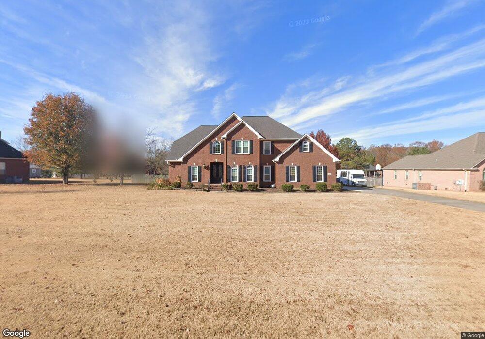
102 Samantha Rd Huntsville, AL 35806
Research Park NeighborhoodEstimated Value: $501,000 - $692,000
4
Beds
4
Baths
3,571
Sq Ft
$159/Sq Ft
Est. Value
About This Home
This home is located at 102 Samantha Rd, Huntsville, AL 35806 and is currently estimated at $569,282, approximately $159 per square foot. 102 Samantha Rd is a home located in Madison County with nearby schools including Monrovia Elementary School, Monrovia Middle School, and Sparkman High School.
Ownership History
Date
Name
Owned For
Owner Type
Purchase Details
Closed on
Aug 21, 2023
Sold by
Lopez Maria E and Lopez Louis
Bought by
Truong Vo C and Truong Norma Eufemia
Current Estimated Value
Purchase Details
Closed on
Aug 17, 2010
Sold by
Cohen William M and Cohen Colleen
Bought by
Lopez Louis and Lopez Maria Elena
Home Financials for this Owner
Home Financials are based on the most recent Mortgage that was taken out on this home.
Original Mortgage
$382,200
Interest Rate
4.6%
Mortgage Type
VA
Create a Home Valuation Report for This Property
The Home Valuation Report is an in-depth analysis detailing your home's value as well as a comparison with similar homes in the area
Home Values in the Area
Average Home Value in this Area
Purchase History
| Date | Buyer | Sale Price | Title Company |
|---|---|---|---|
| Truong Vo C | $227,500 | None Listed On Document | |
| Lopez Louis | -- | -- |
Source: Public Records
Mortgage History
| Date | Status | Borrower | Loan Amount |
|---|---|---|---|
| Previous Owner | Lopez Louis | $382,200 |
Source: Public Records
Tax History Compared to Growth
Tax History
| Year | Tax Paid | Tax Assessment Tax Assessment Total Assessment is a certain percentage of the fair market value that is determined by local assessors to be the total taxable value of land and additions on the property. | Land | Improvement |
|---|---|---|---|---|
| 2024 | $1,684 | $47,740 | $3,600 | $44,140 |
| 2023 | $1,684 | $45,780 | $3,600 | $42,180 |
| 2022 | $1,442 | $41,120 | $3,600 | $37,520 |
| 2021 | $1,442 | $41,120 | $3,600 | $37,520 |
| 2020 | $1,258 | $35,990 | $2,520 | $33,470 |
| 2019 | $1,216 | $34,830 | $2,520 | $32,310 |
| 2018 | $1,134 | $32,580 | $0 | $0 |
| 2017 | $1,134 | $32,580 | $0 | $0 |
| 2016 | $1,134 | $32,580 | $0 | $0 |
| 2015 | $1,134 | $32,580 | $0 | $0 |
| 2014 | $1,236 | $35,380 | $0 | $0 |
Source: Public Records
Map
Nearby Homes
- 131 Fairington Rd NW
- 100 Gordy Dr
- 120 Arbery Dr NW
- 115 Misty Hollow Way
- 1861 Jeff Rd NW
- 102 Springview Ln
- 1.4 acres Jeff Rd NW
- 10.4 acres Jeff Rd NW
- 104 Raymon Cir
- 2031 Blake Bottom Rd NW Unit 15
- 2031 Blake Bottom Rd NW
- 2031 Blake Bottom Rd NW Unit 2
- 229 Brooklet Ct
- 1 ACRE EASEMENT Jeff Rd NW
- 6215 Taramore Ln NW
- 6213 Taramore Ln NW
- 6209 Taramore Ln NW
- 6219 Taramore Ln NW
- 6207 Taramore Ln NW
- 124 Huston Ct
- 100 Samantha Rd
- 104 Samantha Rd
- 103 Waterchase Dr
- 105 Waterchase Dr
- 101 Waterchase Dr
- 103 Samantha Rd
- 101 Samantha Rd
- 107 Crossvine Rd
- 109 Crossvine Rd
- 107 Samantha Rd
- 102 Waterchase Dr
- 104 Waterchase Dr
- 105 Samantha Rd
- 106 Waterchase Dr
- 100 Waterchase Dr
- 110 Samantha Rd
- 108 Waterchase Dr
- 108 Crossvine Rd
- 111 Samantha Rd
- 110 Waterchase Dr