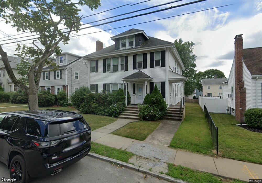
102 Sanborn Ave Unit 1 West Roxbury, MA 02132
West Roxbury NeighborhoodEstimated Value: $920,000 - $1,153,000
2
Beds
1
Bath
1,210
Sq Ft
$859/Sq Ft
Est. Value
About This Home
This home is located at 102 Sanborn Ave Unit 1, West Roxbury, MA 02132 and is currently estimated at $1,039,758, approximately $859 per square foot. 102 Sanborn Ave Unit 1 is a home located in Suffolk County with nearby schools including St Theresa School, Holy Name Parish School, and Catholic Memorial School.
Ownership History
Date
Name
Owned For
Owner Type
Purchase Details
Closed on
Jul 2, 1998
Sold by
Maloof George J and Cristofori Alfred A
Bought by
Kourtis William and Ceraso Isabella L
Current Estimated Value
Purchase Details
Closed on
Jul 1, 1987
Sold by
Ruo Samuel M
Bought by
Maloof George J
Create a Home Valuation Report for This Property
The Home Valuation Report is an in-depth analysis detailing your home's value as well as a comparison with similar homes in the area
Home Values in the Area
Average Home Value in this Area
Purchase History
| Date | Buyer | Sale Price | Title Company |
|---|---|---|---|
| Kourtis William | $245,000 | -- | |
| Maloof George J | $243,000 | -- |
Source: Public Records
Mortgage History
| Date | Status | Borrower | Loan Amount |
|---|---|---|---|
| Open | Maloof George J | $325,000 | |
| Closed | Maloof George J | $179,000 | |
| Closed | Maloof George J | $179,000 |
Source: Public Records
Tax History Compared to Growth
Tax History
| Year | Tax Paid | Tax Assessment Tax Assessment Total Assessment is a certain percentage of the fair market value that is determined by local assessors to be the total taxable value of land and additions on the property. | Land | Improvement |
|---|---|---|---|---|
| 2025 | $9,681 | $836,000 | $263,700 | $572,300 |
| 2024 | $9,308 | $853,900 | $243,300 | $610,600 |
| 2023 | $8,731 | $812,900 | $231,600 | $581,300 |
| 2022 | $8,504 | $781,600 | $222,700 | $558,900 |
| 2021 | $7,793 | $730,400 | $208,100 | $522,300 |
| 2020 | $7,030 | $665,700 | $188,000 | $477,700 |
| 2019 | $6,619 | $628,000 | $162,900 | $465,100 |
| 2018 | $6,266 | $597,900 | $162,900 | $435,000 |
| 2017 | $5,917 | $558,700 | $162,900 | $395,800 |
| 2016 | $5,909 | $537,200 | $162,900 | $374,300 |
| 2015 | $5,512 | $455,200 | $177,600 | $277,600 |
| 2014 | $5,367 | $426,600 | $174,800 | $251,800 |
Source: Public Records
Map
Nearby Homes
- 101 Chesbrough Rd
- 381 Baker St
- 349 Baker St Unit A
- 183 Temple St
- 331 Vermont St
- 480 Baker St
- 100 Keith St
- 1216 Vfw Pkwy Unit 40
- 1214 Vfw Pkwy Unit 37
- 9 Carroll St
- 615 Lagrange St
- 20 Tarleton Rd
- 539 Lagrange St
- 79 Potomac St
- 15 Atlantis St
- 196 Gardner St Unit 196
- 27-29 Temple St
- 5 Crest St
- 577 Baker St Unit 577
- 7 Cass St Unit 6
- 102 Sanborn Ave Unit 104
- 100 Sanborn Ave
- 106 Sanborn Ave
- 106 Sanborn Ave Unit 1
- 98 Sanborn Ave
- 98 Sanborn Ave Unit 2
- 87 Chesbrough Rd
- 89 Chesbrough Rd
- 85 Chesbrough Rd
- 112 Sanborn Ave
- 83 Chesbrough Rd
- 96 Sanborn Ave
- 119 Sanborn Ave
- 117 Sanborn Ave
- 121 Sanborn Ave
- 93 Chesbrough Rd
- 123 Sanborn Ave
- 81 Chesbrough Rd
- 116 Sanborn Ave
- 94 Sanborn Ave