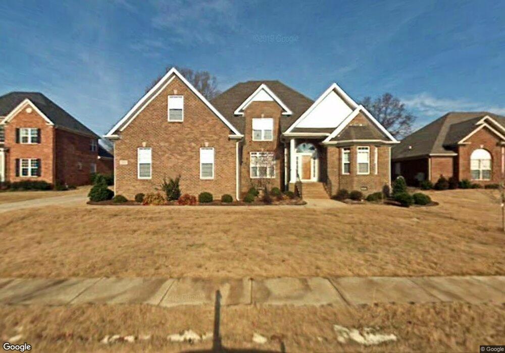
102 Scamp Landing Madison, AL 35758
Estimated Value: $576,622 - $641,000
--
Bed
--
Bath
3,449
Sq Ft
$173/Sq Ft
Est. Value
About This Home
This home is located at 102 Scamp Landing, Madison, AL 35758 and is currently estimated at $597,406, approximately $173 per square foot. 102 Scamp Landing is a home with nearby schools including Mill Creek Elementary School, Liberty Middle School, and James Clemens High School.
Ownership History
Date
Name
Owned For
Owner Type
Purchase Details
Closed on
Mar 31, 2006
Sold by
Paster Stephen David
Bought by
Linton Marilyn T
Current Estimated Value
Home Financials for this Owner
Home Financials are based on the most recent Mortgage that was taken out on this home.
Original Mortgage
$266,260
Interest Rate
6.25%
Mortgage Type
New Conventional
Purchase Details
Closed on
Sep 29, 2005
Sold by
Rigby Homes Inc
Bought by
Paster Stephens David
Create a Home Valuation Report for This Property
The Home Valuation Report is an in-depth analysis detailing your home's value as well as a comparison with similar homes in the area
Home Values in the Area
Average Home Value in this Area
Purchase History
| Date | Buyer | Sale Price | Title Company |
|---|---|---|---|
| Linton Marilyn T | -- | -- | |
| Paster Stephens David | -- | -- |
Source: Public Records
Mortgage History
| Date | Status | Borrower | Loan Amount |
|---|---|---|---|
| Closed | Linton Marilyn T | $266,260 |
Source: Public Records
Tax History Compared to Growth
Tax History
| Year | Tax Paid | Tax Assessment Tax Assessment Total Assessment is a certain percentage of the fair market value that is determined by local assessors to be the total taxable value of land and additions on the property. | Land | Improvement |
|---|---|---|---|---|
| 2024 | $3,670 | $53,500 | $6,500 | $47,000 |
| 2023 | $3,538 | $51,600 | $6,500 | $45,100 |
| 2022 | $2,934 | $42,760 | $3,500 | $39,260 |
| 2021 | $2,642 | $38,560 | $3,500 | $35,060 |
| 2020 | $2,504 | $36,580 | $3,500 | $33,080 |
| 2019 | $1,985 | $35,170 | $3,500 | $31,670 |
| 2018 | $1,879 | $33,340 | $0 | $0 |
| 2017 | $1,863 | $33,060 | $0 | $0 |
| 2016 | $1,863 | $33,060 | $0 | $0 |
| 2015 | $1,863 | $33,060 | $0 | $0 |
| 2014 | $1,919 | $34,200 | $0 | $0 |
Source: Public Records
Map
Nearby Homes
- 108 Elko Jct
- 106 Ervington Place
- 1001 Mill Rd
- 139 Fox Hollow Dr
- 140 Fox Hollow Dr
- 102 Hunington Chase Dr
- 137 Walking Trail Way
- 108 Green Rock Rd
- 106 Green Rock Rd
- 116 Whitworth Ct
- 120 Grantham Cir
- 306 High Coach Cir
- 118 Wesly Clark Blvd
- 103 Carlton Woods Dr
- 118 Bridgehouse Dr
- 126 Mattie Ct
- 210 Healey Dr
- 130 Mattie Ct
- 240 Coral Ct
- 113 Woodvale Dr
- 100 Scamp Landing
- 104 Scamp Landing
- 103 Scamp Landing
- 101 Scamp Landing
- 105 Cottonport Place
- 106 Scamp Landing
- 107 Cottonport Place
- 103 S Brook Place
- 103 Cottonport Place
- 106 S Brook Place
- 210 Cedar Springs Place
- 106 Cottonport Place
- 107 S Brook Place
- 108 S Brook Place
- 217 Cedar Springs Place
- 104 Cottonport Place
- 109 S Brook Place
- 220 Cedar Springs Place
- 215 Cedar Springs Place