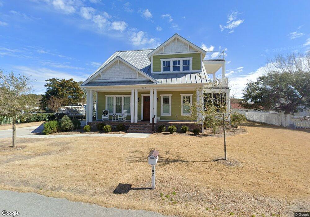
102 Seaview St Beaufort, NC 28516
Estimated Value: $479,000 - $1,219,000
1
Bed
2
Baths
416
Sq Ft
$2,050/Sq Ft
Est. Value
About This Home
This home is located at 102 Seaview St, Beaufort, NC 28516 and is currently estimated at $852,820, approximately $2,050 per square foot. 102 Seaview St is a home located in Carteret County with nearby schools including Beaufort Elementary School, Beaufort Middle School, and East Carteret High School.
Ownership History
Date
Name
Owned For
Owner Type
Purchase Details
Closed on
May 26, 2006
Sold by
Shields Clay R and Shields Adah P
Bought by
Lantz Wendell R and Lantz Dawn
Current Estimated Value
Home Financials for this Owner
Home Financials are based on the most recent Mortgage that was taken out on this home.
Original Mortgage
$190,000
Outstanding Balance
$110,701
Interest Rate
6.41%
Mortgage Type
Fannie Mae Freddie Mac
Estimated Equity
$742,119
Purchase Details
Closed on
Dec 10, 1999
Purchase Details
Closed on
Sep 29, 1999
Create a Home Valuation Report for This Property
The Home Valuation Report is an in-depth analysis detailing your home's value as well as a comparison with similar homes in the area
Home Values in the Area
Average Home Value in this Area
Purchase History
| Date | Buyer | Sale Price | Title Company |
|---|---|---|---|
| Lantz Wendell R | $400,000 | None Available | |
| -- | $239,000 | -- | |
| -- | $135,000 | -- |
Source: Public Records
Mortgage History
| Date | Status | Borrower | Loan Amount |
|---|---|---|---|
| Open | Lantz Wendell R | $190,000 |
Source: Public Records
Tax History Compared to Growth
Tax History
| Year | Tax Paid | Tax Assessment Tax Assessment Total Assessment is a certain percentage of the fair market value that is determined by local assessors to be the total taxable value of land and additions on the property. | Land | Improvement |
|---|---|---|---|---|
| 2025 | $8,619 | $1,515,146 | $209,138 | $1,306,008 |
| 2024 | $6,219 | $704,732 | $253,285 | $451,447 |
| 2023 | $6,124 | $704,732 | $253,285 | $451,447 |
| 2022 | $6,053 | $704,732 | $253,285 | $451,447 |
| 2021 | $6,053 | $704,732 | $253,285 | $451,447 |
| 2020 | $4,741 | $550,305 | $253,285 | $297,020 |
| 2019 | $3,706 | $438,935 | $288,420 | $150,515 |
| 2017 | $3,476 | $450,556 | $288,420 | $162,136 |
| 2016 | $3,273 | $450,556 | $288,420 | $162,136 |
| 2015 | $3,228 | $450,556 | $288,420 | $162,136 |
| 2014 | -- | $462,097 | $298,800 | $163,297 |
Source: Public Records
Map
Nearby Homes
- 1312 Ann St Unit 5
- 1524 Ann St
- 1308 Ann St Unit 16
- 110 Beaufort Walk
- 102 Macgregor Dr
- 770 Laurel Ln
- 1011 Front St Unit 3A
- 301 Hedrick St
- 109 Sunshine Ct
- 1707 Front St
- 132 Freedom Park Rd
- 160 Freedom Park Rd
- 123 Freedom Park Rd
- 121 Freedom Park Rd
- 117 Freedom Park Rd
- 127 Freedom Park Rd
- 111 Freedom Park Rd
- 109 Freedom Park Rd
- 103 Freedom Park Rd
- 122 Spoonbill Ln
- 1402 Ann St
- 103 Belle Air St
- 1403 Front St
- 1405 Front St
- 105 Belle Air St
- 1401 Front St
- 1407 Front St
- 107 Belle Air St
- 1314 Ann St
- 101 Seaview St
- 1409 Front St
- 103 Seaview St Unit A
- 103 Seaview St Unit B
- 103 Seaview St
- 1325 Front St
- 106 Belle Air St
- 1312 Ann
- 1501 Front St
- 0 Front St Unit 10803552
- 1317 Front St