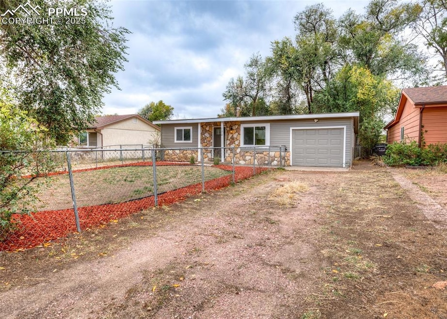
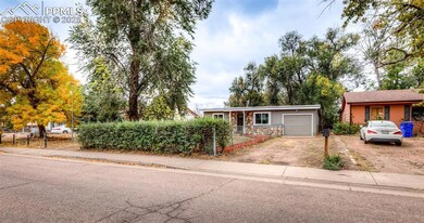
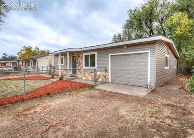
102 Security Blvd Colorado Springs, CO 80911
Fountain Valley Ranch NeighborhoodEstimated payment $1,613/month
Highlights
- 0.36 Acre Lot
- Ranch Style House
- Concrete Porch or Patio
- Property is near a park
- 1 Car Attached Garage
- Landscaped
About This Home
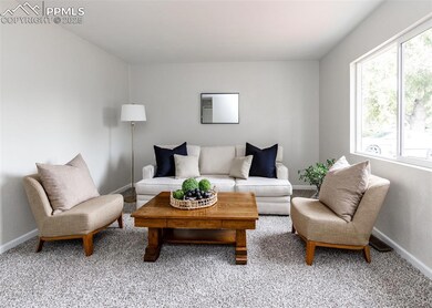
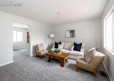
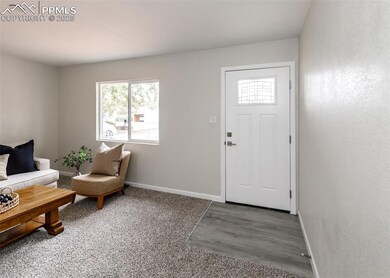
This Ranch Style home has been completely remodeled and sits on a LARGE lot. Walk into the familyroom with new carpet and a large window brining in lots of natural light. Open kitchen with stainless appliances to include a gas range, white cabinets, and beautoful new counter tops. Stackable Washer and dryer hook-ups off the kitchen. Large dingin room could be used as an office or second livingroom that connects to the extra long one car garage. Both bedrooms and the bathroom connect off the familyroom, with new carpet in the bedrooms and a bright and remodeled bathroom with a tub/shower combo and stylish light fixture and vanity.
This huge lot is a blank canvas to do with whatever you can think of, sucj as adding a rasied garden, or kids swing set etc.
Home Details
Home Type
- Single Family
Est. Annual Taxes
- $1,332
Year Built
- Built in 1955
Lot Details
- 0.36 Acre Lot
- Back Yard Fenced
- Landscaped
- Level Lot
Parking
- 1 Car Attached Garage
- Gravel Driveway
Home Design
- Ranch Style House
- Shingle Roof
- Aluminum Siding
- Stone Siding
Interior Spaces
- 900 Sq Ft Home
- Crawl Space
- Electric Dryer Hookup
Kitchen
- Microwave
- Dishwasher
Flooring
- Carpet
- Laminate
Bedrooms and Bathrooms
- 2 Bedrooms
- 1 Full Bathroom
Utilities
- No Cooling
- Forced Air Heating System
Additional Features
- Concrete Porch or Patio
- Property is near a park
Map
Home Values in the Area
Average Home Value in this Area
Tax History
| Year | Tax Paid | Tax Assessment Tax Assessment Total Assessment is a certain percentage of the fair market value that is determined by local assessors to be the total taxable value of land and additions on the property. | Land | Improvement |
|---|---|---|---|---|
| 2025 | $1,332 | $21,750 | -- | -- |
| 2024 | $1,267 | $21,750 | $3,220 | $18,530 |
| 2023 | $1,267 | $21,750 | $3,220 | $18,530 |
| 2022 | $1,080 | $14,460 | $2,220 | $12,240 |
| 2021 | $1,165 | $14,890 | $2,290 | $12,600 |
| 2020 | $833 | $10,340 | $2,000 | $8,340 |
| 2019 | $828 | $10,340 | $2,000 | $8,340 |
| 2018 | $762 | $8,880 | $1,500 | $7,380 |
| 2017 | $771 | $8,880 | $1,500 | $7,380 |
| 2016 | $601 | $8,450 | $1,590 | $6,860 |
| 2015 | $616 | $8,450 | $1,590 | $6,860 |
| 2014 | $560 | $7,720 | $1,430 | $6,290 |
Property History
| Date | Event | Price | List to Sale | Price per Sq Ft |
|---|---|---|---|---|
| 10/10/2025 10/10/25 | Pending | -- | -- | -- |
| 10/07/2025 10/07/25 | For Sale | $285,000 | -- | $317 / Sq Ft |
Purchase History
| Date | Type | Sale Price | Title Company |
|---|---|---|---|
| Special Warranty Deed | $140,000 | Fitco (First Integrity Title C | |
| Deed | -- | -- | |
| Deed | -- | -- | |
| Deed | -- | -- |
Source: Pikes Peak REALTOR® Services
MLS Number: 9608835
APN: 65133-02-031
Disclaimer: Certain information contained herein is derived from information provided by parties other than Homes.com. All information provided is deemed reliable, but is not guaranteed to be accurate and should be independently verified.
![]() IDX information is provided exclusively for personal, non-commercial use, and may not be used for any purpose other than to identify prospective properties consumers may be interested in purchasing. Information is deemed reliable but not guaranteed.
IDX information is provided exclusively for personal, non-commercial use, and may not be used for any purpose other than to identify prospective properties consumers may be interested in purchasing. Information is deemed reliable but not guaranteed.
