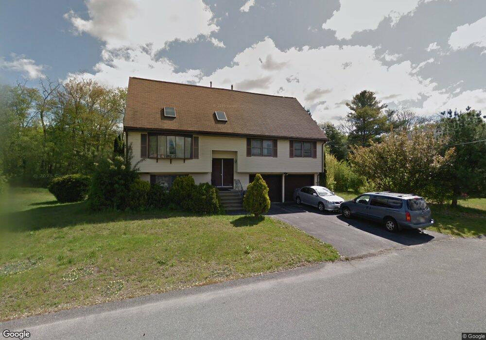
102 Selwyn Rd Randolph, MA 02368
South Randolph NeighborhoodEstimated Value: $689,000 - $772,000
4
Beds
2
Baths
2,363
Sq Ft
$308/Sq Ft
Est. Value
About This Home
This home is located at 102 Selwyn Rd, Randolph, MA 02368 and is currently estimated at $728,120, approximately $308 per square foot. 102 Selwyn Rd is a home located in Norfolk County with nearby schools including Randolph High School and Lighthouse Baptist Christian Academy.
Create a Home Valuation Report for This Property
The Home Valuation Report is an in-depth analysis detailing your home's value as well as a comparison with similar homes in the area
Home Values in the Area
Average Home Value in this Area
Tax History
| Year | Tax Paid | Tax Assessment Tax Assessment Total Assessment is a certain percentage of the fair market value that is determined by local assessors to be the total taxable value of land and additions on the property. | Land | Improvement |
|---|---|---|---|---|
| 2025 | $8,363 | $720,300 | $231,700 | $488,600 |
| 2024 | $8,219 | $717,800 | $227,100 | $490,700 |
| 2023 | $8,028 | $664,600 | $206,500 | $458,100 |
| 2022 | $7,755 | $570,200 | $172,100 | $398,100 |
| 2021 | $7,632 | $516,400 | $143,500 | $372,900 |
| 2020 | $7,662 | $513,900 | $143,500 | $370,400 |
| 2019 | $7,593 | $506,900 | $136,500 | $370,400 |
| 2018 | $7,702 | $485,000 | $124,200 | $360,800 |
| 2017 | $7,265 | $449,000 | $126,500 | $322,500 |
| 2016 | $7,039 | $404,800 | $115,000 | $289,800 |
| 2015 | $6,860 | $379,000 | $109,600 | $269,400 |
Source: Public Records
Map
Nearby Homes
- 15 Hillsdale Rd
- 8 Junior Terrace
- 32 Cole Terrace
- 28 Mcdonnell Dr
- 23 Nightingale Cir
- 12 Darrell Dr
- 7 Oakwood Ave
- 0 Payson Ave
- 7 Van Beal Rd
- 276 Center St
- 5 Patterson Ave E
- 71 Cole Terrace
- 747 S Main St
- 22 Union Square
- 158 Union St
- 503 Page St
- 14 Washington Cir
- 33 Hemlock Terrace
- 327 Union St
- 54 Highland Glen Dr
Your Personal Tour Guide
Ask me questions while you tour the home.