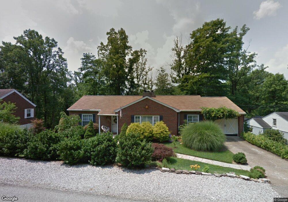
102 Sheridan Cir Charleston, WV 25314
South Hills NeighborhoodEstimated Value: $204,385 - $226,000
3
Beds
2
Baths
1,384
Sq Ft
$155/Sq Ft
Est. Value
About This Home
This home is located at 102 Sheridan Cir, Charleston, WV 25314 and is currently estimated at $215,096, approximately $155 per square foot. 102 Sheridan Cir is a home located in Kanawha County with nearby schools including Weberwood Elementary School, John Adams Middle School, and George Washington High School.
Ownership History
Date
Name
Owned For
Owner Type
Purchase Details
Closed on
Oct 14, 2014
Sold by
Joanne G Joanne G
Bought by
Burka Joanne G and Mcclure Diana L
Current Estimated Value
Purchase Details
Closed on
Apr 4, 2002
Sold by
Trent Susan
Bought by
Burka Joanne
Home Financials for this Owner
Home Financials are based on the most recent Mortgage that was taken out on this home.
Original Mortgage
$98,000
Interest Rate
6.85%
Mortgage Type
New Conventional
Create a Home Valuation Report for This Property
The Home Valuation Report is an in-depth analysis detailing your home's value as well as a comparison with similar homes in the area
Home Values in the Area
Average Home Value in this Area
Purchase History
| Date | Buyer | Sale Price | Title Company |
|---|---|---|---|
| Burka Joanne G | -- | -- | |
| Burka Joanne | $110,000 | -- |
Source: Public Records
Mortgage History
| Date | Status | Borrower | Loan Amount |
|---|---|---|---|
| Previous Owner | Burka Joanne | $98,000 |
Source: Public Records
Tax History Compared to Growth
Tax History
| Year | Tax Paid | Tax Assessment Tax Assessment Total Assessment is a certain percentage of the fair market value that is determined by local assessors to be the total taxable value of land and additions on the property. | Land | Improvement |
|---|---|---|---|---|
| 2024 | $1,635 | $97,020 | $20,280 | $76,740 |
| 2023 | $1,498 | $93,120 | $20,280 | $72,840 |
| 2022 | $1,498 | $93,120 | $20,280 | $72,840 |
| 2021 | $1,402 | $87,480 | $20,280 | $67,200 |
| 2020 | $1,390 | $87,480 | $20,280 | $67,200 |
| 2019 | $1,381 | $87,480 | $20,280 | $67,200 |
| 2018 | $1,222 | $85,560 | $20,280 | $65,280 |
| 2017 | $1,214 | $85,560 | $20,280 | $65,280 |
| 2016 | $1,207 | $85,560 | $20,280 | $65,280 |
| 2015 | $1,237 | $88,380 | $20,280 | $68,100 |
| 2014 | $1,214 | $88,320 | $20,280 | $68,040 |
Source: Public Records
Map
Nearby Homes
- 311 Mckinley Ave
- 207 Mckinley Ave
- 606 Fort Hill Dr
- 416 Sheridan Cir
- 328 Mckinley Ave
- 617 Churchill Dr
- 619 Churchill Dr
- 710 & 708 Daverton Rd
- 901 Evanwood Rd
- 836 Walters Rd
- 502 Kanawha Blvd W
- 805 Basil Rd
- 1507 Rockford Ct
- 202 Kanawha Blvd W
- 112 Park Dr
- 0 Suncrest Place
- 611 Grant St
- 615 Grant St
- 711 Main St
- 0 Suncrest Rd
- 104 Sheridan Cir
- 106 Sheridan Cir
- 100 Sheridan Cir
- 802 Wilkie Dr
- 108 Sheridan Cir
- 297 Fort Circle Dr
- 537 Sheridan Cir
- 110 Sheridan Cir
- 803 Wilkie Dr
- 534 Sheridan Cir
- 535 Sheridan Cir
- 299 Fort Circle Dr
- 809 Wilkie Dr
- 295 Fort Circle Dr
- 112 Sheridan Cir
- 532 Sheridan Cir
- 502 South Fort Dr
- 533 Sheridan Cir
- 100 Samantha Ln
- 812 Wilkie Dr