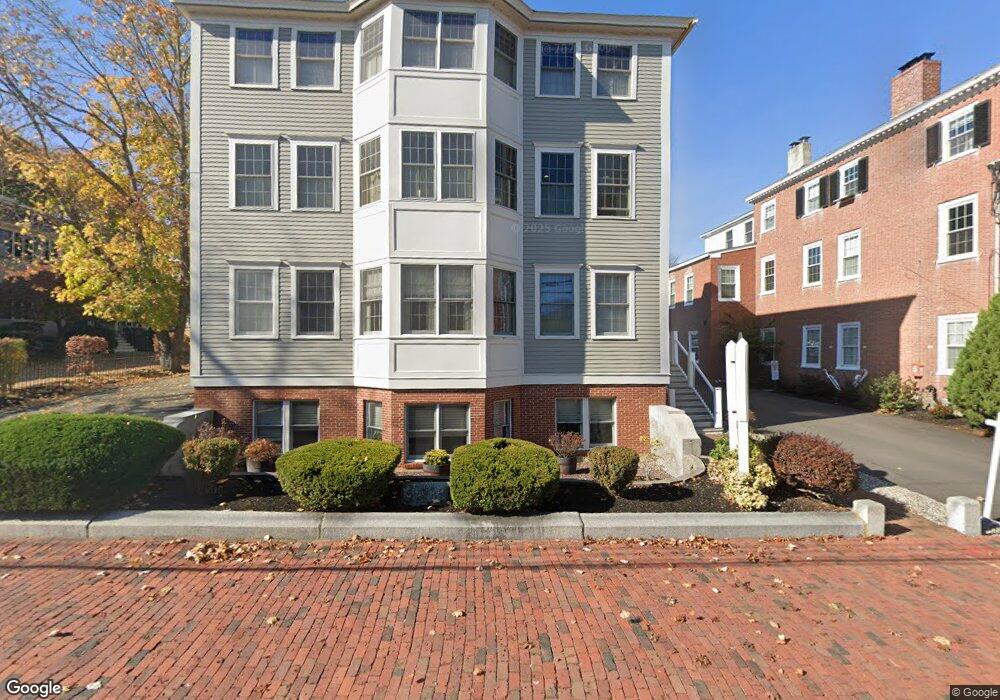
102 State St Unit G Newburyport, MA 01950
Estimated Value: $498,071
--
Bed
1
Bath
948
Sq Ft
$525/Sq Ft
Est. Value
About This Home
This home is located at 102 State St Unit G, Newburyport, MA 01950 and is currently estimated at $498,071, approximately $525 per square foot. 102 State St Unit G is a home located in Essex County with nearby schools including Francis T. Bresnahan Elementary School, Edward G. Molin Elementary School, and Rupert A. Nock Middle School.
Ownership History
Date
Name
Owned For
Owner Type
Purchase Details
Closed on
Jun 8, 2020
Sold by
102 State Street Rt
Bought by
Lnr Rt
Current Estimated Value
Home Financials for this Owner
Home Financials are based on the most recent Mortgage that was taken out on this home.
Original Mortgage
$264,000
Outstanding Balance
$234,016
Interest Rate
3.2%
Mortgage Type
Commercial
Estimated Equity
$264,055
Purchase Details
Closed on
Jan 2, 2015
Sold by
Magnolia Rt
Bought by
102 State Street Rt
Home Financials for this Owner
Home Financials are based on the most recent Mortgage that was taken out on this home.
Original Mortgage
$146,000
Interest Rate
3.99%
Mortgage Type
Commercial
Purchase Details
Closed on
Feb 6, 2004
Sold by
Newkirk Tr Gerald E and Webber Michael A
Bought by
Jones Tr Terry L
Create a Home Valuation Report for This Property
The Home Valuation Report is an in-depth analysis detailing your home's value as well as a comparison with similar homes in the area
Home Values in the Area
Average Home Value in this Area
Purchase History
| Date | Buyer | Sale Price | Title Company |
|---|---|---|---|
| Lnr Rt | $330,000 | None Available | |
| 102 State Street Rt | $182,500 | -- | |
| Jones Tr Terry L | $1,650,000 | -- |
Source: Public Records
Mortgage History
| Date | Status | Borrower | Loan Amount |
|---|---|---|---|
| Open | Lnr Rt | $264,000 | |
| Previous Owner | 102 State Street Rt | $146,000 |
Source: Public Records
Tax History Compared to Growth
Tax History
| Year | Tax Paid | Tax Assessment Tax Assessment Total Assessment is a certain percentage of the fair market value that is determined by local assessors to be the total taxable value of land and additions on the property. | Land | Improvement |
|---|---|---|---|---|
| 2025 | $3,114 | $325,100 | $0 | $325,100 |
| 2024 | $3,145 | $315,400 | $0 | $315,400 |
| 2023 | $3,504 | $326,300 | $0 | $326,300 |
| 2022 | $3,919 | $326,300 | $0 | $326,300 |
| 2021 | $2,710 | $214,400 | $0 | $214,400 |
| 2020 | $2,753 | $214,400 | $0 | $214,400 |
| 2019 | $2,456 | $187,800 | $0 | $187,800 |
| 2018 | $2,310 | $174,200 | $0 | $174,200 |
| 2017 | $2,461 | $183,000 | $0 | $183,000 |
| 2016 | $2,979 | $222,500 | $0 | $222,500 |
| 2015 | $2,968 | $222,500 | $0 | $222,500 |
Source: Public Records
Map
Nearby Homes
- 105 State St Unit 301
- 105 State St Unit 101
- 105 State St Unit 201
- 95 High St Unit 4
- 95 High St Unit 1
- 11 Charter St
- 2 Court St Unit 4
- 10 10th St
- 11 Orange St Unit 2
- 1 Hill St
- 1 Hill St Unit 1
- 42 Federal St Unit B
- 58 Merrimac St Unit 2-5
- 30-32 Water St Unit 4
- 58 Lime St Unit 5
- 44 Washington St Unit C
- 57 Lime St Unit 1
- 41 Washington St Unit B
- 45 Boardman St Unit 1
- 113 Prospect St Unit B
- 102 State St Unit E
- 102 State St Unit D
- 102 State St Unit C
- 102 State St Unit B
- 102 State St Unit A
- 102 State St
- 102 State St Unit F
- 100 State St Unit 9
- 100 State St Unit 7
- 100 State St Unit 6
- 100 State St Unit 5
- 100 State St Unit 4
- 100 State St Unit 3
- 100 State St Unit 2
- 100 State St Unit 1
- 100 State St Unit 6 1
- 100 State St Unit 5 1
- 104 State St Unit D
- 104 State St Unit C
- 104 State St Unit B