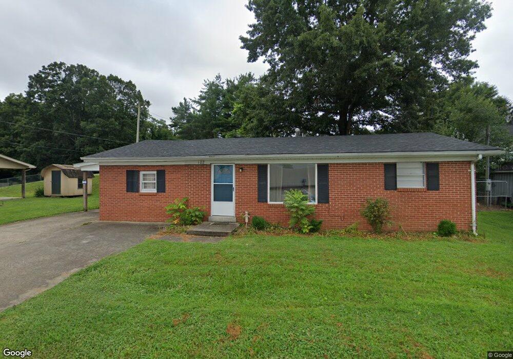
102 Stewart Dr Somerset, KY 42503
Estimated Value: $129,000 - $330,000
2
Beds
1
Bath
1,150
Sq Ft
$161/Sq Ft
Est. Value
About This Home
This home is located at 102 Stewart Dr, Somerset, KY 42503 and is currently estimated at $185,310, approximately $161 per square foot. 102 Stewart Dr is a home located in Pulaski County with nearby schools including Saline Christian Academy and Somerset Christian School.
Ownership History
Date
Name
Owned For
Owner Type
Purchase Details
Closed on
Jan 31, 2022
Sold by
Azalea Properties Llc
Bought by
Lcp Investments Llc
Current Estimated Value
Home Financials for this Owner
Home Financials are based on the most recent Mortgage that was taken out on this home.
Original Mortgage
$375,000
Outstanding Balance
$248,917
Interest Rate
2.66%
Mortgage Type
Construction
Estimated Equity
-$63,607
Purchase Details
Closed on
May 30, 2015
Bought by
Azalea Properties Llc
Create a Home Valuation Report for This Property
The Home Valuation Report is an in-depth analysis detailing your home's value as well as a comparison with similar homes in the area
Home Values in the Area
Average Home Value in this Area
Purchase History
| Date | Buyer | Sale Price | Title Company |
|---|---|---|---|
| Lcp Investments Llc | $375,000 | Attorney Only | |
| Azalea Properties Llc | $41,000 | -- |
Source: Public Records
Mortgage History
| Date | Status | Borrower | Loan Amount |
|---|---|---|---|
| Open | Lcp Investments Llc | $375,000 |
Source: Public Records
Tax History Compared to Growth
Tax History
| Year | Tax Paid | Tax Assessment Tax Assessment Total Assessment is a certain percentage of the fair market value that is determined by local assessors to be the total taxable value of land and additions on the property. | Land | Improvement |
|---|---|---|---|---|
| 2025 | $566 | $75,000 | $8,000 | $67,000 |
| 2024 | $555 | $75,000 | $8,000 | $67,000 |
| 2023 | $584 | $75,000 | $8,000 | $67,000 |
| 2022 | $592 | $75,000 | $8,000 | $67,000 |
| 2021 | $436 | $53,000 | $10,000 | $43,000 |
| 2020 | $439 | $53,000 | $10,000 | $43,000 |
| 2019 | $453 | $53,000 | $10,000 | $43,000 |
| 2018 | $446 | $53,000 | $10,000 | $43,000 |
| 2017 | $338 | $41,000 | $41,000 | $0 |
| 2016 | $338 | $41,000 | $41,000 | $0 |
| 2015 | $436 | $41,000 | $41,000 | $0 |
| 2014 | $424 | $54,000 | $54,000 | $0 |
Source: Public Records
Map
Nearby Homes
- 155 Woodland Dr
- E-2 & F Tracts Country Club Estates
- 150 Woodland Dr
- 103 Caney Fork Rd
- 413 N Harvey Ave
- 210 Caney Fork Rd Unit 4
- 213 E Limestone St
- 203 E Limestone St
- 155 E Ridge Ln
- 103 W Limestone St
- 1156 Highway 39
- 209 W Limestone St
- 303 Robin Dr
- 158 & 172 Muirfield Dr
- 107 Shady Ln
- 50 Muirfield Dr
- 105 Loveless Ln
- 100 Cherry Ln
- 253 W Saddlebrook Dr
- 408 Rosewood Ave
- 401 Crab Orchard Rd
- 104 Stewart Dr
- 106 Stewart Dr
- 315 Crab Orchard Rd
- 402 Crab Orchard Rd
- 108 Stewart Dr
- 404 Crab Orchard Rd
- 400 Crab Orchard Rd
- 313 Crab Orchard Rd
- 110 Stewart Dr
- 314 Crab Orchard Rd
- 39 Christian St Unit 39
- 603 E University Dr
- 0 Hwy 39 Unit 18133
- 0 Hwy 39 Unit 23012101
- 0 Hwy 39 Unit 609236
- 0 Hwy 39 Unit 22020440
- 0 Hwy 39 Unit 3018133
- 112 Stewart Dr
- 290 McGothlin Rd