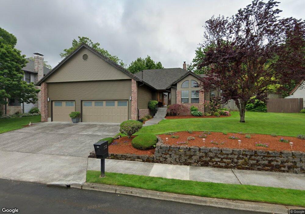
102 SW 5th St Gresham, OR 97080
Gresham Butte NeighborhoodEstimated Value: $546,000 - $598,000
3
Beds
2
Baths
2,036
Sq Ft
$280/Sq Ft
Est. Value
About This Home
This home is located at 102 SW 5th St, Gresham, OR 97080 and is currently estimated at $569,121, approximately $279 per square foot. 102 SW 5th St is a home located in Multnomah County with nearby schools including Dexter McCarty Middle School, Gresham High School, and Gresham Arthur Academy.
Ownership History
Date
Name
Owned For
Owner Type
Purchase Details
Closed on
Jul 15, 2019
Sold by
Grokett Greg and Grokett Paula
Bought by
Grokett Gregory Robert and Gregory Robert Grokett Trust
Current Estimated Value
Purchase Details
Closed on
Mar 22, 2007
Sold by
Bauer Pamela Dianne
Bought by
Grokett Greg and Grokett Paula
Home Financials for this Owner
Home Financials are based on the most recent Mortgage that was taken out on this home.
Original Mortgage
$277,600
Outstanding Balance
$167,469
Interest Rate
6.29%
Mortgage Type
Purchase Money Mortgage
Estimated Equity
$401,652
Create a Home Valuation Report for This Property
The Home Valuation Report is an in-depth analysis detailing your home's value as well as a comparison with similar homes in the area
Home Values in the Area
Average Home Value in this Area
Purchase History
| Date | Buyer | Sale Price | Title Company |
|---|---|---|---|
| Grokett Gregory Robert | -- | None Available | |
| Grokett Greg | $347,000 | Fidelity Natl Title Co Of Or |
Source: Public Records
Mortgage History
| Date | Status | Borrower | Loan Amount |
|---|---|---|---|
| Open | Grokett Greg | $277,600 |
Source: Public Records
Tax History Compared to Growth
Tax History
| Year | Tax Paid | Tax Assessment Tax Assessment Total Assessment is a certain percentage of the fair market value that is determined by local assessors to be the total taxable value of land and additions on the property. | Land | Improvement |
|---|---|---|---|---|
| 2025 | $7,709 | $378,820 | -- | -- |
| 2024 | $7,379 | $367,790 | -- | -- |
| 2023 | $6,723 | $357,080 | $0 | $0 |
| 2022 | $6,535 | $346,680 | $0 | $0 |
| 2021 | $6,370 | $336,590 | $0 | $0 |
| 2020 | $5,994 | $326,790 | $0 | $0 |
| 2019 | $5,837 | $317,280 | $0 | $0 |
| 2018 | $5,566 | $308,040 | $0 | $0 |
| 2017 | $5,340 | $299,070 | $0 | $0 |
| 2016 | $4,686 | $290,360 | $0 | $0 |
Source: Public Records
Map
Nearby Homes
- 126 SW 5th St
- 555 SW 7th St
- 638 SW 7th St
- 0 SW Miller Ct Unit 470855683
- 645 W Powell Blvd
- 200 SW Florence Ave Unit C6
- 200 SW Florence Ave Unit D15
- 200 SW Florence Ave Unit G3
- 200 SW Florence Ave Unit D9
- 1407 SE Beech Place
- 1005 SW 4th St
- 318 NE Roberts Ave Unit 402
- 159 SW Florence Ave Unit 64
- 159 SW Florence Ave
- 0 NE 5th St
- 975 SW Florence Ct
- 1113 W Powell Blvd
- 1284 SW 4th St
- 491 NE Elliott Ave
- 275 SW Towle Ave
- 110 SW 5th St
- 56 SW 5th St-Call Then Sho
- 56 SW 5th St
- 109 SW 6th Ct
- 65 SW 6th Ct
- 117 SW 6th Ct
- 41 SW 6th Ct
- 123 SW 6th Ct
- 605 SW Miller Ct
- 222 SW 5th St
- 135 SW 6th Ct
- 610 SW Miller Ct
- 201 SW 6th Ct
- 625 SW Miller Ct
- 130 SW 6th Ct
- 510 SW Walters Dr
- 520 SW Walters Dr
- 211 SW 6th Ct
- 635 SW Miller Ct
- 638 SW Miller Ct