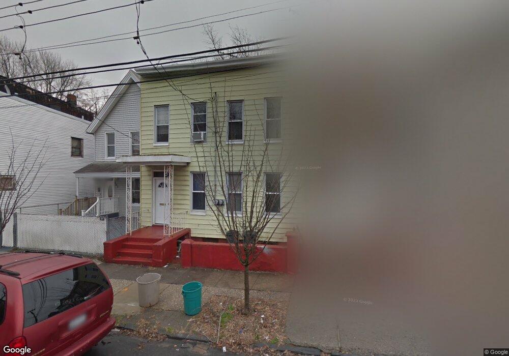
102 Taft Ave Unit 2 Staten Island, NY 10301
New Brighton NeighborhoodEstimated Value: $524,000 - $635,000
3
Beds
1
Bath
1,500
Sq Ft
$379/Sq Ft
Est. Value
About This Home
This home is located at 102 Taft Ave Unit 2, Staten Island, NY 10301 and is currently estimated at $568,293, approximately $378 per square foot. 102 Taft Ave Unit 2 is a home located in Richmond County with nearby schools including P.S. 31 - William T. Davis, Is 61 William A Morris, and Curtis High School.
Ownership History
Date
Name
Owned For
Owner Type
Purchase Details
Closed on
Jan 30, 2015
Sold by
Brighton Avenue Llc
Bought by
Blois Andrew and Buono Blois Diana
Current Estimated Value
Home Financials for this Owner
Home Financials are based on the most recent Mortgage that was taken out on this home.
Original Mortgage
$204,000
Outstanding Balance
$156,133
Interest Rate
3.74%
Mortgage Type
New Conventional
Estimated Equity
$412,160
Purchase Details
Closed on
Jul 1, 2014
Sold by
Brown Curtis and Brown Ruby
Bought by
Brighton Avenue Llc
Create a Home Valuation Report for This Property
The Home Valuation Report is an in-depth analysis detailing your home's value as well as a comparison with similar homes in the area
Home Values in the Area
Average Home Value in this Area
Purchase History
| Date | Buyer | Sale Price | Title Company |
|---|---|---|---|
| Blois Andrew | $272,500 | None Available | |
| Brighton Avenue Llc | $80,000 | First American Title Ins Co |
Source: Public Records
Mortgage History
| Date | Status | Borrower | Loan Amount |
|---|---|---|---|
| Open | Blois Andrew | $204,000 |
Source: Public Records
Tax History Compared to Growth
Tax History
| Year | Tax Paid | Tax Assessment Tax Assessment Total Assessment is a certain percentage of the fair market value that is determined by local assessors to be the total taxable value of land and additions on the property. | Land | Improvement |
|---|---|---|---|---|
| 2025 | $3,454 | $34,260 | $4,144 | $30,116 |
| 2024 | $3,454 | $30,480 | $4,401 | $26,079 |
| 2023 | $3,492 | $17,196 | $4,299 | $12,897 |
| 2022 | $3,397 | $28,320 | $7,800 | $20,520 |
| 2021 | $3,383 | $23,460 | $7,800 | $15,660 |
| 2020 | $3,223 | $20,220 | $7,800 | $12,420 |
| 2019 | $3,011 | $18,420 | $7,800 | $10,620 |
| 2018 | $2,921 | $14,330 | $6,210 | $8,120 |
| 2017 | $2,891 | $14,181 | $6,803 | $7,378 |
| 2016 | $2,678 | $13,394 | $5,804 | $7,590 |
| 2015 | $1,987 | $12,639 | $5,808 | $6,831 |
| 2014 | $1,987 | $11,942 | $4,885 | $7,057 |
Source: Public Records
Map
Nearby Homes
- 118 Hendricks Ave
- 138 Hendricks Ave
- 181 Benziger Ave
- 75 Taft Ave
- 93 Taft Ave
- 102 Winter Ave
- 12 Pauw St
- 344 Westervelt Ave
- 135 Highview Ave
- 20 Winter Ave
- 19 Scribner Ave
- 301 Westervelt Ave
- 32 Scribner Ave
- 203 York Ave
- 61 York Ave
- 0 Van Tuyl St
- 192 Corson Ave
- 446 Jersey St Unit 448
- 20 Van Tuyl St
- 416 Westervelt Ave
- 102 Taft Ave
- 102 Taft Ave Unit 1
- 100 Taft Ave
- 104 Taft Ave
- 108 Taft Ave Unit 2
- 108 Taft Ave Unit 1
- 108 Taft Ave
- 108 Taft Ave Unit A
- 96 Taft Ave
- 143 Hendricks Ave
- 145 Hendricks Ave
- 92 Taft Ave Unit 2nd Floor
- 92 Taft Ave
- 141 Hendricks Ave Unit 1
- 141 Hendricks Ave
- 149 Hendricks Ave
- 137 Hendricks Ave
- 319 Jersey St Unit 333
- 151 Hendricks Ave Unit 1
- 151 Hendricks Ave