102 Tailwinds Dr Unit 2-R Buena Vista, CO 81211
Estimated payment $5,652/month
Highlights
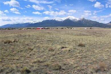
- 23.06 Acre Lot
- No HOA
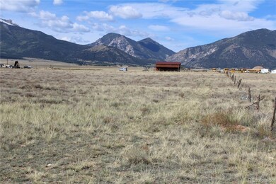
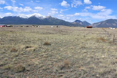
- Level Lot
- Mountain View
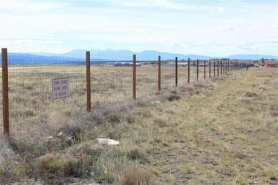
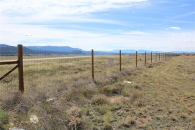
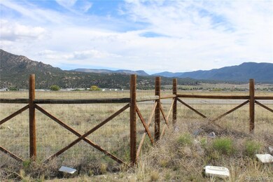
- Partially Fenced Property
- Natural State Vegetation
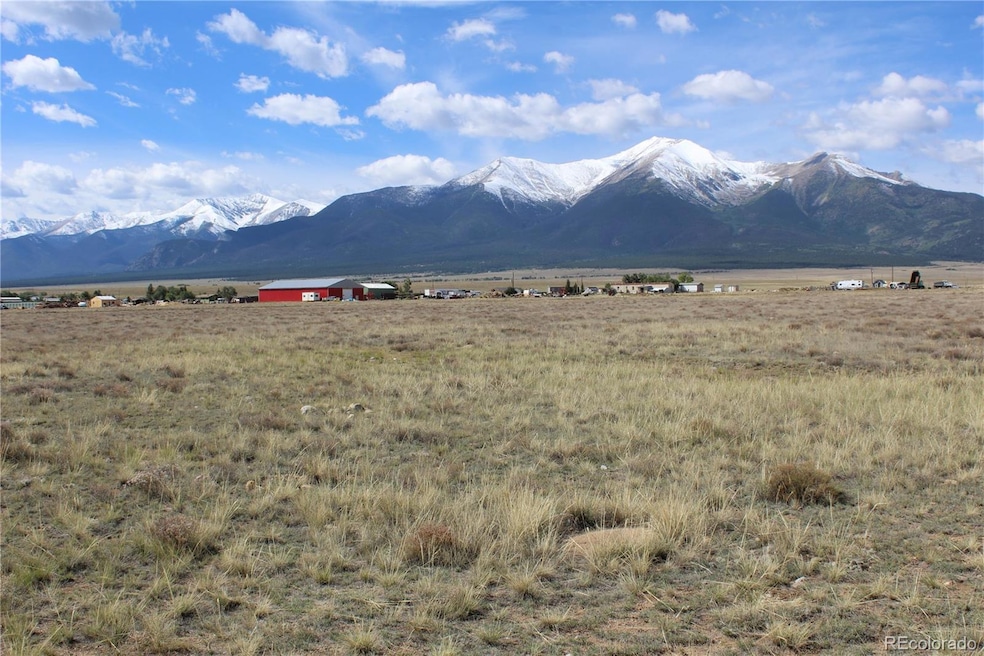
About This Lot
This 23-acre parcel is ideal for the buyer who needs access to an airport or who serves the aviation sector, as it shares a fence with the Central Colorado Regional Airport (CCRA). The seller owns a Through the Fence Agreement (TTF) which will be included with the purchase of the land. The opening for the TTF straddles this parcel and the parcel to the north. A shared easement can be in place to insure both parcels have suitable access to the opening. Access to the property is from CR 319, just past the airport office and hangars, approximately one mile south of Buena Vista. Zoned by Chaffee County as Industrial. Signature views of the Collegiate Range with 3 of the 4 peaks being visible. Utilities (public water and sewer, 3ph power, and fiber optic cable) are nearby and will be the responsibility of the buyer. If buyer prefers, the parcel is eligible for a well and septic rather than the public utilities. Single phase power is at the entrance to the parcel on CR 319. And very good high-speed Internet is available via clear wireless signal. A unique property with airport access -- the most centrally located airport to four of Colorado’s major ski areas — Monarch, Breckenridge, Copper Mountain, and Ski Cooper, VFR on most days, and an 8,300 ft. runway, with reasonably priced airport services. CCRA is located at an elevation of 7950.4 ft. and boasts the longest high-altitude runway in Colorado at 8,300’, along with a full-length taxiway. CCRA’s identifier is AEJ (KAEJ). General flight information and supplemental resources can be found on the AirNav website. AWOS and weather data analysis is available, as is ARNAV (GPS) approach. CCRA sits on a mesa above the intersection of US 285 and US 24. Throughout most of the year, the sky above the airport is cloudless, even though the surrounding mountains may be shrouded by clouds. Consequently, the airport enjoys many more days of visibility than most mountain airfields. Immediate possession upon transfer of funds.
Listing Agent
Summit Realty, Inc Brokerage Phone: 719-221-8865 License #100023639 Listed on: 09/29/2023
Property Details
Property Type
- Land
Est. Annual Taxes
- $4,702
Lot Details
- 23.06 Acre Lot
- Partially Fenced Property
- Natural State Vegetation
- Level Lot
- Property is zoned light industrial
Property Views
- Mountain
- Valley
Utilities
- Single-Phase Power
- 110 Volts
- Propane
- Well
- Septic Tank
Community Details
- No Home Owners Association
Listing and Financial Details
- Assessor Parcel Number R327121300008
Map
Home Values in the Area
Average Home Value in this Area
Property History
| Date | Event | Price | List to Sale | Price per Sq Ft |
|---|---|---|---|---|
| 03/10/2025 03/10/25 | Price Changed | $1,000,000 | -7.0% | -- |
| 11/20/2023 11/20/23 | Price Changed | $1,075,000 | -6.5% | -- |
| 09/29/2023 09/29/23 | For Sale | $1,150,000 | -- | -- |
Source: REcolorado®
MLS Number: 7981444
Disclaimer: Certain information contained herein is derived from information provided by parties other than Homes.com. All information provided is deemed reliable, but is not guaranteed to be accurate and should be independently verified.
![]() The content relating to real estate for sale in this Web site comes in part from the Internet Data eXchange (“IDX”) program of METROLIST, INC., DBA RECOLORADO®. Real estate listings held by brokers other than Ten-X are marked with the IDX Logo. This information is being provided for the consumers’ personal, non-commercial use and may not be used for any other purpose. All information subject to change and should be independently verified.
The content relating to real estate for sale in this Web site comes in part from the Internet Data eXchange (“IDX”) program of METROLIST, INC., DBA RECOLORADO®. Real estate listings held by brokers other than Ten-X are marked with the IDX Logo. This information is being provided for the consumers’ personal, non-commercial use and may not be used for any other purpose. All information subject to change and should be independently verified.
This publication is designed to provide information with regard to the subject matter covered. It is displayed with the understanding that the publisher and authors are not engaged in rendering real estate, legal, accounting, tax, or other professional services and that the publisher and authors are not offering such advice in this publication. If real estate, legal, or other expert assistance is required, the services of a competent, professional person should be sought.
The information contained in this publication is subject to change without notice. METROLIST, INC., DBA RECOLORADO MAKES NO WARRANTY OF ANY KIND WITH REGARD TO THIS MATERIAL, INCLUDING, BUT NOT LIMITED TO, THE IMPLIED WARRANTIES OF MERCHANTABILITY AND FITNESS FOR A PARTICULAR PURPOSE. METROLIST, INC., DBA RECOLORADO SHALL NOT BE LIABLE FOR ERRORS CONTAINED HEREIN OR FOR ANY DAMAGES IN CONNECTION WITH THE FURNISHING, PERFORMANCE, OR USE OF THIS MATERIAL.
PUBLISHER’S NOTICE: All real estate advertised herein is subject to the Federal Fair Housing Act and the Colorado Fair Housing Act, which Acts make it illegal to make or publish any advertisement that indicates any preference, limitation, or discrimination based on race, color, religion, sex, handicap, familial status, or national origin.
METROLIST, INC., DBA RECOLORADO will not knowingly accept any advertising for real estate that is in violation of the law. All persons are hereby informed that all dwellings advertised are available on an equal opportunity basis.
© 2025 METROLIST, INC., DBA RECOLORADO® – All Rights Reserved. 6455 S. Yosemite St., Suite 500 Greenwood Village, CO 80111 USA
ALL RIGHTS RESERVED WORLDWIDE. No part of this publication may be reproduced, adapted, translated, stored in a retrieval system or transmitted in any form or by any means, electronic, mechanical, photocopying, recording, or otherwise, without the prior written permission of the publisher. The information contained herein including but not limited to all text, photographs, digital images, virtual tours, may be seeded and monitored for protection and tracking.
- 28847 Castle Rock Cir
- 26794 County Road 320a
- 27436 County Road 313 Unit 7
- 27665 County Road 313 Unit 34
- 27665 County Road 313 Unit 19
- 13944 Meadow Ln Unit 21
- 13939 Meadow Ln
- 27835 County Road 301
- 160 Weathervane Ln
- 242 Weathervane Ln
- 495 Antero Cir
- 495 Antero Cir Unit 5R
- 316 Barnwood Dr
- 28310 County Road 313
- 108 Baylor Dr
- 106 Dartmouth Dr
- 139 Brady Rd
- 131 Baylor Dr
- 101 Harvard Ln
- 709 Marquette Ave
