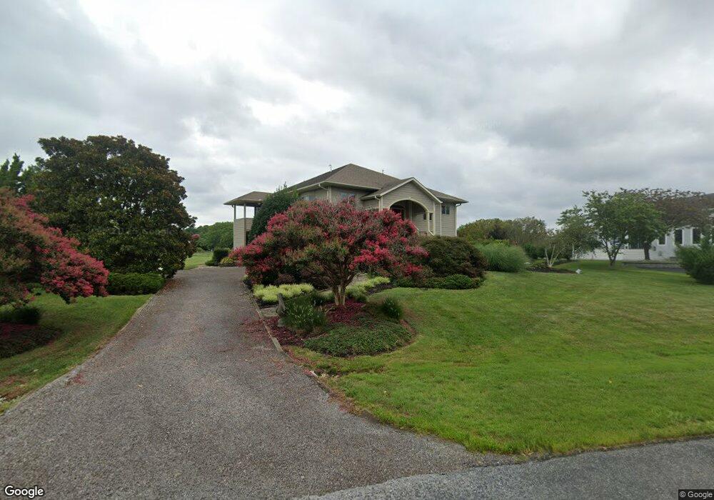
102 Teal Ct Stevensville, MD 21666
Estimated Value: $842,000 - $1,502,000
4
Beds
3
Baths
2,830
Sq Ft
$397/Sq Ft
Est. Value
About This Home
This home is located at 102 Teal Ct, Stevensville, MD 21666 and is currently estimated at $1,124,036, approximately $397 per square foot. 102 Teal Ct is a home located in Queen Anne's County with nearby schools including Matapeake Elementary School, Matapeake Middle School, and Kent Island High School.
Ownership History
Date
Name
Owned For
Owner Type
Purchase Details
Closed on
May 24, 2013
Sold by
Bird Donna S and Bird Christopher
Bought by
Bird Donna S
Current Estimated Value
Home Financials for this Owner
Home Financials are based on the most recent Mortgage that was taken out on this home.
Original Mortgage
$295,000
Outstanding Balance
$208,569
Interest Rate
3.43%
Mortgage Type
New Conventional
Estimated Equity
$915,467
Purchase Details
Closed on
May 23, 1996
Sold by
Lantelme Kenneth J and Lantelme Peggy
Bought by
Bird Donna S and Bird Christopher
Purchase Details
Closed on
Jun 22, 1989
Sold by
Vanwagenen John A and Vanwagenen Rosalie L
Bought by
Lantelme Kenneth J and Lantelme Peggy-Anne
Create a Home Valuation Report for This Property
The Home Valuation Report is an in-depth analysis detailing your home's value as well as a comparison with similar homes in the area
Home Values in the Area
Average Home Value in this Area
Purchase History
| Date | Buyer | Sale Price | Title Company |
|---|---|---|---|
| Bird Donna S | -- | Title Solutions | |
| Bird Donna S | $65,000 | -- | |
| Lantelme Kenneth J | $105,000 | -- |
Source: Public Records
Mortgage History
| Date | Status | Borrower | Loan Amount |
|---|---|---|---|
| Open | Bird Donna S | $295,000 |
Source: Public Records
Tax History Compared to Growth
Tax History
| Year | Tax Paid | Tax Assessment Tax Assessment Total Assessment is a certain percentage of the fair market value that is determined by local assessors to be the total taxable value of land and additions on the property. | Land | Improvement |
|---|---|---|---|---|
| 2025 | $5,838 | $625,300 | $0 | $0 |
| 2024 | $5,557 | $590,100 | $0 | $0 |
| 2023 | $5,287 | $554,900 | $220,000 | $334,900 |
| 2022 | $5,190 | $544,633 | $0 | $0 |
| 2021 | $4,861 | $534,367 | $0 | $0 |
| 2020 | $4,861 | $524,100 | $224,000 | $300,100 |
| 2019 | $4,625 | $492,633 | $0 | $0 |
| 2018 | $4,399 | $461,167 | $0 | $0 |
| 2017 | $4,181 | $429,700 | $0 | $0 |
| 2016 | -- | $429,700 | $0 | $0 |
| 2015 | $2,629 | $429,700 | $0 | $0 |
| 2014 | $2,629 | $471,400 | $0 | $0 |
Source: Public Records
Map
Nearby Homes
- 102 Golf Ct
- 224 Long Point Rd
- 0 Ackerman Dr
- 214 Pennick Dr
- 213 Pennick Dr
- 210 Pennick Dr
- Lot 8 Ackerman Dr
- 208 Long Point Rd
- 203 Olive Branch Rd
- 200 Mallard Cove Ln
- 123 Long Point Rd
- 312 S Lake Dr
- 9401 Romancoke Rd
- Lot 1 - E/Kent Point Romancoke
- 114 N Lake Dr
- 145 N Lake Dr
- 208 Tower Dr
- 8905 Romancoke Rd
- 118 N Lake Dr
- 201 Beachside Dr
- 100 Cove Creek Rd
- 104 Teal Ct
- 103 Windward Ct
- 101 Windward Ct
- 101 Teal Ct
- 103 Teal Ct
- 105 Teal Ct
- 201 Cove Creek Rd
- 105 Windward Ct
- 101 Cove Creek Rd
- 202 Cove Creek Rd
- 101 Some Other Place
- 102 Windward Ct
- 203 Cove Creek Rd
- 100 Windward Ct
- 107 Windward Ct
- 104 Windward Ct
- 100 Some Other Place
- 102 Cove Creek Ct
- 103 Some Other Place