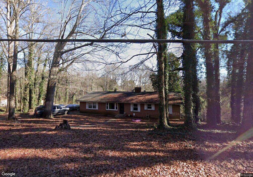
102 Turner Rd Jonesboro, GA 30236
Estimated Value: $198,000 - $283,000
3
Beds
3
Baths
1,412
Sq Ft
$173/Sq Ft
Est. Value
About This Home
This home is located at 102 Turner Rd, Jonesboro, GA 30236 and is currently estimated at $243,782, approximately $172 per square foot. 102 Turner Rd is a home located in Clayton County with nearby schools including Suder Elementary School, Mundys Mill Middle School, and Jonesboro High School.
Ownership History
Date
Name
Owned For
Owner Type
Purchase Details
Closed on
Dec 30, 2004
Sold by
Spence Gloria L
Bought by
Toles Latonya
Current Estimated Value
Home Financials for this Owner
Home Financials are based on the most recent Mortgage that was taken out on this home.
Original Mortgage
$136,400
Interest Rate
4.38%
Mortgage Type
New Conventional
Purchase Details
Closed on
May 13, 2004
Sold by
Mayo Lynda
Bought by
Thomas Jimmy D
Purchase Details
Closed on
Dec 16, 1996
Sold by
Rowe Carolyn
Bought by
Thomas Jimmy
Create a Home Valuation Report for This Property
The Home Valuation Report is an in-depth analysis detailing your home's value as well as a comparison with similar homes in the area
Home Values in the Area
Average Home Value in this Area
Purchase History
| Date | Buyer | Sale Price | Title Company |
|---|---|---|---|
| Toles Latonya | $170,500 | -- | |
| Thomas Jimmy D | -- | -- | |
| Thomas Jimmy | $129,900 | -- |
Source: Public Records
Mortgage History
| Date | Status | Borrower | Loan Amount |
|---|---|---|---|
| Previous Owner | Toles Latonya | $136,400 | |
| Closed | Thomas Jimmy | $0 |
Source: Public Records
Tax History Compared to Growth
Tax History
| Year | Tax Paid | Tax Assessment Tax Assessment Total Assessment is a certain percentage of the fair market value that is determined by local assessors to be the total taxable value of land and additions on the property. | Land | Improvement |
|---|---|---|---|---|
| 2024 | $2,061 | $62,840 | $24,840 | $38,000 |
| 2023 | $2,295 | $63,560 | $24,840 | $38,720 |
| 2022 | $2,039 | $61,960 | $24,840 | $37,120 |
| 2021 | $1,980 | $60,120 | $24,840 | $35,280 |
| 2020 | $2,135 | $63,388 | $29,319 | $34,069 |
| 2019 | $2,117 | $62,158 | $29,319 | $32,839 |
| 2018 | $2,140 | $62,712 | $29,319 | $33,393 |
| 2017 | $1,700 | $51,773 | $29,319 | $22,454 |
| 2016 | $1,700 | $51,773 | $29,319 | $22,454 |
| 2015 | $1,361 | $0 | $0 | $0 |
| 2014 | $1,830 | $51,361 | $29,319 | $22,042 |
Source: Public Records
Map
Nearby Homes
- 242 Lake Jodeco Rd
- 116 Thornton Dr
- 304 Mercer Dr
- 192 Cloud St
- 1519 Red Briar Way
- 1457 Brownleaf Dr
- 1535 Lake Jodeco Rd
- 57 Teal Trail NE
- 111 Teal Trail
- 8645 Embrey Dr
- 1558 Thornwood Ct
- 215 King St
- 135 Main St
- 1433 Butler St
- 116 Stewart Ave
- 109 Stockbridge Rd
- 0 State Highway 54
- 151 Irvin St
- 9132 Endicott Place
- 8857 Woodridge Ct
- 100 Lake Jodeco Rd
- 98 Lake Jodeco Rd Unit B
- 98 Lake Jodeco Rd
- 101 Turner Rd
- 110 Elaine Terrace
- 108 Elaine Terrace
- 112 Elaine Terrace
- 112 Elaine Terrace Unit 7
- 104 Elaine Terrace
- 102 Elaine Terrace
- 100 Elaine Terrace
- 0 Elaine Terrace Unit 8220682
- 111 Thornton Dr
- 114 Elaine Terrace
- 113 Elaine Terrace
- 115 Elaine Terrace
- 111 Elaine Terrace
- 109 Thornton Dr
- 109 Elaine Terrace
- 109 Elaine Terrace Unit 8