--
Bed
--
Bath
11,124
Sq Ft
1.12
Acres
About This Home
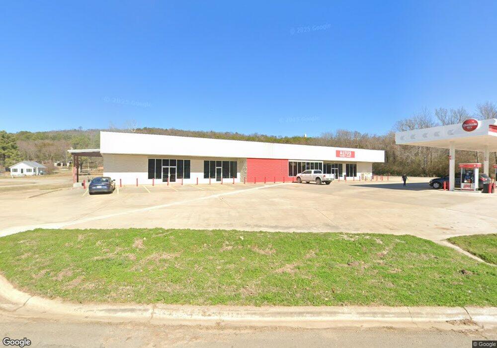
This home is located at 102 W Park St, Altus, AR 72821. 102 W Park St is a home located in Franklin County with nearby schools including Ozark Kindergarten School, Elgin B. Milton Elementary School, and Ozark Upper Elementary School.
Ownership History
Date
Name
Owned For
Owner Type
Purchase Details
Closed on
Mar 18, 2020
Sold by
Cline Jimmy R and Clime Phyllis A
Bought by
Littletield Oil Co
Home Financials for this Owner
Home Financials are based on the most recent Mortgage that was taken out on this home.
Original Mortgage
$500,000
Interest Rate
3.4%
Mortgage Type
Construction
Purchase Details
Closed on
Apr 2, 2002
Bought by
Altus Foods and Altus Cline
Purchase Details
Closed on
Aug 27, 1999
Bought by
Altus Eubanks and Altus Food Store
Purchase Details
Closed on
Aug 25, 1999
Bought by
Thornbury and Eubanks
Purchase Details
Closed on
Feb 4, 1999
Bought by
Phillips and Eubanks
Purchase Details
Closed on
Nov 12, 1996
Bought by
Mayner and Phillips
Purchase Details
Closed on
Oct 8, 1996
Bought by
Eubanks and Mayner
Purchase Details
Closed on
May 1, 1994
Bought by
Audine and Diana
Create a Home Valuation Report for This Property
The Home Valuation Report is an in-depth analysis detailing your home's value as well as a comparison with similar homes in the area
Home Values in the Area
Average Home Value in this Area
Purchase History
| Date | Buyer | Sale Price | Title Company |
|---|---|---|---|
| Littletield Oil Co | $150,000 | Waco Title Company | |
| Altus Foods | $700,000 | -- | |
| Altus Eubanks | $45,000 | -- | |
| Thornbury | -- | -- | |
| Phillips | -- | -- | |
| Mayner | -- | -- | |
| Eubanks | -- | -- | |
| Audine | -- | -- |
Source: Public Records
Mortgage History
| Date | Status | Borrower | Loan Amount |
|---|---|---|---|
| Closed | Littletield Oil Co | $500,000 |
Source: Public Records
Tax History Compared to Growth
Tax History
| Year | Tax Paid | Tax Assessment Tax Assessment Total Assessment is a certain percentage of the fair market value that is determined by local assessors to be the total taxable value of land and additions on the property. | Land | Improvement |
|---|---|---|---|---|
| 2025 | $4,404 | $83,250 | $5,970 | $77,280 |
| 2024 | $4,404 | $83,250 | $5,970 | $77,280 |
| 2023 | $1,866 | $35,270 | $5,970 | $29,300 |
| 2022 | $1,866 | $35,270 | $5,970 | $29,300 |
| 2021 | $1,866 | $35,270 | $5,970 | $29,300 |
| 2020 | $2,847 | $53,810 | $3,380 | $50,430 |
| 2019 | $2,847 | $53,810 | $3,380 | $50,430 |
| 2018 | $5,432 | $102,690 | $3,380 | $99,310 |
| 2017 | $5,432 | $102,690 | $3,380 | $99,310 |
| 2016 | $5,432 | $102,690 | $3,380 | $99,310 |
| 2015 | $5,435 | $102,740 | $6,000 | $96,740 |
| 2013 | -- | $102,740 | $6,000 | $96,740 |
Source: Public Records
Map
Nearby Homes
- TBD Saint Marys Mountain Rd
- 1504 Hendrix St
- 104 Smitherman St
- 205 Smitherman St
- 707 W Park St
- 1420 Elm St
- 26 Miller St
- 717 Brannon St
- 208 Crumpler
- 1204 W College St
- 2914 Hatties Ln
- 2929 Hatties Ln
- 375 E Vineyard Dr
- 1015 E Church St
- 619 S Cherry St
- 5930 Liberty Rd
- 3935 Highway 186
- 5636 Leisure Estate
- 2055 E Church St
- 8468 Cambridge Rd