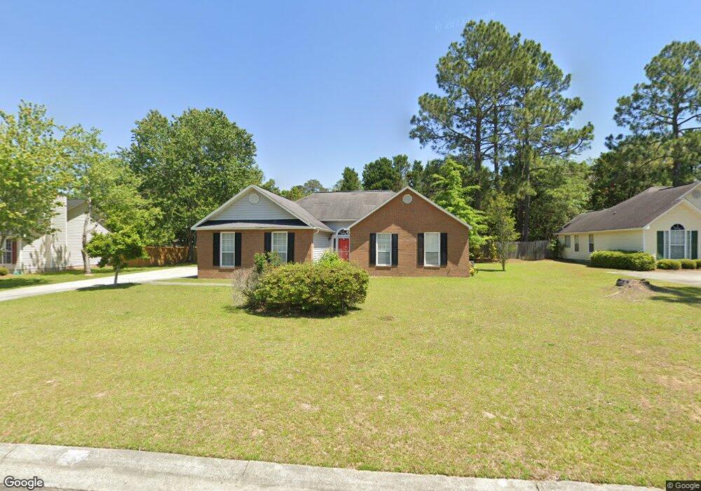
102 Westchester Dr Dublin, GA 31021
Estimated Value: $192,045 - $235,000
--
Bed
2
Baths
1,432
Sq Ft
$152/Sq Ft
Est. Value
About This Home
This home is located at 102 Westchester Dr, Dublin, GA 31021 and is currently estimated at $217,011, approximately $151 per square foot. 102 Westchester Dr is a home located in Laurens County with nearby schools including Susie Dasher, Moore Street School, and Dublin Middle School.
Ownership History
Date
Name
Owned For
Owner Type
Purchase Details
Closed on
Jul 10, 2018
Sold by
Patel Chandu
Bought by
Carter Steven and Coney Yolonder
Current Estimated Value
Home Financials for this Owner
Home Financials are based on the most recent Mortgage that was taken out on this home.
Original Mortgage
$135,000
Outstanding Balance
$75,715
Interest Rate
4.6%
Mortgage Type
New Conventional
Estimated Equity
$141,296
Purchase Details
Closed on
Jun 5, 2013
Sold by
Screws Gloria S
Bought by
Patel Chandu and Patel Madhu
Home Financials for this Owner
Home Financials are based on the most recent Mortgage that was taken out on this home.
Original Mortgage
$103,311
Interest Rate
3.42%
Mortgage Type
New Conventional
Purchase Details
Closed on
Mar 9, 2007
Sold by
Screws Alton Joseph
Bought by
Screws Gloria S
Purchase Details
Closed on
Apr 30, 1995
Sold by
Oconee Holding Co
Bought by
Screws Alton J and Screws Glo
Create a Home Valuation Report for This Property
The Home Valuation Report is an in-depth analysis detailing your home's value as well as a comparison with similar homes in the area
Home Values in the Area
Average Home Value in this Area
Purchase History
| Date | Buyer | Sale Price | Title Company |
|---|---|---|---|
| Carter Steven | $145,000 | -- | |
| Patel Chandu | $103,000 | -- | |
| Screws Gloria S | -- | -- | |
| Screws Alton J | $78,400 | -- |
Source: Public Records
Mortgage History
| Date | Status | Borrower | Loan Amount |
|---|---|---|---|
| Open | Carter Steven | $135,000 | |
| Previous Owner | Patel Chandu | $103,311 |
Source: Public Records
Tax History Compared to Growth
Tax History
| Year | Tax Paid | Tax Assessment Tax Assessment Total Assessment is a certain percentage of the fair market value that is determined by local assessors to be the total taxable value of land and additions on the property. | Land | Improvement |
|---|---|---|---|---|
| 2024 | $1,579 | $49,498 | $9,000 | $40,498 |
| 2023 | $1,560 | $48,780 | $10,000 | $38,780 |
| 2022 | $329 | $48,780 | $10,000 | $38,780 |
| 2021 | $318 | $44,472 | $8,000 | $36,472 |
| 2020 | $319 | $44,472 | $8,000 | $36,472 |
| 2019 | $319 | $44,472 | $8,000 | $36,472 |
| 2018 | $320 | $44,472 | $8,000 | $36,472 |
| 2017 | $320 | $44,472 | $8,000 | $36,472 |
| 2016 | $320 | $44,472 | $8,000 | $36,472 |
| 2015 | $320 | $44,472 | $8,000 | $36,472 |
| 2014 | $219 | $34,154 | $7,600 | $26,554 |
Source: Public Records
Map
Nearby Homes
- 101 Westchester Dr
- 1610 Lance Dr
- 403 Irvindale Dr
- 404 Eastwood Dr
- 218 Brookwood Dr
- 561 Live Oak Way
- 239 Brookwood Dr
- 214 Brookwood Dr
- 230 Ridge Cir
- 305 Ridgecrest Rd
- 206 Ridge Cir
- 622 Live Oak Way
- 1103 Wingate St
- 336 MacE Cannon Rd
- 504 Payne Place
- 311 Fairmont Dr
- 0 Brookhaven Dr Unit 18954
- 254 Trinity Rd
- 104 White Oak Cir
- 102 Westchester Ct
- 103 Westchester Ct
- 118 Westchester Cir
- 116 Westchester Dr
- 116 Westchester Cir
- 112 Westchester Cir
- 114 Westchester Cir
- 110 Westchester Cir
- 120 Westchester Cir
- 303 Westchester Dr
- 106 Westchester Cir
- 403 Westchester Dr
- 108 Westchester Cir
- 131 Westchester Cir
- 133 Westchester Cir
- 133 Westchester Cir
- 123 Westchester Cir
- 129 Westchester Cir
- 0 Westchester Cir Unit 4482