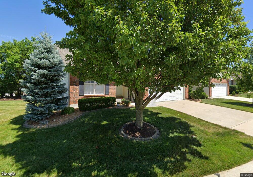
102 Westgate Dr Saint Peters, MO 63376
Estimated Value: $316,844 - $328,000
2
Beds
2
Baths
1,513
Sq Ft
$214/Sq Ft
Est. Value
About This Home
This home is located at 102 Westgate Dr, Saint Peters, MO 63376 and is currently estimated at $323,711, approximately $213 per square foot. 102 Westgate Dr is a home located in St. Charles County with nearby schools including Progress South Elementary School, Fort Zumwalt South Middle School, and Fort Zumwalt South High School.
Ownership History
Date
Name
Owned For
Owner Type
Purchase Details
Closed on
Sep 22, 2022
Sold by
Dean Martellaro
Bought by
Murawski Paul G and Murawski Martha L
Current Estimated Value
Purchase Details
Closed on
May 18, 2011
Sold by
Griffin Melvin Mark
Bought by
Martellaro Joseph and Martellaro Dean
Purchase Details
Closed on
Dec 31, 2001
Sold by
Tr Hughes Inc
Bought by
Griffin Amos L
Home Financials for this Owner
Home Financials are based on the most recent Mortgage that was taken out on this home.
Original Mortgage
$110,000
Interest Rate
6.73%
Create a Home Valuation Report for This Property
The Home Valuation Report is an in-depth analysis detailing your home's value as well as a comparison with similar homes in the area
Home Values in the Area
Average Home Value in this Area
Purchase History
| Date | Buyer | Sale Price | Title Company |
|---|---|---|---|
| Murawski Paul G | -- | -- | |
| Martellaro Joseph | $160,000 | Ort | |
| Griffin Amos L | -- | -- |
Source: Public Records
Mortgage History
| Date | Status | Borrower | Loan Amount |
|---|---|---|---|
| Previous Owner | Griffin Amos L | $110,000 |
Source: Public Records
Tax History Compared to Growth
Tax History
| Year | Tax Paid | Tax Assessment Tax Assessment Total Assessment is a certain percentage of the fair market value that is determined by local assessors to be the total taxable value of land and additions on the property. | Land | Improvement |
|---|---|---|---|---|
| 2025 | $3,569 | $56,646 | -- | -- |
| 2023 | $3,571 | $53,898 | $0 | $0 |
| 2022 | $3,155 | $44,262 | $0 | $0 |
| 2021 | $3,157 | $44,262 | $0 | $0 |
| 2020 | $2,894 | $39,302 | $0 | $0 |
| 2019 | $2,901 | $39,302 | $0 | $0 |
| 2018 | $2,606 | $33,681 | $0 | $0 |
| 2017 | $2,569 | $33,681 | $0 | $0 |
| 2016 | $2,465 | $32,189 | $0 | $0 |
| 2015 | $2,292 | $32,189 | $0 | $0 |
| 2014 | $2,290 | $31,630 | $0 | $0 |
Source: Public Records
Map
Nearby Homes
- 110 Westgate Dr Unit 34A
- 5 Arborgate Dr Unit 69A
- 211 Butternut Stage Dr
- 6 Covered Wagon Trail Ct
- 113 Stage Coach Landing Dr
- 307 Santa Fe Trail Dr
- 24 Saint Robert Dr
- 7 Park City Ct
- 146 Huntington Crossing Dr
- 39 Gulf Shores Dr
- 32 Gulf Shores Dr
- 367 Shamrock St
- 361 Shamrock St
- 108 Mill Pond Dr
- 1910 Pebble Brook Dr
- 13 Kingspointe Dr
- 114 Knaust Rd
- 212 Jacobs Way
- 42 Kingspointe Dr
- 225 Jacobs Way
- 102 Westgate Dr Unit 36A
- 104 Westgate Dr
- 106 Westgate Dr
- 20 Concord Trail Dr
- 21 Gatetower Dr
- 22 Concord Trail Dr
- 108 Westgate Dr
- 20 Gatetower Dr
- 18 Concord Trail Dr
- 24 Concord Trail Dr
- 23 Gatetower Dr
- 23 Gatetower Dr Unit 5B
- 22 Gatetower Dr
- 110 Westgate Dr
- 40 Huntgate Dr Unit 6B
- 16 Concord Trail Dr
- 26 Concord Trail Dr
- 29 Gatetower Dr
- 112 Westgate Dr
- 112 Westgate Dr Unit 34B