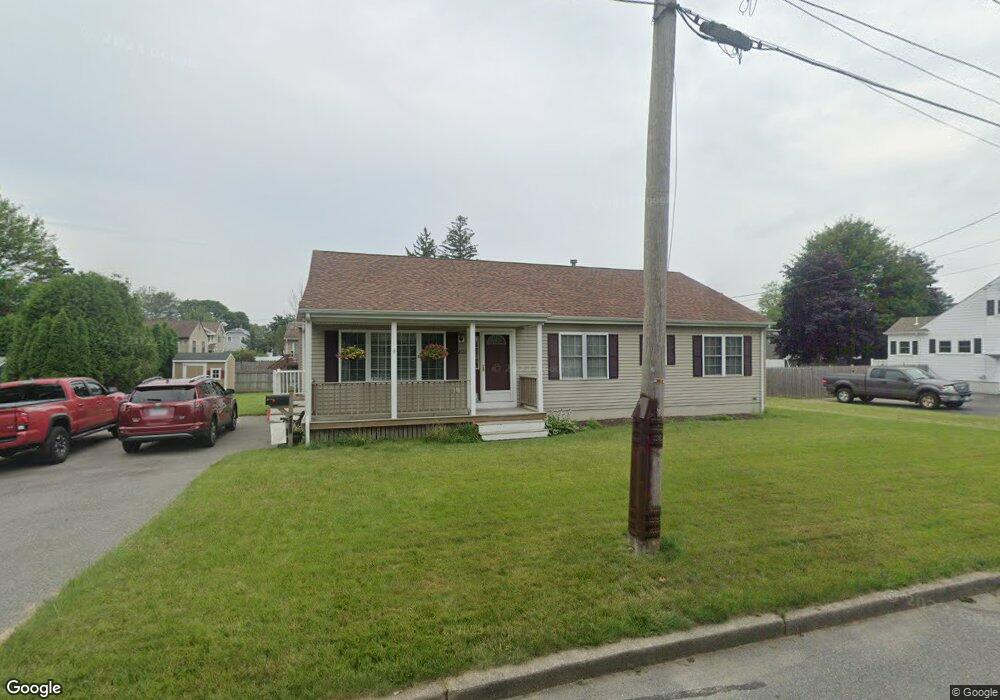
1020 Beckett St New Bedford, MA 02745
Acushnet-Pine Hill NeighborhoodEstimated Value: $504,000 - $551,647
3
Beds
2
Baths
1,520
Sq Ft
$345/Sq Ft
Est. Value
About This Home
This home is located at 1020 Beckett St, New Bedford, MA 02745 and is currently estimated at $524,912, approximately $345 per square foot. 1020 Beckett St is a home located in Bristol County with nearby schools including Jireh Swift School, Normandin Middle School, and New Bedford High School.
Ownership History
Date
Name
Owned For
Owner Type
Purchase Details
Closed on
Dec 31, 1998
Sold by
Mazewski Victoria
Bought by
Leblanc Leo A and Leblanc Leidi S
Current Estimated Value
Home Financials for this Owner
Home Financials are based on the most recent Mortgage that was taken out on this home.
Original Mortgage
$113,600
Interest Rate
6.84%
Mortgage Type
Purchase Money Mortgage
Create a Home Valuation Report for This Property
The Home Valuation Report is an in-depth analysis detailing your home's value as well as a comparison with similar homes in the area
Home Values in the Area
Average Home Value in this Area
Purchase History
| Date | Buyer | Sale Price | Title Company |
|---|---|---|---|
| Leblanc Leo A | $46,000 | -- | |
| Leblanc Leo A | $46,000 | -- |
Source: Public Records
Mortgage History
| Date | Status | Borrower | Loan Amount |
|---|---|---|---|
| Open | Leblanc Leo A | $136,000 | |
| Closed | Leblanc Leo A | $113,600 | |
| Closed | Leblanc Leo A | $22,700 |
Source: Public Records
Tax History Compared to Growth
Tax History
| Year | Tax Paid | Tax Assessment Tax Assessment Total Assessment is a certain percentage of the fair market value that is determined by local assessors to be the total taxable value of land and additions on the property. | Land | Improvement |
|---|---|---|---|---|
| 2025 | $6,030 | $533,200 | $148,300 | $384,900 |
| 2024 | $6,017 | $501,400 | $148,300 | $353,100 |
| 2023 | $6,375 | $446,100 | $122,100 | $324,000 |
| 2022 | $5,754 | $370,300 | $113,400 | $256,900 |
| 2021 | $5,592 | $358,700 | $111,200 | $247,500 |
| 2020 | $5,629 | $348,300 | $111,200 | $237,100 |
| 2019 | $5,516 | $334,900 | $111,200 | $223,700 |
| 2018 | $5,240 | $315,100 | $111,200 | $203,900 |
| 2017 | $4,894 | $293,200 | $104,700 | $188,500 |
| 2016 | $4,490 | $272,300 | $100,300 | $172,000 |
| 2015 | $4,220 | $268,300 | $100,300 | $168,000 |
| 2014 | $4,089 | $269,700 | $100,300 | $169,400 |
Source: Public Records
Map
Nearby Homes
- 1024 Marion St
- 65 Armsby St
- 9 Middlefield Place
- 6 Middlefield Place
- 209 Jarry St
- 6 Illinois St
- 506 Hawes St
- 0 Church Dutton & Chaffee Unit 73371719
- 187 Tarkiln Hill Rd
- 850 Terry Ln
- 362 Tarkiln Hill Rd
- 957 Glen St
- 847 Terry Ln
- 1044 Victoria St Unit B-29
- 683 Church St
- 362 Prescott St
- 398 Brockton St
- 1164 Victoria St
- 263 Hersom St
- 1158 Joyce St
- 1012 Beckett St
- 1021 Beckett St
- 1015 Beckett St
- 1034 Beckett St
- 1029 Beckett St
- 1027 Shelburne St
- 1033 Shelburne St
- 2529 Acushnet Ave
- 1021 Shelburne St
- 2543 Acushnet Ave
- 2521 Acushnet Ave
- 1020 Monmouth St
- 2549 Acushnet Ave
- 1022 Monmouth St
- 1032 Monmouth St
- 1042 Beckett St
- 1043 Beckett St
- 1005 Shelburne St
- 240 Adelaide St
- 2553 Acushnet Ave