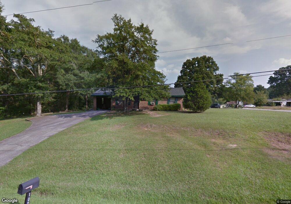
1020 Bloodworth St Union Point, GA 30669
Estimated Value: $81,000 - $106,000
3
Beds
1
Bath
1,000
Sq Ft
$95/Sq Ft
Est. Value
About This Home
This home is located at 1020 Bloodworth St, Union Point, GA 30669 and is currently estimated at $94,648, approximately $94 per square foot. 1020 Bloodworth St is a home located in Greene County with nearby schools including Greene County High School.
Ownership History
Date
Name
Owned For
Owner Type
Purchase Details
Closed on
Dec 27, 2024
Sold by
Harris Cleo Price Estate
Bought by
Johnson Ricky
Current Estimated Value
Home Financials for this Owner
Home Financials are based on the most recent Mortgage that was taken out on this home.
Original Mortgage
$64,000
Outstanding Balance
$21,818
Interest Rate
6.81%
Mortgage Type
New Conventional
Estimated Equity
$72,830
Purchase Details
Closed on
Jul 6, 2010
Sold by
Harris Seth
Bought by
Price Cleo
Purchase Details
Closed on
Jul 15, 2009
Sold by
Price Cleo
Bought by
Harris Seth and Harris Christopher
Purchase Details
Closed on
Jan 1, 1978
Sold by
Price Anna Cornelia and Price Cleo
Bought by
Price Cleo
Purchase Details
Closed on
Jan 3, 1974
Sold by
Wilson William R
Bought by
Price Anna Cornelia and Price Cleo
Purchase Details
Closed on
Jan 2, 1974
Sold by
Summerhill Dev
Bought by
Wilson William R
Purchase Details
Closed on
Jan 1, 1974
Sold by
Wilson William R Etal
Bought by
Summerhill Dev
Create a Home Valuation Report for This Property
The Home Valuation Report is an in-depth analysis detailing your home's value as well as a comparison with similar homes in the area
Home Values in the Area
Average Home Value in this Area
Purchase History
| Date | Buyer | Sale Price | Title Company |
|---|---|---|---|
| Johnson Ricky | $80,000 | -- | |
| Price Cleo | -- | -- | |
| Harris Seth | -- | -- | |
| Price Cleo | -- | -- | |
| Price Anna Cornelia | -- | -- | |
| Wilson William R | -- | -- | |
| Summerhill Dev | -- | -- | |
| Wilson William R Etal | -- | -- |
Source: Public Records
Mortgage History
| Date | Status | Borrower | Loan Amount |
|---|---|---|---|
| Open | Johnson Ricky | $64,000 |
Source: Public Records
Tax History Compared to Growth
Tax History
| Year | Tax Paid | Tax Assessment Tax Assessment Total Assessment is a certain percentage of the fair market value that is determined by local assessors to be the total taxable value of land and additions on the property. | Land | Improvement |
|---|---|---|---|---|
| 2024 | $480 | $34,160 | $2,520 | $31,640 |
| 2023 | $243 | $32,960 | $2,520 | $30,440 |
| 2022 | $181 | $29,960 | $2,520 | $27,440 |
| 2021 | $172 | $27,040 | $2,520 | $24,520 |
| 2020 | $167 | $10,680 | $2,680 | $8,000 |
| 2019 | $165 | $10,680 | $2,680 | $8,000 |
| 2018 | $26 | $10,680 | $2,680 | $8,000 |
| 2017 | $143 | $10,474 | $2,700 | $7,774 |
| 2016 | $143 | $10,918 | $2,700 | $8,218 |
| 2015 | $117 | $10,918 | $2,700 | $8,218 |
| 2014 | $117 | $10,793 | $2,700 | $8,093 |
Source: Public Records
Map
Nearby Homes
- 0 Washington Hwy Unit 7276060
- 0 S Rhodes St Unit 10618488
- 215 Hunter St
- 1010 Orear Rd
- 324 N Rhodes St
- 606 Bryan Ave
- 202 Veazey St
- 504 Crawfordville Rd
- 0 Woodland Ct Unit 1027434
- 0 Woodland Ct Unit 10543600
- 1241 Old Siloam Rd
- 1180 Moody St
- 1041 Hillcrest Dr
- 1251 Adams Rd
- 1860 Washington Hwy
- 0 Old Union Point Rd Unit 1 10557753
- 0 Buffalo Lick Rd Unit 10551328
- 1201 Buffalo Lick Rd
- 0 Buffalo Lick Rd Unit 10551325
- 0 Buffalo Lick Rd Unit 10551234
- 1171 Alexander St
- 1031 Bloodworth St
- 1040 Bloodworth St
- 1170 Alexander Ave
- 1170 Alexander St
- 1161 Alexander St
- 1160 Alexander St
- 1151 Alexander St
- 1050 Bloodworth St
- 1010 Parham Dr
- 1150 Alexander St
- 1020 Parham Dr
- 1141 Alexander St
- 1141 Alexander Ave
- 1030 Parham Dr
- 1290 Highway 77 N
- 1011 Parham Dr
- 1070 Bloodworth St
- 1131 Alexander St
- 1021 Parham Dr