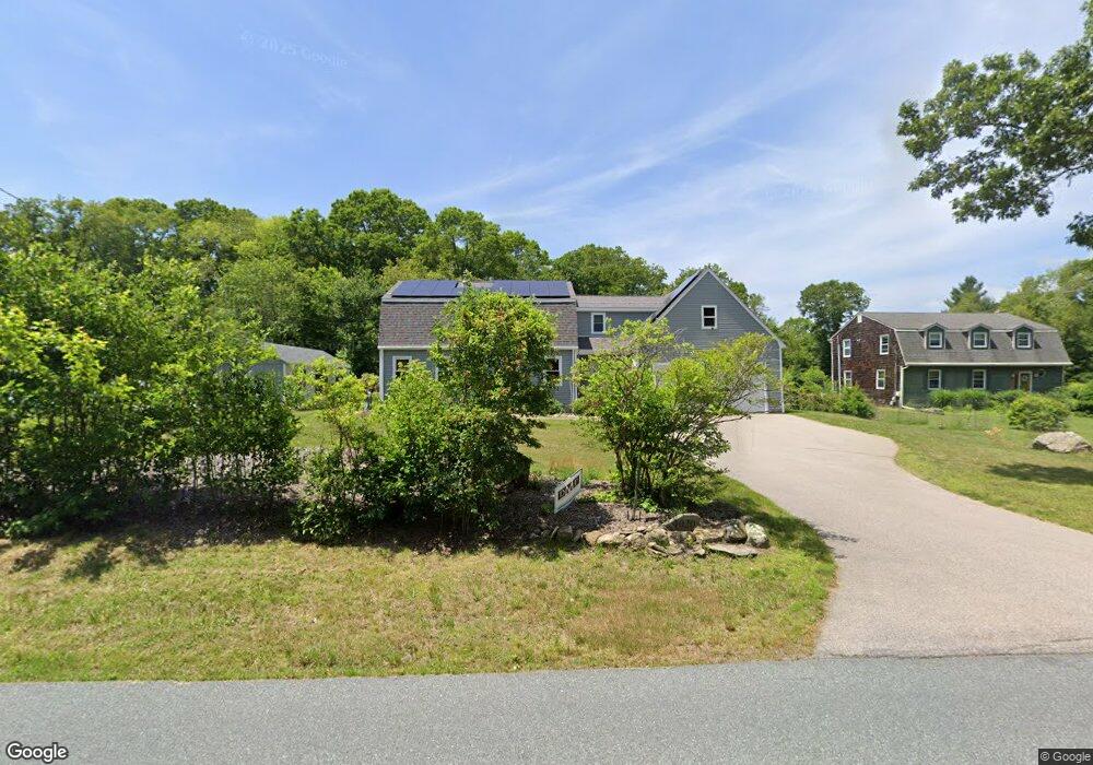
1020 Broad Rock Rd Wakefield, RI 02879
Estimated Value: $650,000 - $710,000
3
Beds
2
Baths
1,660
Sq Ft
$408/Sq Ft
Est. Value
About This Home
This home is located at 1020 Broad Rock Rd, Wakefield, RI 02879 and is currently estimated at $677,587, approximately $408 per square foot. 1020 Broad Rock Rd is a home located in Washington County with nearby schools including South Kingstown High School, Kingston Hill Academy, and Monsignor Matthew Clarke Catholic Regional School.
Ownership History
Date
Name
Owned For
Owner Type
Purchase Details
Closed on
Aug 2, 2002
Sold by
Livingston Paul F and Livingston Karen M
Bought by
Masse Leo J and Nappi Jennifer F
Current Estimated Value
Home Financials for this Owner
Home Financials are based on the most recent Mortgage that was taken out on this home.
Original Mortgage
$178,800
Interest Rate
6.64%
Purchase Details
Closed on
Jul 20, 1996
Sold by
Lapre Roland L and Lapre Nancy
Bought by
Livingston Paul F and Livingston Karen
Create a Home Valuation Report for This Property
The Home Valuation Report is an in-depth analysis detailing your home's value as well as a comparison with similar homes in the area
Home Values in the Area
Average Home Value in this Area
Purchase History
| Date | Buyer | Sale Price | Title Company |
|---|---|---|---|
| Masse Leo J | $223,500 | -- | |
| Livingston Paul F | $124,500 | -- |
Source: Public Records
Mortgage History
| Date | Status | Borrower | Loan Amount |
|---|---|---|---|
| Open | Livingston Paul F | $221,000 | |
| Closed | Livingston Paul F | $80,000 | |
| Closed | Livingston Paul F | $178,800 | |
| Previous Owner | Livingston Paul F | $174,000 |
Source: Public Records
Tax History
| Year | Tax Paid | Tax Assessment Tax Assessment Total Assessment is a certain percentage of the fair market value that is determined by local assessors to be the total taxable value of land and additions on the property. | Land | Improvement |
|---|---|---|---|---|
| 2025 | $5,073 | $567,500 | $200,100 | $367,400 |
| 2024 | $4,998 | $452,300 | $153,900 | $298,400 |
| 2023 | $4,998 | $452,300 | $153,900 | $298,400 |
| 2022 | $4,905 | $447,900 | $153,900 | $294,000 |
| 2021 | $5,014 | $347,000 | $126,800 | $220,200 |
| 2020 | $5,004 | $346,300 | $126,800 | $219,500 |
| 2019 | $5,004 | $346,300 | $126,800 | $219,500 |
| 2018 | $5,007 | $319,300 | $122,700 | $196,600 |
| 2017 | $4,888 | $319,300 | $122,700 | $196,600 |
| 2016 | $4,818 | $319,300 | $122,700 | $196,600 |
| 2015 | $4,735 | $305,100 | $115,100 | $190,000 |
| 2014 | $4,723 | $305,100 | $115,100 | $190,000 |
Source: Public Records
Map
Nearby Homes
- 0 Indian Trail Trail S Unit 1389828
- 0 Indian Run Trail Unit 1403300
- 1808 Kingstown Rd
- 15 Jessica Ln
- 57 Rocky Brook Way
- 44 Vespia Ln
- 56 Vespia Ln
- 416 Bridgetown Rd
- 301 Church St Unit 103
- 5 Wayland Trail
- 48 Stone Bridge Dr
- 604 Stony Fort Rd
- 79 Linden Dr
- 125 Montauk Rd
- 1729 South Rd Unit C
- 1724 South Rd
- 131 Columbia St
- 54 Isabelle Dr
- 0 South Rd Unit 1400966
- 20 Cleveland St
Your Personal Tour Guide
Ask me questions while you tour the home.